
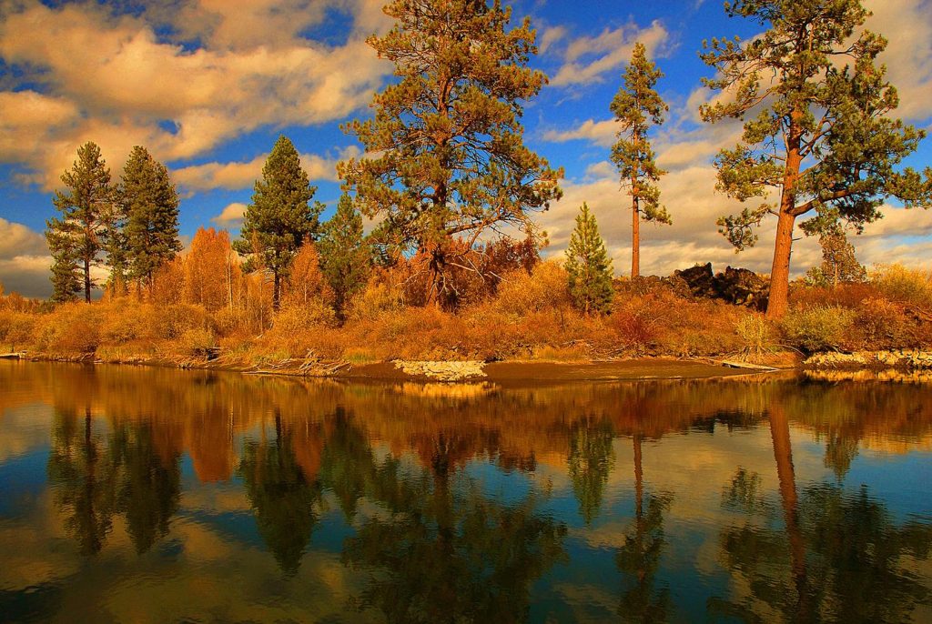
The United States has many scenic rivers running through US Forest Service recreation areas.
The 259 on this page are great choices if you are looking for scenic rivers with camping and hiking options nearby.
Click through on each of the scenic river areas listed below for full details of what each area has to offer.
You will find everything from nearby campground information to maps, directions, images and more.
Yukon – Charley Rivers National Preserve, Alaska Camping & Hiking
Listen Directions Although there is no direct highway connection to Yukon-Charley Rivers National Preserve, visitors are able to access the preserve by either air travel from Fairbanks, or water or air travel from two small towns on the road system(Eagle and Circle), near the preserve boundaries. Phone 907459-3730 Activities BOATING,
Youghiogheny River Lake, Pennsylvania Camping & Hiking
Listen Directions From Confluence, PA, go .5 miles south on PA 281. Phone (814) 395-3242 Activities BOATING, CAMPING, FISHING, HIKING, PICNICKING, WATER SPORTS, WILDLIFE VIEWING, PLAYGROUND PARK SPECIALIZED SPORT SITE, ENVIRONMENTAL EDUCATION Camping Reservations Reserve your campsite at these camping areas: Pennsylvania Campgrounds OUTFLOW CAMPING Hiking Trails Looking for nice
Yakima River Canyon, Washington Camping & Hiking
Listen Directions From Ellensburg, Washington, take Hwy 821 (Canyon Road) south into the Yakima River Canyon. Umtanum is located at milepost 16, Lmuma Creek is located at milepost 12, Big Pines is located at milepost 10 and Roza is located at milepost 7, a half mile above Roza dam and
Wisconsin River islands in Wisconsin Rapids, Wisconsin Camping & Hiking
Listen Directions Coming from the North: Follow US-51S to WI-34S in Knowlton. Follow WI-34S/State Hwy 13S towards Hanson Park in Wisconsin Rapids. The exit for Hanson Park is on the right. Coming from the South: Follow I-39N, also known as I-90W/I-94W, towards Plainfield. Take exit 136 for WI-73N/ State Hwy
Wisconsin River islands in Stevens Point, Wisconsin Camping & Hiking
Listen Directions Take Interstate Highway 39 North and exit onto U.S. Route 10, headed west. From central Stevens Point, take County Road HH across the Wisconsin River. Turn left onto River Road. Proceed approximately 1.5 miles to the Portage County boat launch. Phone 414-297-4400 Activities CAMPING, FISHING, WATER SPORTS, WILDLIFE
Willis Creek Wild and Scenic River, Utah Camping & Hiking
Listen Directions From Interstate 15, Exit 42 at New Harmony/Kanarraville, continue on Old US Hwy 91 to Lower Basin Rd. Three day hike up into the La Verkin Creek Trail and into Willis Creek. Phone 435-688-3200 Camping Reservations Reserve your campsite at these camping areas: Utah Campgrounds Hiking Trails Looking
Wildhorse Creek Wild and Scenic River, Oregon Camping & Hiking
Listen Directions Wildhorse Lake: The lake is accessible by a trail starting at the Wildhorse Lake Overlook, which is just off the Steens Mountain Loop Road near the summit. Phone 541-573-4400 Activities CAMPING, FISHING, HIKING, HUNTING, WILDLIFE VIEWING, WILDERNESS, OBSERVATION SITE, PHOTOGRAPHY Camping Reservations Reserve your campsite at these camping
Wild Rivers Backcountry Byway, New Mexico Camping & Hiking
Listen Directions The Wild Rivers Backcountry Byway is located in northern New Mexico, 26 miles north of Taos and 17 miles south of the Colorado-New Mexico state line, near the town of Questa. From New Mexico Highway 522, turn west onto NM 378 approximately 2 miles north of Questa. The
White Wild and Scenic River, Oregon Camping & Hiking
Listen Directions From Maupin, OR: Head southwest on US-197 N/Deschutes Ave toward 6th St continuing to follow US-197 N for 2.7 miles. Turn left onto OR-216 W for 4.8 miles, then take a slight right onto Kelly Cutoff for another 1.1 miles. Turn left onto Old Wapinitia Rd for 0.3
White River, Utah Camping & Hiking
Listen Directions Near the Utah/ Colorado border. Phone (435) 781-4400 Activities BIKING, BOATING, CLIMBING, CAMPING, FISHING, HIKING, HUNTING, WATER SPORTS, WILDLIFE VIEWING Camping Reservations Reserve your campsite at these camping areas: Utah Campgrounds Hiking Trails Looking for nice hiking areas to take a hike? Choose from these scenic hiking trails:
White River National Wildlife Refuge, Arkansas Camping & Hiking
Listen Directions null Phone 870-282-8200 Activities BOATING, FISHING, HIKING, HUNTING, WILDLIFE VIEWING Camping Reservations Reserve your campsite at these camping areas: Arkansas Campgrounds Hiking Trails Looking for nice hiking areas to take a hike? Choose from these scenic hiking trails: Arkansas Hiking Trails Related Link(s) More Arkansas Recreation Areas White
White River National Forest, Colorado Camping & Hiking
Listen Activities AUTO TOURING, BIKING, BOATING, CAMPING, INTERPRETIVE PROGRAMS, FISHING, HIKING, HORSEBACK RIDING, HUNTING, OFF HIGHWAY VEHICLE, PICNICKING, WINTER SPORTS, RECREATIONAL VEHICLES, VISITOR CENTER, WILDLIFE VIEWING, FIRE LOOKOUTS/CABINS OVERNIGHT, SWIMMING, HORSE CAMPING Camping Reservations Reserve your campsite at these camping areas: Colorado Campgrounds DIFFICULT CAMPGROUND BOGAN FLATS CAMPGROUND GRP S
Westwater Canyon River, Utah Camping & Hiking
Listen Directions Westwater Ranger Station (the put-in): From Interstate 70, take exit 227. Turn south at the stop sign and proceed for nine miles to the Ranger Station. Alternate Route: From I-70, take exit 221. Turn north at the stop sign. Turn right onto the road paralleling I-70. Turn left
Wallowa Wild and Scenic River, Oregon Camping & Hiking
Listen Directions From Enterprise, Oregon: Drive west 31 miles on State Highway 82. The highway crosses the Wallowa River at Minam, Oregon. Phone 541-473-3144 Activities CAMPING, FISHING, HIKING, HUNTING, WILDLIFE VIEWING, PADDLING, SWIMMING Camping Reservations Reserve your campsite at these camping areas: Oregon Campgrounds Hiking Trails Looking for nice hiking
Wallkill River National Wildlife Refuge, New Jersey Camping & Hiking
Listen Directions From I-95 in South Jersey, take I-95 North (NJ Turnpike)to I-287 North. Then take State Route 23 North, through Hamburg, and turn right onto County Route 565 North (Glenwood Rd) by the Bank of New York in Wantage. The Refuge headquarters is 1.5 miles on left. Traveling East
Virgin River Canyon Recreation Management Area, Arizona Camping & Hiking
Listen Directions The Recreation Area is located off of Interstate 15 about 20 miles southwest of St. George Utah and about 20 miles northeast of Mesquite, Nevada. Take the Cedar Pockets exit, located halfway through the Virgin River Gorge. Phone (435) 688-3200 Activities CAMPING, HIKING, PICNICKING, RECREATIONAL VEHICLES, WILDERNESS, DAY
Upper Missouri River Breaks National Monument, Montana Camping & Hiking
Listen Directions The “Breaks” begins at historic Fort Benton on U.S. Highway 87 and ends 149 miles later where the Robinson Bridge on U.S. Highway 191 crosses the Missouri River. Phone 406-538-1900 Activities BOATING, CAMPING, FISHING, HIKING, HUNTING, WATER SPORTS, WILDLIFE VIEWING Camping Reservations Reserve your campsite at these camping
Upper Missouri National Wild and Scenic River, Montana Camping & Hiking
Listen Directions The main access points for the Upper Missouri are in Fort Benton, Loma, Coal Banks Landing, Judith Landing and James Kipp Recreation Area. In the town of Fort Benton river access points may be found at the Chouteau County Fairgrounds Canoe Launch and Campground (River Mile 0), and
Upper Mississippi River National Wildlife & Fish Refuge, Minnesota Camping & Hiking
Listen Directions There are four district offices and a main headquarters. For more information on district opportunities and activities and detailed maps, go to the refuge’s web site listed at the top of this page. The headquarters and Winona District office are located in the Exchange Building at the corner
Upper Klamath Wild and Scenic River, Oregon Camping & Hiking
Listen Directions Spring Island Day-Use Site: From Ashland, Oregon, travel east on State Highway 66 for approximately 43 miles. Turn right onto J.C. Boyle Powerhouse Road (40-6E-1.2). Follow J.C. Boyle Powerhouse Road (40-6E-1.2) for approximately 4 miles to Spring Island Day Use Site. From Klamath Falls, Oregon travel west on
Upper Delaware Scenic & Recreational River, Pennsylvania Camping & Hiking
Listen Directions See complete directions on Upper Delaware S&RR’s webpage. Phone (570) 685-4871 Activities BOATING, FISHING, PADDLING Camping Reservations Reserve your campsite at these camping areas: Pennsylvania Campgrounds Hiking Trails Looking for nice hiking areas to take a hike? Choose from these scenic hiking trails: Pennsylvania Hiking Trails Related Link(s)
Upper Colorado River, Colorado Camping & Hiking
Listen Directions The Upper Colorado River has access points at various locations along US-40 between Hot Sulphur Springs and Dotsero. Phone CRVFO: (970) 876-9000 or KRO: (970) 724-3000 Activities AUTO TOURING, BOATING, CAMPING, FISHING, HIKING, HUNTING, WATER SPORTS, WILDLIFE VIEWING, PHOTOGRAPHY Camping Reservations Reserve your campsite at these camping areas:
Unalakleet National Wild River Recreation Management Area, Alaska Camping & Hiking
Listen Directions The Unalakleet River is located in the northwestern part of Alaska and drains into Norton Sound. It is accessible only by airplane or snowmobile (winter only). Phone 907-267-1246 Activities BOATING, CAMPING, FISHING, WILDLIFE VIEWING Camping Reservations Reserve your campsite at these camping areas: Alaska Campgrounds Hiking Trails Looking
Two Rivers Dam, New Mexico Camping & Hiking
Listen Directions From Roswell, 14 miles west on US 70/380, 7 miles south on project access road. Phone (505) 472-3115 Activities WILDLIFE VIEWING Camping Reservations Reserve your campsite at these camping areas: New Mexico Campgrounds Hiking Trails Looking for nice hiking areas to take a hike? Choose from these scenic
Trinity River National Wildlife Refuge, Texas Camping & Hiking
Listen Directions Trinity River National Wildlife Refuge is located in Liberty County, TX, approximately 45 miles northeast of Houston and 45 miles west of Beaumont. The physical address is 601 FM 1011, Liberty, TX, 77575. Refuge Headquarters From Houston: Take I-10 east to TX-146 (Mont Belvieu exit). Go north on
Trinity River Fish Hatchery, California Camping & Hiking
Listen Directions Located northeast of Weaverville on California Highway 3. Phone 530-623-2121 Activities INTERPRETIVE PROGRAMS, WILDLIFE VIEWING, FISH HATCHERY Camping Reservations Reserve your campsite at these camping areas: California Campgrounds Hiking Trails Looking for nice hiking areas to take a hike? Choose from these scenic hiking trails: California Hiking Trails
Tonsina River Trail, Alaska Camping & Hiking
Listen Directions Access the trail at MP 12.3 S. Edgerton Hwy. Phone 907-822-3217 Activities HIKING, WILDLIFE VIEWING, PHOTOGRAPHY Camping Reservations Reserve your campsite at these camping areas: Alaska Campgrounds Hiking Trails Looking for nice hiking areas to take a hike? Choose from these scenic hiking trails: Alaska Hiking Trails Related
Tijuana River National Estuarine Research Reserve, California Camping & Hiking
Listen Directions The reserve is located near Imperial Beach, in San Diego County, on the Mexican boarder. Phone 619-575-3613 Activities INTERPRETIVE PROGRAMS, VISITOR CENTER, WILDLIFE VIEWING, PHOTOGRAPHY, PADDLING, SWIMMING Camping Reservations Reserve your campsite at these camping areas: California Campgrounds Hiking Trails Looking for nice hiking areas to take a
Three Rivers Petroglyph Site, New Mexico Camping & Hiking
Listen Directions The site is located 17 miles north of Tularosa, NM, and 28 miles south of Carrizozo, NM on U.S. 54. Turn east from U.S. 54 at Three Rivers onto County Road B30 and travel five miles on paved road, following signs. Phone (575) 525-4300 Activities HISTORIC & CULTURAL
Tensas River National Wildlife Refuge, Louisiana Camping & Hiking
Listen Directions Tensas River National Wildlife Refuge is located in three parishes of northeast Louisiana. The visitor center and headquarters are approximately 60 miles east of Monroe, Louisiana, and 35 miles west of Vicksburg, Mississippi. To reach the visitor center and headquarters heading eastbound on I-20: Exit at Waverly (exit
Taylor River State Wildlife Area, Colorado Camping & Hiking
Listen Directions The are is about 35 miles northeast of Gunnison, Colorado. The first 11 miles from Gunnison to Almont are paved Colorado Highway 135. From Almont, the last 20 miles are paved Forest Service roads. Phone 970-248-0600 Activities CAMPING, FISHING, HIKING, PICNICKING, WILDLIFE VIEWING Camping Reservations Reserve your campsite
Stones River National Battlefield, Tennessee Camping & Hiking
Listen Directions From Interstate 24 – Take Exit 76 and turn left (eastbound) or right (westbound) onto Medical Center Parkway. Turn left onto Thompson Lane. Turn left at the park entrance at 1563 N. Thompson Lane. Follow the tour road to the visitor center. From Interstate 40 – Take Exit
Stanislaus River Parks, California Camping & Hiking
Listen Directions East of Manteca, 35 miles via CA 120. Phone (209) 881-3517 Activities BIKING, BOATING, HISTORIC & CULTURAL SITE, FISHING, HIKING, PICNICKING, VISITOR CENTER, WATER SPORTS, WILDLIFE VIEWING, ENVIRONMENTAL EDUCATION Camping Reservations Reserve your campsite at these camping areas: California Campgrounds Hiking Trails Looking for nice hiking areas to
St Marys River, Michigan Camping & Hiking
Listen Phone (906) 635-3464 Activities HISTORIC & CULTURAL SITE, PICNICKING, VISITOR CENTER, ENVIRONMENTAL EDUCATION Camping Reservations Reserve your campsite at these camping areas: Michigan Campgrounds Hiking Trails Looking for nice hiking areas to take a hike? Choose from these scenic hiking trails: Michigan Hiking Trails Related Link(s) More Michigan Recreation
South Fork Owyhee River, Idaho Camping & Hiking
Listen Directions From Elko, travel 27 miles north on State Highway 225. Turn west onto State Highway 226 for 40 miles until the pavement ends. Then follow County Rd 728 for 16 miles to the Petan Ranch. Phone 775-753-0200 Activities BOATING, CLIMBING, CAMPING, INTERPRETIVE PROGRAMS, FISHING, HIKING, HUNTING, WILDLIFE VIEWING
South Fork John Day Wild and Scenic River, Oregon Camping & Hiking
Listen Directions From Dayville, Oregon, Drive 4.7 miles south on South Fork Road to the confluence of the South Fork John Day River with Smokey Creek. This is the northern terminus of the Wild and Scenic River segment. Phone 541-416-6700 Activities AUTO TOURING, CAMPING, FISHING, HIKING, WILDLIFE VIEWING Camping Reservations
South Fork John Day River Back Country Byway, Oregon Camping & Hiking
Listen Directions From Dayville, Oregon: Turn south on South Fork Road; the back country byway begins here. Phone 541-416-6700 Activities AUTO TOURING, HIKING, HUNTING, WILDLIFE VIEWING, PHOTOGRAPHY Camping Reservations Reserve your campsite at these camping areas: Oregon Campgrounds Hiking Trails Looking for nice hiking areas to take a hike? Choose
South Fork Eel River Wilderness, California Camping & Hiking
Listen Directions The BLM’s Red Mountain unit is 75 miles south of Eureka, California and three miles northeast of Leggett, California. The Cahto Peak unit is 100 miles south of Eureka, California and 10 miles west of Laytonville, California. These two areas are bisected by U.S. Highway 101 and private
South Fork Clackamas Wild and Scenic River, Oregon Camping & Hiking
Listen Directions From Estacada, Oregon: Follow Oregon Highway 224 East for 9.5 miles to the Memaloose Bridge. Phone 503-815-1100 Activities HISTORIC & CULTURAL SITE, FISHING, HIKING, WILDLIFE VIEWING, PHOTOGRAPHY Camping Reservations Reserve your campsite at these camping areas: Oregon Campgrounds Hiking Trails Looking for nice hiking areas to take a
South Fork American River, California Camping & Hiking
Listen Directions The South Fork American River can be accessed at many points from Highway 49. Please see our South Fork American River General Map. Phone 916-941-3101 Activities BIKING, HISTORIC & CULTURAL SITE, INTERPRETIVE PROGRAMS, FISHING, HIKING, HORSEBACK RIDING, PICNICKING, WILDLIFE VIEWING, ENVIRONMENTAL EDUCATION, PHOTOGRAPHY, PADDLING, SWIMMING Camping Reservations Reserve
Snake River Vista Recreation Site, Idaho Camping & Hiking
Listen Directions Located approximately 3 miles southwest of American Falls on the North Side of the Snake River. Phone 208-677-6600 Activities CAMPING, INTERPRETIVE PROGRAMS, FISHING, HIKING, WATER SPORTS, WILDLIFE VIEWING, PHOTOGRAPHY Camping Reservations Reserve your campsite at these camping areas: Idaho Campgrounds Hiking Trails Looking for nice hiking areas to
Smith River Falls, Oregon Camping & Hiking
Listen Directions From Reedsport, Oregon, travel a short distance north on U.S. Highway 101 ebfore turning east on to Smith River Road. Travel 26.4 miles to the Recreation Site. Phone 541-756-0100 Activities CAMPING, FISHING, PICNICKING, SWIMMING Camping Reservations Reserve your campsite at these camping areas: Oregon Campgrounds Hiking Trails Looking
Smith Creek Wild and Scenic River, Utah Camping & Hiking
Listen Directions From Interstate 15, Exit 16 to Hwy 9 to Virgin and Kolob Terrace Rd/Pocketville Rd and onto Smith Mesa Rd Phone 435-688-3200 Camping Reservations Reserve your campsite at these camping areas: Utah Campgrounds Hiking Trails Looking for nice hiking areas to take a hike? Choose from these scenic
Sixes River, Oregon Camping & Hiking
Listen Directions The campground is located five miles north of Port Orford, Oregon and 25 miles south of Bandon, Oregon. From U.S. Highway 101, turn east onto Sixes River Road. Travel approximately 11 miles. Phone 541-756-0100 Activities CAMPING, FISHING, PICNICKING, DAY USE AREA, SWIMMING Camping Reservations Reserve your campsite at
Six Rivers National Forest, California Camping & Hiking
Listen Activities AUTO TOURING, BIKING, CAMPING, FISHING, HIKING, HORSEBACK RIDING, OFF HIGHWAY VEHICLE, RECREATIONAL VEHICLES, FIRE LOOKOUTS/CABINS OVERNIGHT, SWIMMING, HORSE CAMPING Camping Reservations Reserve your campsite at these camping areas: California Campgrounds Hiking Trails Looking for nice hiking areas to take a hike? Choose from these scenic hiking trails: California
Six Rivers National Forest Camping Areas
Listen Activities AUTO TOURING, BIKING, CAMPING, FISHING, HIKING, HORSEBACK RIDING, OFF HIGHWAY VEHICLE, RECREATIONAL VEHICLES, FIRE LOOKOUTS/CABINS OVERNIGHT, SWIMMING, HORSE CAMPING Camping Reservations Reserve your campsite at these camping areas: Make camping reservations at the following Six Rivers National Forest camping areas: PANTHER FLAT CAMPGROUND – Panther Flat Campground sits
Shunes Creek Wild and Scenic River, Utah Camping & Hiking
Listen Directions From InterState 15, Exit 16 to Hwy 9 to Rockville Phone 435-688-3200 Camping Reservations Reserve your campsite at these camping areas: Utah Campgrounds Hiking Trails Looking for nice hiking areas to take a hike? Choose from these scenic hiking trails: Utah Hiking Trails Related Link(s) More Utah Recreation
Shoshone River Pathway, Wyoming Camping & Hiking
Listen Directions The trail is accessed from River View Drive in Codys Canyon View subdivision. Phone 307-261-5628 Activities FISHING, HIKING, WILDLIFE VIEWING Camping Reservations Reserve your campsite at these camping areas: Wyoming Campgrounds Hiking Trails Looking for nice hiking areas to take a hike? Choose from these scenic hiking trails:
Shenango River Lake, Pennsylvania Camping & Hiking
Listen Directions Take the Sharon/Hermitage exit 4b from Interstate 80 and go North on SR 18 for approximately 7 miles. Take the Birchwood Drive exit and head South on SR18 for about 1/4 mile. Turn right onto West Lake Drive and the Shenango Recreation Area is 1/4 mile on the
Sevier River, Utah Camping & Hiking
Listen Directions Access to the Sevier River can be found by taking Highway 89 up Marysvale Canyon. Phone 435-896-1500 Activities CAMPING, FISHING, WATER SPORTS, WILDLIFE VIEWING, ENVIRONMENTAL EDUCATION, PHOTOGRAPHY Camping Reservations Reserve your campsite at these camping areas: Utah Campgrounds Hiking Trails Looking for nice hiking areas to take a
Santa Clara River Reserve, Utah Camping & Hiking
Listen Directions Cove wash Trailhead-From St. George, travel north on Bluff Street. Turn left on Sunset Blvd. Continue on Sunset Blvd as it turns into Santa Clara drive. Phone 435-688-3200 Activities RECREATIONAL VEHICLES, WILDLIFE VIEWING Camping Reservations Reserve your campsite at these camping areas: Utah Campgrounds Hiking Trails Looking for
Sandy Wild and Scenic River, Oregon Camping & Hiking
Listen Directions From US 26-Oregon 212 Junction: Head east 0.7miles on OR-212 E/SE Compton Rd toward SE 312th Ave, then continue to follow SE Compton Rd. Turn left onto Old Loop Rd/SE Orient Dr for 0.2 miles, then turn right onto SE Revenue Rd and proceed for another 1.9 miles.
San Miguel River, Colorado Camping & Hiking
Listen Directions To the northern portion of the river: from Naturita, travel east on Highway 145, and then turn left onto Highway 90. To the southern portion of the river: from Naturita, travel east on Highway 145. After Norwood, look for river access points. From Placerville, take State Highway 145
San Joaquin River Gorge, California Camping & Hiking
Listen Directions The San Joaquin River Gorge Recreation Area is located approximately five (5) miles northwest of the town of Auberry. The visitor center is located at 40060 Smalley Road, Auberry, California. Google Maps accurately locates the visitor center at it’s actual location. From Fresno, take CA-168 north. One mile
San Joaquin River Gorge Visitor Center, California Camping & Hiking
Listen Directions The San Joaquin River Gorge is located approximately five (5) miles northwest of the town of Auberry. The visitor center is located at 40060 Smalley Road, Auberry, California. Google Maps accurately locates the visitor center at it’s actual location. From Fresno, take CA-168 north. One mile after the
Salt River Bay National Historic Park and Ecological Preserve, NULL Camping & Hiking
Listen Directions There are several air carriers to St Croix arriving at the Henry E. Rohlesen Airport. The park is five miles from Christiansted National Historic Site and can be reached by car via Rt. 75 from Christiansted, connecting to Route 80. Cars may be rented at the airport and
Salmon Wild and Scenic River, Oregon Camping & Hiking
Listen Directions From Welches, Oregon: Drive 1.3 miles west on US highway 26. Wildwood Recreation Site will be on the left. Phone 503-815-1100 Activities BIKING, INTERPRETIVE PROGRAMS, FISHING, WILDLIFE VIEWING, FISH VIEWING SITE, DAY USE AREA Camping Reservations Reserve your campsite at these camping areas: Oregon Campgrounds WILDWOOD RECREATION SITE
Salinas River National Wildlife Refuge, California Camping & Hiking
Listen Directions From Monterey, California, go north on U.S. Highway 1 approximately 11 miles, to the Del Monte exit. Go left on Del Monte which becomes a dirt road. The dirt road ends in the refuge parking lot. From Castroville, California: go south on U.S. Highway 1 approximately 3 miles
Saint Croix National Scenic Riverway, Wisconsin Camping & Hiking
Listen Directions The St. Croix National Scenic Riverway stretches for over 200 miles in northwest Wisconsin and east-central Minnesota. The Namekagon River flows entirely in Wisconsin while the St. Croix River serves as a border between the two states for much of its length. With many different access points there
Sacramento River National Wildlife Refuge, California Camping & Hiking
Listen Directions From Highway 99E in Gridley, travel north approximately 9 miles. Turn west on Highway 162, and travel approximately 12 miles to Road Z. Turn north and travel approximately 11 miles to the Sacramento River Refuge entrance. From Chico, take Dayton Road south approximately 5 miles, turn west onto
Sacramento River Bend Area, California Camping & Hiking
Listen Directions From I-5, just north of Red Bluff, CA, take the Jelly’s Ferry exit and head east. Turn right on Bend Ferry Road and follow the road to the recreation sites and trailheads. Phone 530-224-2100 Activities BOATING, FISHING, HIKING, HORSEBACK RIDING, HUNTING Camping Reservations Reserve your campsite at these
S.F. Shoshone River, Wyoming Camping & Hiking
Listen Directions From Sheridan Ave in Cody, Wyoming, head south on the South Fork Highway (County Road 6WX). The entire length of the road will take you to the public parcels, and will end at Cabin Creek, located within the Shoshone National Forest. Phone (307) 578-5900 Activities FISHING, HIKING, HORSEBACK
Row River Trail, Oregon Camping & Hiking
Listen Directions From Eugene, take Interstate 5 south to the Cottage Grove exit (#174), and turn east onto Row River Road. Travel for 3.5 miles. Turn right onto Layng Road and proceed 1.2 miles to the corner of Layng and Mosby Creek Roads. Phone 541-683-6600 Activities BIKING, BOATING, HISTORIC &
Rough River Lake, Kentucky Camping & Hiking
Listen Directions From Louisville, KY: Option 1: Begin at ramp onto I-64 West toward New Albany/St. Louis, traveling 22.3 miles. Take the IN-135 exit- Exit Number 105- toward Palmyra/Corydon, onto IN-135 South toward Corydon, traveling 16.7 miles. Continue on Bypass Road KY-79 for 2.1 miles. Turn right onto KY-79, traveling
Rogue Wild & Scenic River, Oregon Camping & Hiking
Listen Directions Approximately 15 miles of the 40 mile Rogue River Trail #1160, a National Recreation Trail, provides year-round hiker only access to the river corridor from Graves Creek down to Big Bend near Illahe. The Panther Ridge Trail #1253 follows Panther Ridge from Clay Hill to Buck Point along
Rogue River-Siskiyou National Forest, California Camping & Hiking
Listen Activities AUTO TOURING, BIKING, BOATING, CAMPING, INTERPRETIVE PROGRAMS, FISHING, HIKING, HORSEBACK RIDING, HUNTING, OFF HIGHWAY VEHICLE, PICNICKING, WINTER SPORTS, RECREATIONAL VEHICLES, VISITOR CENTER, WILDLIFE VIEWING, FIRE LOOKOUTS/CABINS OVERNIGHT, SWIMMING, HORSE CAMPING Camping Reservations Reserve your campsite at these camping areas: California Campgrounds HART-TISH PARK at APPLEGATE LAKE CHINQUAPIN GROUP
Rogue River National Recreation Trail, Oregon Camping & Hiking
Listen Directions From Grants Pass, Oregon: Take I-5 north to exit 61, Merlin exit. Turn left and continue northwest on the Merlin-Galice Road for 23 miles. Cross the Grave Creek bridge and take two immediate left turns to descend to the Grave Creek Boat Launch. The Rogue River Trailhead is
Rivers Of Steel National Heritage Area, Pennsylvania Camping & Hiking
Listen Directions The Bost Building is located at 623 E. Eighth Avenue in Homestead, PA. Phone (412) 464-4020 Camping Reservations Reserve your campsite at these camping areas: Pennsylvania Campgrounds Hiking Trails Looking for nice hiking areas to take a hike? Choose from these scenic hiking trails: Pennsylvania Hiking Trails Related
River Raisin National Battlefield Park, Michigan Camping & Hiking
Listen Directions River Raisin National Battlefield is located in SE Lower Michigan along the western shoreline of Lake Erie, in the city of Monroe. Park headquarters is 35 miles south of Detroit, and only 270 miles east of Chicago. By Car: Take Interstate 75 to exit 15 and go south
Rio Grande Wild and Scenic River, New Mexico Camping & Hiking
Listen Directions The designated wild and scenic river corridor begins at the New Mexico/Colorado state line and ends at Rinconada, approximately 1 mile downstream of the Taos/Rнo Arriba County line. Phone 575-758-8851 Activities BIKING, CAMPING, FISHING, HIKING, HORSEBACK RIDING, WILDLIFE VIEWING, PADDLING Camping Reservations Reserve your campsite at these camping
Rio Grande Wild & Scenic River, Texas Camping & Hiking
Listen Directions Hwy 118 south from Alpine; Hwy 385 south from Marathon; FM 170 from Presidio through Study Butte. Phone (432) 477-2251 Activities BOATING, CAMPING, PADDLING Camping Reservations Reserve your campsite at these camping areas: Texas Campgrounds Hiking Trails Looking for nice hiking areas to take a hike? Choose from
Rio Grande River SRMA, Colorado Camping & Hiking
Listen Directions From Alamosa, travel south on US-285. At Romeo, turn left onto Highway 142. North of Highway 142: turn left onto U Road and bear right at the fork to continue onto County Road 28. Turn right onto Z road and continue to the bridge put-in. South of Colorado
Red River Wild and Scenic River, New Mexico Camping & Hiking
Listen Directions From Taos, follow NM 68 north 7 miles. Take NM 522 approximately 20 miles to Questa. Travel 3 miles past the stoplight in Questa to NM 378. Turn left onto NM 378, and follow the signs about 12 miles west to the Wild Rivers Recreation Area. Phone 575-758-8851
Red River Waterway, Louisiana Camping & Hiking
Listen Phone (318) 322-6391 Activities BOATING, HIKING, PICNICKING, VISITOR CENTER, WATER SPORTS, WILDLIFE VIEWING, PLAYGROUND PARK SPECIALIZED SPORT SITE, ENVIRONMENTAL EDUCATION Camping Reservations Reserve your campsite at these camping areas: Louisiana Campgrounds Hiking Trails Looking for nice hiking areas to take a hike? Choose from these scenic hiking trails: Louisiana
Red River National Wildlife Refuge, Louisiana Camping & Hiking
Listen Directions null Phone 318-726-4222 Camping Reservations Reserve your campsite at these camping areas: Louisiana Campgrounds Hiking Trails Looking for nice hiking areas to take a hike? Choose from these scenic hiking trails: Louisiana Hiking Trails Related Link(s) More Louisiana Recreation Areas The Red River National Wildlife Refuge Act was
Rappahannock River Valley National Wildlife Refuge, Virginia Camping & Hiking
Listen Directions From Tappahannock, Virginia, take US-360 E (across the Rappahannock River, toward Warsaw). Follow US-360 E for 4.1 miles, then turn LEFT onto Rt. 624/Newland Rd. Follow Newland Rd. for 4.2 miles, then turn LEFT onto Strangeway/Rt 636. Follow Strangeway for 1/4 mile, then turn RIGHT onto Sandy Lane/Rt
Quartzville Creek Wild and Scenic River, Oregon Camping & Hiking
Listen Directions From Sweet Home, Oregon go east on U.S. Highway 20. Approximately one mile out of town turn left on the Quartzville Access Road heading towards Green Peter Reservoir and Quartzville Creek. Old Miners Meadow is located approximately 25 miles up the road on the right, about one mile
Powder Wild and Scenic River, Oregon Camping & Hiking
Listen Directions From Baker City, Oregon: Head north on I-84 for 5 miles and take exit 298 for Medical Springs/OR-203 toward Halnes for 0.2 miles. Turn right onto OR-203 N/Medical Springs Highway and drive 9.7 miles to a bridge over the Powder River. The wild and scenic segment is immediately
Pecos River Corridor, New Mexico Camping & Hiking
Listen Directions The Pecos River Corridor Recreation Area stretches along the Pecos River, north of Loving, NM, to the NM-TX State line. The public access boat ramp is located on the NM-TX State line, east of US 285 on County Road 276. Public land in the corridor is intermingled with
Pearl River – 3 Pools, Louisiana Camping & Hiking
Listen Phone (504) 886-3141 Activities WILDLIFE VIEWING Camping Reservations Reserve your campsite at these camping areas: Louisiana Campgrounds Hiking Trails Looking for nice hiking areas to take a hike? Choose from these scenic hiking trails: Louisiana Hiking Trails Related Link(s) More Louisiana Recreation Areas Pearl River – 3 Pools Website
Payette River, Idaho Camping & Hiking
Listen Directions From Boise take State Highway 55 north past Horseshoe Bend. The Highway follows the Payette River. The South Fork Payette joins the North Fork Payette at Banks, Idaho. Phone (208) 384-3300 Activities BOATING, FISHING, PICNICKING, WATER SPORTS Camping Reservations Reserve your campsite at these camping areas: Idaho Campgrounds
Patoka River National Wildlife Refuge and Wildlife Management Area, Indiana Camping & Hiking
Listen Directions Located in the counties of Pike and Gibson, the refuge is 30 miles north of Evansville by way of State Road 57. It is adjacent to the small towns of Oakland City along State Road 64 and Winslow on State Road 61. The refuge headquarters is located on
Parker River National Wildlife Refuge, Massachusetts Camping & Hiking
Listen Directions The refuge is located approximately 35 miles north of Boston. From Interstate 95 take exit 57 and travel east on Route 113, then continue straight onto Route 1A South to the intersection with Rolfe’s Lane for a total of 3.5 miles. Turn left onto Rolfe’s Lane and travel
Ozark National Scenic Riverways, Missouri Camping & Hiking
Listen Directions The Headquarters for Ozark National Scenic Riverways is located at 404 Watercress Drive in Van Buren, Missouri. It’s located at the corner of Watercress Drive and Main Street, across the street from the Van Buren Public School complex. Phone (573) 323-4236 Activities AUTO TOURING, HISTORIC & CULTURAL SITE,
Owyhee Wild & Scenic River, Oregon Camping & Hiking
Listen Directions From Rome, Oregon: Head east 0.3 miles on US Highway 95 over the Owyhee River, and turn right (south) on the first graveled road. Proceed another 0.3 miles to the Rome Launch Site. Phone 541-473-3144 Activities AUTO TOURING, BIKING, BOATING, HISTORIC & CULTURAL SITE, CAMPING, INTERPRETIVE PROGRAMS, FISHING,
Ouachita-Black River – Jonesville Pool, Louisiana Camping & Hiking
Listen Phone (318) 322-6391 Activities BOATING, PICNICKING, WATER SPORTS, WILDLIFE VIEWING, PLAYGROUND PARK SPECIALIZED SPORT SITE Camping Reservations Reserve your campsite at these camping areas: Louisiana Campgrounds Hiking Trails Looking for nice hiking areas to take a hike? Choose from these scenic hiking trails: Louisiana Hiking Trails Related Link(s) More
Ouachita-Black River – Felsenthal Pool, Louisiana Camping & Hiking
Listen Phone (318) 322-6391 Activities BOATING, CAMPING, FISHING, PICNICKING, WATER SPORTS, WILDLIFE VIEWING, PLAYGROUND PARK SPECIALIZED SPORT SITE, HOTEL/LODGE/RESORT PRIVATELY OWNED Camping Reservations Reserve your campsite at these camping areas: Louisiana Campgrounds Hiking Trails Looking for nice hiking areas to take a hike? Choose from these scenic hiking trails: Louisiana
Ouachita-Black River – Columbia Pool, Louisiana Camping & Hiking
Listen Phone (318) 322-6391 Activities BOATING, HIKING, PICNICKING, WATER SPORTS, WILDLIFE VIEWING, PLAYGROUND PARK SPECIALIZED SPORT SITE Camping Reservations Reserve your campsite at these camping areas: Louisiana Campgrounds Hiking Trails Looking for nice hiking areas to take a hike? Choose from these scenic hiking trails: Louisiana Hiking Trails Related Link(s)
Ouachita-Black River – Calion Pool, Louisiana Camping & Hiking
Listen Phone (318) 322-6391 Activities BOATING, CAMPING, PICNICKING, WATER SPORTS, WILDLIFE VIEWING Camping Reservations Reserve your campsite at these camping areas: Louisiana Campgrounds Hiking Trails Looking for nice hiking areas to take a hike? Choose from these scenic hiking trails: Louisiana Hiking Trails Related Link(s) More Louisiana Recreation Areas Ouachita-Black
Old River Lock, Louisiana Camping & Hiking
Listen Directions Located on LA Highway 15, north of Lettsworth. Phone (225) 492-2690 Activities BOATING, HIKING, OFF HIGHWAY VEHICLE, PICNICKING, WATER SPORTS, WILDLIFE VIEWING, ENVIRONMENTAL EDUCATION Camping Reservations Reserve your campsite at these camping areas: Louisiana Campgrounds Hiking Trails Looking for nice hiking areas to take a hike? Choose from
Ohio River Islands National Wildlife Refuge, West Virginia Camping & Hiking
Listen Directions Directions to Visitor Center · From I-77 take WV exit #185; follow WV-14 (Highland Ave.) 1.3 miles; turn right onto Waverly Road (E. 4th St.); continue 2 miles to site. · From Marietta, OH cross Williamstown Bridge, take first left after DaVinci’s Restaurant onto Waverly Road (E. 4th
Ohio River – Willow Island Pool, Ohio Camping & Hiking
Listen Directions The locks are located across the river from Willow Island, WV approximately 9 miles from Marietta, OH, on State Route 7 North. Phone (740) 374-8710 Activities BOATING, FISHING, PICNICKING, WATER SPORTS, WILDLIFE VIEWING Camping Reservations Reserve your campsite at these camping areas: Ohio Campgrounds Hiking Trails Looking for
Ohio River – Smithland Pool, Illinois Camping & Hiking
Listen Phone (618) 564-2315 Activities FISHING, PICNICKING, PLAYGROUND PARK SPECIALIZED SPORT SITE Camping Reservations Reserve your campsite at these camping areas: Illinois Campgrounds Hiking Trails Looking for nice hiking areas to take a hike? Choose from these scenic hiking trails: Illinois Hiking Trails Related Link(s) More Illinois Recreation Areas Ohio
Ohio River – Robert. C. Byrd Pool, West Virginia Camping & Hiking
Listen Directions Located approximately 14 miles south of Point Pleasant, WV on State Route 2 South. Phone (304) 576-2272 Activities BOATING, FISHING, HIKING, PICNICKING, WATER SPORTS, WILDLIFE VIEWING, PLAYGROUND PARK SPECIALIZED SPORT SITE Camping Reservations Reserve your campsite at these camping areas: West Virginia Campgrounds Hiking Trails Looking for nice
Ohio River – Racine Pool, West Virginia Camping & Hiking
Listen Directions Take I-77 to Ripley, US 33 west to Letart. Phone (304) 882-2118 Activities FISHING, PICNICKING, WILDLIFE VIEWING Camping Reservations Reserve your campsite at these camping areas: West Virginia Campgrounds Hiking Trails Looking for nice hiking areas to take a hike? Choose from these scenic hiking trails: West Virginia
Ohio River – Pool 53, Illinois Camping & Hiking
Listen Phone (618) 742-6213 Camping Reservations Reserve your campsite at these camping areas: Illinois Campgrounds Hiking Trails Looking for nice hiking areas to take a hike? Choose from these scenic hiking trails: Illinois Hiking Trails Related Link(s) More Illinois Recreation Areas Ohio River – Pool 53 Website Locks and Dam
Ohio River – Pool 52, Illinois Camping & Hiking
Listen Phone (618) 564-3151 Camping Reservations Reserve your campsite at these camping areas: Illinois Campgrounds Hiking Trails Looking for nice hiking areas to take a hike? Choose from these scenic hiking trails: Illinois Hiking Trails Related Link(s) More Illinois Recreation Areas Ohio River – Pool 52 Photo Album Ohio River
Ohio River – Pike Island Pool, West Virginia Camping & Hiking
Listen Directions Located on WV 2, 5 miles north of Wheeling. Phone (304) 277-2240 Activities WILDLIFE VIEWING Camping Reservations Reserve your campsite at these camping areas: West Virginia Campgrounds Hiking Trails Looking for nice hiking areas to take a hike? Choose from these scenic hiking trails: West Virginia Hiking Trails
Ohio River – Newburgh Pool, Indiana Camping & Hiking
Listen Phone (812) 853-8470 Activities BOATING, PICNICKING, WATER SPORTS, PLAYGROUND PARK SPECIALIZED SPORT SITE Camping Reservations Reserve your campsite at these camping areas: Indiana Campgrounds Hiking Trails Looking for nice hiking areas to take a hike? Choose from these scenic hiking trails: Indiana Hiking Trails Related Link(s) More Indiana Recreation
Ohio River – New Cumberland Pool, Ohio Camping & Hiking
Listen Directions Located on OH 7, 9 miles north of Steubenville. Phone (614) 537-2571 Activities WILDLIFE VIEWING Camping Reservations Reserve your campsite at these camping areas: Ohio Campgrounds Hiking Trails Looking for nice hiking areas to take a hike? Choose from these scenic hiking trails: Ohio Hiking Trails Related Link(s)
Ohio River – Meldahl Pool, Ohio Camping & Hiking
Listen Directions Capt Anthony Meldahl Locks and Dam is located about 30-40 minutes east of Cincinnati, OH. Take the New Richmond Exit from I-275 onto east US 52. The locks and dam are between Neville and Chilo, OH. Also, From Portsmouth, Ohio, about 2 hours on west US 52. Phone
Ohio River – McAlpine Pool, Kentucky Camping & Hiking
Listen Phone (502) 774-3514 Activities HIKING, PICNICKING Camping Reservations Reserve your campsite at these camping areas: Kentucky Campgrounds Hiking Trails Looking for nice hiking areas to take a hike? Choose from these scenic hiking trails: Kentucky Hiking Trails Related Link(s) More Kentucky Recreation Areas Ohio River – McAlpine Pool Website
Ohio River – Markland Pool, Kentucky Camping & Hiking
Listen Directions From Louisville, 50 miles east on I-71, 5 miles north on KY 227, 14 miles east on KY 42 to Markland. Phone (859) 567-7661 Activities BOATING, FISHING, PICNICKING, WATER SPORTS, WILDLIFE VIEWING, PLAYGROUND PARK SPECIALIZED SPORT SITE, OTHER RECREATION CONCESSION SITE Camping Reservations Reserve your campsite at these
Ohio River – John T. Myers Lock and Dam, Indiana Camping & Hiking
Listen Phone (812) 838-5836 Activities BOATING, PICNICKING, WATER SPORTS Camping Reservations Reserve your campsite at these camping areas: Indiana Campgrounds Hiking Trails Looking for nice hiking areas to take a hike? Choose from these scenic hiking trails: Indiana Hiking Trails Related Link(s) More Indiana Recreation Areas Ohio River – John
Ohio River – Hannibal Pool, Ohio Camping & Hiking
Listen Directions Located off OH 7 at Hannibal, OH. Phone (614) 483-2305 Activities WILDLIFE VIEWING Camping Reservations Reserve your campsite at these camping areas: Ohio Campgrounds Hiking Trails Looking for nice hiking areas to take a hike? Choose from these scenic hiking trails: Ohio Hiking Trails Related Link(s) More Ohio
Ohio River – Greenup Pool, Kentucky Camping & Hiking
Listen Directions Located off US 23 at Greenup, KY. Phone (606) 473-7441 Activities BOATING, FISHING, PICNICKING, WATER SPORTS, WILDLIFE VIEWING, PLAYGROUND PARK SPECIALIZED SPORT SITE, OTHER RECREATION CONCESSION SITE Camping Reservations Reserve your campsite at these camping areas: Kentucky Campgrounds Hiking Trails Looking for nice hiking areas to take a
Ohio River – Cannelton Pool, Indiana Camping & Hiking
Listen Phone (812) 547-2962 Activities BOATING, FISHING, PICNICKING, WATER SPORTS, WILDLIFE VIEWING Camping Reservations Reserve your campsite at these camping areas: Indiana Campgrounds Hiking Trails Looking for nice hiking areas to take a hike? Choose from these scenic hiking trails: Indiana Hiking Trails Related Link(s) More Indiana Recreation Areas Ohio
Ohio River – Belleville Pools, Ohio Camping & Hiking
Listen Directions From Marietta, OH, Take State Rt. 7 south to State Route 124 at Little Hocking, follow St. Rt. 124 to Reedsville, OH. Phone (740) 378-6110 Activities BOATING, FISHING, PICNICKING, WATER SPORTS, WILDLIFE VIEWING, PLAYGROUND PARK SPECIALIZED SPORT SITE, OTHER RECREATION CONCESSION SITE Camping Reservations Reserve your campsite at
Ochoco National Forest & Crooked River National Grassland, Oregon Camping & Hiking
Listen Directions The Ochoco National Forest Offices, Lookout Mountain Ranger District Office & Paulina Ranger District Office are located at: 3160 NE 3rd Street Prineville, OR 97754 The Crooked River National Grassland Office is located at: 274 SW 4th Street, Madras, OR 97741 Activities AUTO TOURING, BIKING, BOATING, CLIMBING, CAMPING,
Obed Wild & Scenic River, Tennessee Camping & Hiking
Listen Directions The Obed Wild & Scenic River Visitor Center is located at 208 North Maiden Street in downtown Wartburg, Tennessee. Please use the link for more information. Phone (423) 346-6294 Activities CLIMBING, CAMPING, FISHING, HIKING, WILDLIFE VIEWING, PADDLING Camping Reservations Reserve your campsite at these camping areas: Tennessee Campgrounds
Oak Creek Wild and Scenic River, Utah Camping & Hiking
Listen Directions From Interstate 15, Exit 16 to Hwy 9 to Springdale and turn right onto Oak Creek Drive Phone 435-688-3200 Camping Reservations Reserve your campsite at these camping areas: Utah Campgrounds Hiking Trails Looking for nice hiking areas to take a hike? Choose from these scenic hiking trails: Utah
North Umpqua Wild and Scenic River, Oregon Camping & Hiking
Listen Directions To access to the Susan Creek Recreation Area, travel 29 miles east of Roseburg along Highway 138. A parking area is located at the Susan Creek day-use area; this is where river access for rafters is located. Across the road, an easy ADA accessible 0.8 mile trail leads
North Platte River, Wyoming Camping & Hiking
Listen Directions There are various access points along the river. Phone 307-261-7600 Activities BIKING, CAMPING, FISHING, HIKING, HUNTING, PICNICKING, RECREATIONAL VEHICLES, WATER SPORTS, WILDLIFE VIEWING, PHOTOGRAPHY Camping Reservations Reserve your campsite at these camping areas: Wyoming Campgrounds Hiking Trails Looking for nice hiking areas to take a hike? Choose from
North Fork Virgin Wild and Scenic River, Utah Camping & Hiking
Listen Directions Interstate 15, Exit 16 to Hwy 9 to Springdale and and it will be on the righ tside of the road Phone 435-688-3200 Camping Reservations Reserve your campsite at these camping areas: Utah Campgrounds Hiking Trails Looking for nice hiking areas to take a hike? Choose from these
North Fork Virgin River Wilderness Study Area, Utah Camping & Hiking
Listen Directions North Fork Virgin River Wilderness Study Area is located in western Kane County along the eastern boundary of Zion National Park, about 45 miles from Kanab, UT. Phone 435-644-1200 Camping Reservations Reserve your campsite at these camping areas: Utah Campgrounds Hiking Trails Looking for nice hiking areas to
North Fork Virgin River Merriam’s Turkey Viewing Area, Utah Camping & Hiking
Listen Directions Phone (435) 644-4600 Activities HUNTING, WILDLIFE VIEWING Camping Reservations Reserve your campsite at these camping areas: Utah Campgrounds Hiking Trails Looking for nice hiking areas to take a hike? Choose from these scenic hiking trails: Utah Hiking Trails Related Link(s) More Utah Recreation Areas The North Fork Virgin
North Fork Owyhee Wild and Scenic River, Oregon Camping & Hiking
Listen Directions Getting there is a challenge, but it™s worth the effort. Note: high-clearance four-wheel drive is highly recommended. From U.S. 95 near Danner, Oregon: Approximately 16 miles west of Jordan Valley, Oregon, look for a sign marking the Soldier Creek Loop Road, Owyhee Canyon Overlook, and Three Forks. Turn
North Fork of the Powder River, Wyoming Camping & Hiking
Listen Directions There is no direct public access to the North Fork Wilderness Study Area. Access is controlled by adjacent private landowners and landowner permission is required to cross any private lands. Phone 307-684-1100 Activities FISHING, HIKING, HORSEBACK RIDING, HUNTING, WILDLIFE VIEWING, PHOTOGRAPHY Camping Reservations Reserve your campsite at these
North Fork of Pound River Lake, Virginia Camping & Hiking
Listen Directions From Pound, 1 mile southwest on VA 630. Phone (276) 796-5775 Activities HIKING, PICNICKING, WILDLIFE VIEWING Camping Reservations Reserve your campsite at these camping areas: Virginia Campgrounds Hiking Trails Looking for nice hiking areas to take a hike? Choose from these scenic hiking trails: Virginia Hiking Trails Related
North Fork Crooked Wild and Scenic River, Oregon Camping & Hiking
Listen Directions Telephone Springs: From Prineville, Oregon, drive southeast for 35 miles on the Post-Paulina Highway (OR 380). Turn left on Teaters Road and proceed 1.4 miles to an unnamed gravel road on the left. Drive approximately 6.2 miles to the seasonal gate at Telephone Springs. From here, you can
North Fork American River, California Camping & Hiking
Listen Directions Getting there: Take the Alta exit off I-80 East, thirty miles northeast of Auburn. Turn south on Casa Loma Road to the trailhead. Put-in is a two (2) mile walk from the trailhead. To take-out, take the Canyon Way exit off I-80 at Colfax to the Colfax-Iowa Hill
North Branch Kokosing River Lake, Ohio Camping & Hiking
Listen Directions Kokosing Lake is about 15 minutes north of Mount Vernon and just west of Fredericktown, Ohio. From Fredericktown, access to the dam is via State Route 13 north to Waterford Road. The dam is located on the right about 2 miles from the Waterford Road and Route 13
Nolin River Lake, Kentucky Camping & Hiking
Listen Directions Several exits from I-65 south offer access. From Brownsville, north 5 miles on KY 259, right on KY 728, follow signs. Phone (270) 286-4511 Activities BIKING, BOATING, CAMPING, FISHING, HIKING, PICNICKING, WATER SPORTS, WILDLIFE VIEWING, PLAYGROUND PARK SPECIALIZED SPORT SITE, OTHER RECREATION CONCESSION SITE, HOTEL/LODGE/RESORT PRIVATELY OWNED, ENVIRONMENTAL
Niobrara National Scenic River, Nebraska Camping & Hiking
Listen Directions Most visitors start their trip in the city of Valentine, Nebraska. Valentine is 76 miles south of I-90 (Murdo, SD Exit) on Hwy 83; or 130 miles north of I-80 (North Platte, NE Exit) on Hwy 83. The nearest major airports are in Rapid City, SD (220 miles);
New River Gorge National River, West Virginia Camping & Hiking
Listen Directions To reach Park Headquarters take Route 19 North from Beckley to the Glen Jean exit. Upon exiting Rt 19, make an immediate left turn. At the next intersection, turn right. Park Headquarters will be straight ahead on the right. GPS Coordinates for Headquarters: 81.15587W, 37.92775N Phone (304) 465-0508
Nestucca River, Oregon Camping & Hiking
Listen Directions From Coastal Hwy 101 at Beaver, Oregon: Turn right onto Blaine Road. Drive 7 miles to reach the Nestucca Byway. From Willamina, Oregon: Take Willamina Creek Road, to Coast Creek Road, to Gilbert Creek Road, to Bald Mountain Access Road , to Bible Creek Road to the Nestucca
Mud Mountain Dam (White River), Washington Camping & Hiking
Listen Directions From Enumclaw, 8 miles east on WA 410. Phone (360) 825-3211 Activities HIKING, HORSEBACK RIDING, PICNICKING, WILDLIFE VIEWING, PLAYGROUND PARK SPECIALIZED SPORT SITE Camping Reservations Reserve your campsite at these camping areas: Washington Campgrounds Hiking Trails Looking for nice hiking areas to take a hike? Choose from these
Morley Nelson Snake River Birds of Prey National Conservation Area, Idaho Camping & Hiking
Listen Directions Located 15 miles south of Boise. Phone 208-384-3300 Activities AUTO TOURING, BIKING, BOATING, HISTORIC & CULTURAL SITE, HIKING, HORSEBACK RIDING, HUNTING Camping Reservations Reserve your campsite at these camping areas: Idaho Campgrounds Hiking Trails Looking for nice hiking areas to take a hike? Choose from these scenic hiking
Monongahela River – Opekiska Pool, West Virginia Camping & Hiking
Listen Directions Located off WV 73, 7 miles north of Fairmont. Phone (304) 366-4224 Activities HISTORIC & CULTURAL SITE, WILDLIFE VIEWING Camping Reservations Reserve your campsite at these camping areas: West Virginia Campgrounds Hiking Trails Looking for nice hiking areas to take a hike? Choose from these scenic hiking trails:
Mojave River Dam, California Camping & Hiking
Listen Directions Near Hesperia, 15 miles east of I-15 via CA 138 and 173. Phone (213) 452-3402 Activities HIKING Camping Reservations Reserve your campsite at these camping areas: California Campgrounds Hiking Trails Looking for nice hiking areas to take a hike? Choose from these scenic hiking trails: California Hiking Trails
Moab Daily River, Utah Camping & Hiking
Listen Directions The put in for the river trip is located at the Hittle Bottom Campground, 21 miles east of Moab on Utah State Route 128. Alternate launch points are at Dewey Bridge, Onion Creek, Rocky Rapid, Ida Gulch and Sandy Beach. Phone 435-259-2100 Activities BOATING, CAMPING, WATER SPORTS Camping
Missouri National Recreational River, South Dakota Camping & Hiking
Listen Directions The National Park Service headquarters is located at 508 East Second Street in Yankton, South Dakota. Phone (605) 665-0209 Activities AUTO TOURING, BIKING, BOATING, HISTORIC & CULTURAL SITE, CAMPING, FISHING, HIKING, HUNTING, PICNICKING, WILDLIFE VIEWING, PADDLING, SWIMMING Camping Reservations Reserve your campsite at these camping areas: South Dakota
Mississippi River Headwaters – Sandy Lake, Minnesota Camping & Hiking
Listen Phone (218) 426-3482 Activities BOATING, CAMPING, FISHING, HIKING, PICNICKING, VISITOR CENTER, WATER SPORTS, PLAYGROUND PARK SPECIALIZED SPORT SITE, ENVIRONMENTAL EDUCATION Camping Reservations Reserve your campsite at these camping areas: Minnesota Campgrounds SANDY LAKE Hiking Trails Looking for nice hiking areas to take a hike? Choose from these scenic hiking
Mississippi River Headwaters – Gull Lake, Minnesota Camping & Hiking
Listen Phone (218) 829-3334 Activities CAMPING, FISHING, HIKING, PICNICKING, VISITOR CENTER, PLAYGROUND PARK SPECIALIZED SPORT SITE, ENVIRONMENTAL EDUCATION Camping Reservations Reserve your campsite at these camping areas: Minnesota Campgrounds GULL LAKE RECREATION AREA Hiking Trails Looking for nice hiking areas to take a hike? Choose from these scenic hiking trails:
Mississippi River Headwaters – Cross Lake, Minnesota Camping & Hiking
Listen Phone (218) 692-2025 Activities BOATING, HISTORIC & CULTURAL SITE, CAMPING, FISHING, HIKING, PICNICKING, WINTER SPORTS, WATER SPORTS, WILDLIFE VIEWING, PLAYGROUND PARK SPECIALIZED SPORT SITE, ENVIRONMENTAL EDUCATION Camping Reservations Reserve your campsite at these camping areas: Minnesota Campgrounds Cross Lake Recreation Area CROSS LAKE DAY USE Hiking Trails Looking for
Mississippi River – Upper, Missouri Camping & Hiking
Listen Phone (636) 899-2600 Activities BIKING, BOATING, HISTORIC & CULTURAL SITE, CAMPING, FISHING, HIKING, PICNICKING, VISITOR CENTER, WATER SPORTS, WILDLIFE VIEWING, PLAYGROUND PARK SPECIALIZED SPORT SITE, OTHER RECREATION CONCESSION SITE, HOTEL/LODGE/RESORT PRIVATELY OWNED Camping Reservations Reserve your campsite at these camping areas: Missouri Campgrounds Hiking Trails Looking for nice hiking
Mississippi River – St. Anthony Falls Pool, Wisconsin Camping & Hiking
Listen Directions Located in downtown Minneapolis, at 1 Portland Avenue, off the west River Road Parkway. Phone (608) 687-3011 Activities HISTORIC & CULTURAL SITE, WILDLIFE VIEWING Camping Reservations Reserve your campsite at these camping areas: Wisconsin Campgrounds Hiking Trails Looking for nice hiking areas to take a hike? Choose from
Mississippi River – Pools 11-22, Iowa Camping & Hiking
Listen Phone (309)794-4524 Activities BIKING, BOATING, CAMPING, FISHING, HIKING, PICNICKING, VISITOR CENTER, WATER SPORTS, WILDLIFE VIEWING, PLAYGROUND PARK SPECIALIZED SPORT SITE, OTHER RECREATION CONCESSION SITE, HOTEL/LODGE/RESORT PRIVATELY OWNED Camping Reservations Reserve your campsite at these camping areas: Iowa Campgrounds BLANDING LANDING CLARKS FERRY FISHERMANS CORNER GRANT RIVER SHADY CREEK THOMSON
Mississippi River – Pool 9, Minnesota Camping & Hiking
Listen Directions Located on the Wisconsin side of the river, approximately 3 miles south of Lynxville, WI with access off of WI State Highway 35, part of the Great River Road. R.R. 1, Box 119, Eastman, WI. Phone (507) 895-6341 Activities BOATING, CAMPING, FISHING, PICNICKING, WATER SPORTS, WILDLIFE VIEWING, PLAYGROUND
Mississippi River – Pool 8, Wisconsin Camping & Hiking
Listen Directions Located on the Wisconsin side of the river, approximately 1/4 of a mile south of Genoa, WI with direct access off of WI State Highway 35, part of the Great River Road. Box B, Genoa, WI. Phone (608) 687-3011 Activities BOATING, CAMPING, FISHING, PICNICKING, WATER SPORTS, WILDLIFE VIEWING,
Mississippi River – Pool 7, Wisconsin Camping & Hiking
Listen Directions Located on the Minnesota side of the river, approximately 2 m north of La Crescent, MN and across the river from La Crosse, Wisconsin. Junction of I-90 and US Highway 61, part of the Great River Road. Route 2, Box 51, La Crescent, MN. Phone (507) 895-6341 Activities
Mississippi River – Pool 6, Wisconsin Camping & Hiking
Listen Directions Located on the Wisconsin side of the river, adjacent to the town of Trempealeau and just south of Perrot State Park. This project is just a few blocks off of WI State Highway 35, part of the Great River Road. W24005 Lock and Dam Road, Trempealeau, WI. Phone
Mississippi River – Pool 5A, Minnesota Camping & Hiking
Listen Directions Located on the Wisconsin side of the river, approximately 3 miles south of Fountain City, WI, accessible from WI State Highway 35, part of the Great River Road. W679 State Highway 35, Fountain City, WI. Phone (507) 895-6341 Activities BOATING, FISHING, PICNICKING, WATER SPORTS, WILDLIFE VIEWING, PLAYGROUND PARK
Mississippi River – Pool 5, Minnesota Camping & Hiking
Listen Directions Located on the Minnesota side of the river, access off of US Highway 61, approximately 5 miles north of Minnesota City, MN. Part of the Great River Road. Route 1, Box 396, Minnesota City, MN. Phone (507) 895-6341 Activities BOATING, FISHING, PICNICKING, WATER SPORTS, WILDLIFE VIEWING Camping Reservations
Mississippi River – Pool 4, Wisconsin Camping & Hiking
Listen Directions Located on the Wisconsin side of the river, within the city of Alma, WI, access off of WI State Highway 35, part of the Great River Road. PO Box 325, Alma, WI. Phone (608) 687-3011 Activities BOATING, CAMPING, FISHING, PICNICKING, WATER SPORTS, WILDLIFE VIEWING, PLAYGROUND PARK SPECIALIZED SPORT
Mississippi River – Pool 3, Minnesota Camping & Hiking
Listen Directions Located on the Minnesota side of the river, Lock and Dam 3 is in a relatively remote area near Red Wing, MN, approximately 8 miles off of US Highway 61, part of the Great River Road, on County Highway 19. 4330 Lock and Dam Road, Welch, MN. Phone
Mississippi River – Pool 2, Minnesota Camping & Hiking
Listen Directions Lock and Dam 2 is about 1 mile north of downtown Hastings, MN just off of US Highway 61, part of the Great River Road. This project is adjacent to Lake Rebecca Park. 1350 Dam Road, Hastings, MN. Phone (507) 895-6341 Activities WILDLIFE VIEWING Camping Reservations Reserve your
Mississippi River – Pool 10, Minnesota Camping & Hiking
Listen Directions Located on the Iowa side of the river, in downtown Guttenberg, IA, 5 blocks off of State Highway 52. PO Box 849, 5 Lock and Dam Lane, Guttenberg, IA. Phone (507) 895-6341 Activities BOATING, HISTORIC & CULTURAL SITE, FISHING, PICNICKING, WATER SPORTS, WILDLIFE VIEWING, OTHER RECREATION CONCESSION SITE,
Mississippi River – Pool 1, Minnesota Camping & Hiking
Listen Directions Lock and Dam 1 (Ford Dam) is 4 miles downstream from St. Anthony Falls and adjacent to Minnehaha Park. Access to the site is from west River Parkway. 5000 West River Parkway, Minneapolis, MN. Phone (507) 895-6341 Activities WILDLIFE VIEWING Camping Reservations Reserve your campsite at these camping
Mississippi River – Kaskaskia River, Illinois Camping & Hiking
Listen Phone (636) 899-2600 Activities BOATING, HISTORIC & CULTURAL SITE, CAMPING, PICNICKING, WATER SPORTS, WILDLIFE VIEWING Camping Reservations Reserve your campsite at these camping areas: Illinois Campgrounds Hiking Trails Looking for nice hiking areas to take a hike? Choose from these scenic hiking trails: Illinois Hiking Trails Related Link(s) More
Mississippi National River and, Minnesota Camping & Hiking
Listen Directions Limited metered street parking is available on nearby streets near our headquarters. Several parking ramps are available nearby including the Kellogg Square parking ramp. Visitor Centers are located in the lobby of the Science Museum of Minnesota (120 Kellogg Blvd East, St. Paul, MN) and at the Upper
Middle Fork Taylor Creek Wild and Scenic River, Utah Camping & Hiking
Listen Directions From Interstate 15, Exit 40 at Kolob Canyons, follow E Kolob Canyon Rd, hike Taylor Creek Trail until you hit Middle Fork Taylor Creek Phone 435-688-3200 Camping Reservations Reserve your campsite at these camping areas: Utah Campgrounds Hiking Trails Looking for nice hiking areas to take a hike?
Middle Fork Powder River, Wyoming Camping & Hiking
Listen Directions From Interstate 90, take exit 254 for Kaycee. Head west on Highway 191 for about 1 mile. Turn left onto Highway 190W for about 16 miles to Barnum. Turn left onto Bar C Road (sign for Middle Fork Powder River Management Area). This road is an improved all-weather
Middle Fork & South Fork Eel River, California Camping & Hiking
Listen Directions The Red Mountain unit is accessed by traveling U.S. Highway 101 to Piercy and then the frontage road to Red Mountain Access Road. Travel to the end of Red Mountain Access Road. The wilderness area is upslope several hundred meters; however, there is no developed trail but pink
Middle Deschutes Wild and Scenic River, Oregon Camping & Hiking
Listen Directions Steelhead Falls Trail: From Terrebonne, turn west on Lower Bridge Road and proceed 2.2 miles to NW 43rd St. Turn right and drive 1.8 miles to NW Chinook Drive. Turn left at the 2nd cross street onto SW Badger Road and go 1.8 miles to SW Quail Drive
Merced River Recreation Management Area, California Camping & Hiking
Listen Directions From the city of Merced, located on U.S. Highway 99, travel 40 miles east on State Highway 140 to the town of Mariposa. Then travel another 15 miles along Highway 140 to the Briceburg Visitor Center at the Merced Wild & Scenic River. There are three developed BLM
Lower White River Wilderness, Oregon Camping & Hiking
Listen Directions The Lower White River rises in the high Cascades in western Wasco County, in the Mount Hood National Forest on the southeast side of Mount Hood. The headwaters are just below White River Glacier in White River Canyon. Mount Hood Wilderness protects upper portions of the river, while
Lower Salmon River, Idaho Camping & Hiking
Listen Directions Access is via U.S. Highway 95 through Riggins and White Bird, Idaho. Phone 208-962-3245 Activities BOATING, CAMPING, FISHING, HUNTING, OFF HIGHWAY VEHICLE, PICNICKING, WATER SPORTS, PADDLING Camping Reservations Reserve your campsite at these camping areas: Idaho Campgrounds Hiking Trails Looking for nice hiking areas to take a hike?
Lower Deschutes Wild and Scenic River, Oregon Camping & Hiking
Listen Directions The Deschutes River runs north through Central Oregon and meets the Columbia River east of The Dalles. The river can be accessed via U.S. 97, U.S. 197, and U.S. 26. Phone 541-416-6700 Activities AUTO TOURING, BIKING, CLIMBING, HISTORIC & CULTURAL SITE, CAMPING, FISHING, HIKING, HUNTING, PICNICKING, WILDLIFE VIEWING,
Lower Deschutes River Back Country Byway, Oregon Camping & Hiking
Listen Directions From Maupin, Oregon: On the east side of the Deschutes River drive either direction on the Deschutes River Access road. Phone 541-416-6700 Activities AUTO TOURING, BIKING, BOATING, HISTORIC & CULTURAL SITE, CAMPING, FISHING, HUNTING, PICNICKING, DAY USE AREA, PHOTOGRAPHY, PADDLING, WATER ACTIVITIES Camping Reservations Reserve your campsite at
Lower Crooked River Back Country Byway, Oregon Camping & Hiking
Listen Directions From Bend, Oregon: Drive 33.3 miles east on State Highway 20; the junction with State Highway 27 -the Lower Crooked River Back Country Byway- will be on your left. Phone 541-416-6700 Activities AUTO TOURING, BIKING, CAMPING, FISHING, HIKING, HUNTING, PICNICKING, PHOTOGRAPHY Camping Reservations Reserve your campsite at these
Little Wood River Wilderness Study Area, Idaho Camping & Hiking
Listen Directions Located in Blaine County, Idaho. Phone 208-732-7200 Activities CAMPING, HIKING, HORSEBACK RIDING, HUNTING, WILDLIFE VIEWING, PHOTOGRAPHY Camping Reservations Reserve your campsite at these camping areas: Idaho Campgrounds Hiking Trails Looking for nice hiking areas to take a hike? Choose from these scenic hiking trails: Idaho Hiking Trails Related
Little River Canyon National Preserve, Alabama Camping & Hiking
Listen Directions GPS Address: 472 AL Hwy 35, Fort Payne, AL 35967. Our address was updated by 911 and some GPS units will send you to an incorrect address. Please use this address for GPS units. Phone (256) 845-9605 Activities AUTO TOURING, BIKING, CLIMBING, FISHING, HIKING, HORSEBACK RIDING, HUNTING, PICNICKING,
LaVerkin Creek Wild and Scenic River, Utah Camping & Hiking
Listen Directions From Interstate 15, Exit 16 to La Verkin, the creek will go through town Phone 435-688-3200 Camping Reservations Reserve your campsite at these camping areas: Utah Campgrounds Hiking Trails Looking for nice hiking areas to take a hike? Choose from these scenic hiking trails: Utah Hiking Trails Related
Laurel River Lake, Kentucky Camping & Hiking
Listen Directions From London, KY, 20 mi E on KY 192 to KY 1193. Phone (606) 864-6412 Activities FISHING, HIKING, PICNICKING, WILDLIFE VIEWING, PLAYGROUND PARK SPECIALIZED SPORT SITE, ENVIRONMENTAL EDUCATION Camping Reservations Reserve your campsite at these camping areas: Kentucky Campgrounds Laurel River Lake Picnic Area Hiking Trails Looking for
Labyrinth Canyon River, Utah Camping & Hiking
Listen Directions Launch sites for the Labyrinth Canyon trip are Green River State Park or Ruby Ranch (Ruby Ranch is private property and there is a fee) The takeout is at Mineral Bottom. To access the takeout from Utah Highway 191 travel west on Utah Highway 313 for 13 miles.
Kolob Creek Wild and Scenic River, Utah Camping & Hiking
Listen Directions From Interstate 15, Exit 16 to Hwy 9 and onto Kolob Terrace Phone 435-688-3200 Camping Reservations Reserve your campsite at these camping areas: Utah Campgrounds Hiking Trails Looking for nice hiking areas to take a hike? Choose from these scenic hiking trails: Utah Hiking Trails Related Link(s) More
Knife River Indian Villages National Historic Site, North Dakota Camping & Hiking
Listen Directions Plane Fly into Bismarck or Minot, ND. Hazen, ND (15 miles from site) has an airport for small planes. Car One-half mile north of Stanton, ND on County Road 37. One hour northwest of Bismarck, ND and one and a half hours southwest of Minot, ND. Public Transportation
Kiger Creek Wild and Scenic River, Oregon Camping & Hiking
Listen Directions Kiger Gorge Overlook: From Frenchglen, Oregon, head southeast on OR-205 S for 0.2 miles. Take Fish Lake Rd and Steens Mountain Rd to the overlook, approximately 22.8 miles. Phone 541-573-4400 Activities CAMPING, FISHING, HIKING, HUNTING, WILDLIFE VIEWING, WILDERNESS, OBSERVATION SITE, PHOTOGRAPHY Camping Reservations Reserve your campsite at these
Kentucky River, Kentucky Camping & Hiking
Listen Phone (502) 223-8338 Camping Reservations Reserve your campsite at these camping areas: Kentucky Campgrounds Hiking Trails Looking for nice hiking areas to take a hike? Choose from these scenic hiking trails: Kentucky Hiking Trails Related Link(s) More Kentucky Recreation Areas Kentucky River Website Provides a navigational channel for commercial
Kanawha River – Winfield Pool, West Virginia Camping & Hiking
Listen Directions Approximately 18 miles west of Charleston, WV, on State Rt. 62. Phone (304) 586-2501 Activities BOATING, FISHING, PICNICKING, WATER SPORTS, WILDLIFE VIEWING Camping Reservations Reserve your campsite at these camping areas: West Virginia Campgrounds Hiking Trails Looking for nice hiking areas to take a hike? Choose from these
Kanawha River – Marmet Pool, West Virginia Camping & Hiking
Listen Directions Located east of Charleston, WV, off US Rt. 60 near Belle, WV. Phone (304) 949-1175 Activities FISHING, PICNICKING, PLAYGROUND PARK SPECIALIZED SPORT SITE Camping Reservations Reserve your campsite at these camping areas: West Virginia Campgrounds Hiking Trails Looking for nice hiking areas to take a hike? Choose from
Kanawha River – London Pool, West Virginia Camping & Hiking
Listen Directions Located approximately 2 miles west of Montgomery, WV on US Route 60. Phone (304) 442-8422 Activities PICNICKING Camping Reservations Reserve your campsite at these camping areas: West Virginia Campgrounds Hiking Trails Looking for nice hiking areas to take a hike? Choose from these scenic hiking trails: West Virginia
Jordan River OHV State, Utah Camping & Hiking
Listen Directions Park is within the Salt Lake City limits, approximately 8 miles west and north of downtown. Take exit 25 off I-215 then take the frontage road (Rose Park Ln “ 2100 N.) north to the park. Phone 801-533-5425 Activities OFF HIGHWAY VEHICLE, DAY USE AREA Camping Reservations Reserve
John H. Chafee Blackstone River Valley National Heritage Corridor, Massachusetts Camping & Hiking
Listen Directions The Heritage Corridor is in Linwood Mill Suite #10, located on Linwood Avenue in the town of Northbridge, MA. It is just to the northwest of the intersection of Linwood Avenue and Rt. 122. Phone (508) 234-4242 Activities BIKING, BOATING, HISTORIC & CULTURAL SITE, CAMPING, FISHING, HIKING, WILDLIFE
John Day Wild and Scenic River, Oregon Camping & Hiking
Listen Directions Service Creek : From Prineville, Oregon:Take US 26 east out of town and drive 46.5 miles to OR 207 N. Turn left and drive 23.5 miles. Service Creek Campground and boat launch will be on the right. Clarno : From Prineville, Oregon:Take US 26 north out of town
Jarbidge River Launch Site, Idaho Camping & Hiking
Listen Directions Travel to Murphy Hot Springs via the Bruneau-Three Creek Road or the Jarbidge Road. The Jarbidge Road, also called Three Creek Highway, has an asphalt surface and originates from U.S. 93 at Rogerson, Idaho. Phone 208-735-2060 Activities AUTO TOURING, CAMPING, INTERPRETIVE PROGRAMS, FISHING, WILDLIFE VIEWING, PHOTOGRAPHY, PADDLING Camping
James River National Wildlife Refuge, Virginia Camping & Hiking
Listen Directions Public access is only available for pre-registered visitors and participants of refuge sponsored events. 4550 Flowerdew Hundred Road Hopewell, VA 23860 Take Route 10 south/east toward Hopewell. After passing through Hopewell, proceed another 8 miles to Route 639. Take a left and look for the Refuge entrance sign.
IWW Delaware River to Chesapeake Bay, Maryland Camping & Hiking
Listen Phone (301) 885-5622 Camping Reservations Reserve your campsite at these camping areas: Maryland Campgrounds Hiking Trails Looking for nice hiking areas to take a hike? Choose from these scenic hiking trails: Maryland Hiking Trails Related Link(s) More Maryland Recreation Areas IWW Delaware River to Chesapeake Bay Website Facebook Primarily
Illinois River – Riverlands, Missouri Camping & Hiking
Listen Phone (636) 899-2600 Activities BOATING, HISTORIC & CULTURAL SITE, HIKING, WATER SPORTS, WILDLIFE VIEWING Camping Reservations Reserve your campsite at these camping areas: Missouri Campgrounds Hiking Trails Looking for nice hiking areas to take a hike? Choose from these scenic hiking trails: Missouri Hiking Trails Related Link(s) More Missouri
Hudson River Valley National Heritage Area, New York Camping & Hiking
Listen Directions For directions to particular sites within the Hudson River Valley National Heritage Area, visit http://www.hudsonrivervalley.com Phone (518) 473-3835 Camping Reservations Reserve your campsite at these camping areas: New York Campgrounds Hiking Trails Looking for nice hiking areas to take a hike? Choose from these scenic hiking trails: New
Hassayampa River Canyon Wilderness, Arizona Camping & Hiking
Listen Directions Phone (623) 580-5500 Activities HIKING, HORSEBACK RIDING, WILDERNESS Camping Reservations Reserve your campsite at these camping areas: Arizona Campgrounds Hiking Trails Looking for nice hiking areas to take a hike? Choose from these scenic hiking trails: Arizona Hiking Trails Related Link(s) More Arizona Recreation Areas Hassayampa River Canyon
Gulkana Wild and Scenic River, Alaska Camping & Hiking
Listen Directions From Glennallen, drive northeast about 15 miles on State Highway 1 (Glenn Highway) to State Highway 4 (Richardson Highway). Travel about 20 miles north on Highway 4 to Sourdough Campground. Continue north for an additional 25 miles to the put-in at Paxson Lake Campground. Phone 907-822-3217 Activities BOATING,
Greenriver +2 Locks, Kentucky Camping & Hiking
Listen Phone (270) 826-7360 Camping Reservations Reserve your campsite at these camping areas: Kentucky Campgrounds Hiking Trails Looking for nice hiking areas to take a hike? Choose from these scenic hiking trails: Kentucky Hiking Trails Related Link(s) More Kentucky Recreation Areas Greenriver +2 Locks Photo Album Greenriver +2 Locks Website
Green River/Warren Bridge River Access Area, Wyoming Camping & Hiking
Listen Directions This recreation area is located 20 miles north of Pinedale, Wyoming off of US Highway 191. If traveling north, slow down as you cross the Green River. The entrance road will be on your right about 200 yards north of the bridge. If traveling south, from Bondurant Wyoming,
Green River State Park, Utah Camping & Hiking
Listen Directions Approximately 182 miles southeast of Salt Lake City and 52 miles north of Moab. Located within the city limits of Green River, Utah just off Interstate 70. Make a reservation on the Utah State Parks reservation site. Phone 435-564-3633 Activities BOATING, CAMPING, FISHING, PICNICKING, RECREATIONAL VEHICLES, DAY USE
Green River Lake, Kentucky Camping & Hiking
Listen Directions Located 90 miles southeast of Louisville via I-65 and KY 61, 210, and 55 south. Phone (270) 465-4463 Activities BOATING, HISTORIC & CULTURAL SITE, CAMPING, FISHING, HIKING, PICNICKING, VISITOR CENTER, WATER SPORTS, WILDLIFE VIEWING, PLAYGROUND PARK SPECIALIZED SPORT SITE, OTHER RECREATION CONCESSION SITE, HOTEL/LODGE/RESORT PRIVATELY OWNED, ENVIRONMENTAL EDUCATION
Great Egg Harbor River, New Jersey Camping & Hiking
Listen Directions Estell Manor Park, where visitors can see the Great Egg Harbor National Scenic and Recreational River, is located 3.5 miles South of Mays Landing, New Jersey, off of Route 50. It is approximately 17 miles west of Atlantic City. There is a stamper for Passport Stamp Books at
Grande Ronde Wild and Scenic River, Oregon Camping & Hiking
Listen Directions From Enterprise, Oregon: Drive west 31 miles on State Highway 82. The highway crosses the Wallowa River at Minam, Oregon and is a common starting point for Grande Ronde river adventures. Phone 541-473-3144 Activities CAMPING, FISHING, HIKING, HUNTING, WILDLIFE VIEWING, SWIMMING SITE, PADDLING Camping Reservations Reserve your campsite
Goose Creek Wild and Scenic River, Utah Camping & Hiking
Listen Directions From Interstate 15, exit 16 to Hwy 9, take Kolob terrace rd and a right onto Lava point rd, follow service rd for 4.3 miles Phone 435-688-3200 Camping Reservations Reserve your campsite at these camping areas: Utah Campgrounds Hiking Trails Looking for nice hiking areas to take a
Gila River, Arizona Camping & Hiking
Listen Directions From Winkelman, take SR77 east to milepost 141.4 to the Shores Recreation Site entrance road, and milepost 144.6 to the Christmas Recreation Site. Phone (520) 258-7200 Activities BOATING, CAMPING, FISHING, PICNICKING, WILDLIFE VIEWING, PHOTOGRAPHY Camping Reservations Reserve your campsite at these camping areas: Arizona Campgrounds Hiking Trails Looking
Gauley River National, West Virginia Camping & Hiking
Listen Directions Plane The largest airport is at Charleston, about 65 miles from Summersville. There are also small airports at Summersville and Beckley. Car The main entrance to Gauley River National Recreation Area is located off US Route 19 south of Summersville and north of Fayetteville, West Virginia. Turn off
Fresno River, California Camping & Hiking
Listen Directions Proceed north from Oakhurst on Highway 49 to the Raymond Rd. (also referred to as Grub Gulch Rd.). Drive 2.5 miles west from Hwy 49 to the dirt parking area at the junction of the Fresno River and Crook’s Creek, by the historical marker for Sugar Pine Flume.
Frank Church-River of No Return Wilderness, Idaho Camping & Hiking
Listen Directions Phone 208-373-4000 Activities WILDERNESS Camping Reservations Reserve your campsite at these camping areas: Idaho Campgrounds Hiking Trails Looking for nice hiking areas to take a hike? Choose from these scenic hiking trails: Idaho Hiking Trails Related Link(s) More Idaho Recreation Areas Frank Church-River of No Return Wilderness Map
Fox River National Wildlife Refuge, Wisconsin Camping & Hiking
Listen Directions From Portage, take Highway 33 east to County Highway F north; from Montello, take Highway 22 south to County Highway F south. Refuge is on west side of County Highway F, across from John Muir County Park. Phone 920-387-2658 Activities INTERPRETIVE PROGRAMS, HUNTING Camping Reservations Reserve your campsite
Fortymile National Wild and Scenic River, Alaska Camping & Hiking
Listen Directions Most visitors to the Fortymile Wild and Scenic River arrive via the 160-mile-long Taylor Highway, which branches off the Alaska Highway at Tetlin Junction near Tok, or via the Top of the Highway from Dawson City. From Tok, proceed east 12 miles on State Highway 2 to the
Fort Stanton-Snowy River Cave National Conservation Area, New Mexico Camping & Hiking
Listen Directions From the intersection of NM 246 and US 380 in Capitan, NM, drive east on US 380 for 4.3 miles to NM 220, which will be on the right. From the west end of Lincoln, NM, drive west 7.75 miles to NM 220, which will be on the
Fall River Lake, Kansas Camping & Hiking
Listen Directions From El Dorado, 10 miles south on US 77, 46 miles east on KS 96. Phone (620) 658-4445 Activities BIKING, BOATING, CAMPING, FISHING, HIKING, PICNICKING, WATER SPORTS, WILDLIFE VIEWING, PLAYGROUND PARK SPECIALIZED SPORT SITE, HOTEL/LODGE/RESORT PRIVATELY OWNED, ENVIRONMENTAL EDUCATION Camping Reservations Reserve your campsite at these camping areas:
Elkhorn Creek Wild and Scenic River, Oregon Camping & Hiking
Listen Directions From Salem, Oregon:Follow OR-22 E/Santiam Hwy SE 24 miles to N Fork Rd/Little North Fork, turn left. Continue on N Fork Rd. and turn right onto N Fork Ln. Continue for approximately 1.7 miles where the road meets Elkhorn Creek. Phone 503-815-1100 Activities FISHING, HIKING, HUNTING Camping Reservations
Elk River Trailhead, California Camping & Hiking
Listen Directions To access the north end of Headwaters along the Elk River, take the Elk River Road exit off Highway 101, at the south end of Eureka. Turn right onto Elk River Road and drive approximately six miles to the Elk River Trailhead parking area. Phone 707-825-2300 Activities HIKING,
East Branch Clarion River Lake, Pennsylvania Camping & Hiking
Listen Phone (814) 965-2065 Activities BOATING, CAMPING, HIKING, PICNICKING, WATER SPORTS, WILDLIFE VIEWING, PLAYGROUND PARK SPECIALIZED SPORT SITE, ENVIRONMENTAL EDUCATION Camping Reservations Reserve your campsite at these camping areas: Pennsylvania Campgrounds Hiking Trails Looking for nice hiking areas to take a hike? Choose from these scenic hiking trails: Pennsylvania Hiking
Eagle River Recreation Management Area, Colorado Camping & Hiking
Listen Directions From Denver, CO to Colorado River Valley Field Office (1.Take the exit onto I-70 W toward Grand Jct 164 mi (2. Take exit 97 toward 9th St 0.2 mi (3. Turn left onto 9th St 0.1 mi (4. Turn left onto River Frontage Rd. Destination will be on
Donner Ñnd Blitzen Wild and Scenic River, Oregon Camping & Hiking
Listen Directions From Burns, Oregon Take State Highway 78 southeast for approximately 2 miles. Tum right onto State Highway 205 and travel south for 60 miles to Frenchglen, Oregon. Just past Frenchglen, tum left onto the Steens Mountain Loop Road. Follow the Loop Road for approximately 3 miles before turning
Dolores River, Utah Camping & Hiking
Listen Directions The Dolores River confluence with the Colorado River is located just upstream from Dewey Bridge on Utah Highway 128. Phone 435-259-2100 Activities CAMPING, WATER SPORTS Camping Reservations Reserve your campsite at these camping areas: Utah Campgrounds Hiking Trails Looking for nice hiking areas to take a hike? Choose
Dolores River SRMA, Colorado Camping & Hiking
Listen Directions The Bradfield Bridge Recreation Site is the furthest upstream of several access points and can be accessed from County Road R off of Highway 491 (on the northern end of the town of Cahone, Co). Turn East off of CR R and drive approximately 3 miles to County
Dirty Devil River, Utah Camping & Hiking
Listen Directions River put-in is 4 miles east of State Route 95 on 650 East Phone (435) 542-3461 Activities BOATING, HIKING, HORSEBACK RIDING, PHOTOGRAPHY Camping Reservations Reserve your campsite at these camping areas: Utah Campgrounds Hiking Trails Looking for nice hiking areas to take a hike? Choose from these scenic
Detroit River International Wildlife Refuge, Michigan Camping & Hiking
Listen Directions Not Applicable. Phone 734-365-0219 Activities BOATING, FISHING Camping Reservations Reserve your campsite at these camping areas: Michigan Campgrounds Hiking Trails Looking for nice hiking areas to take a hike? Choose from these scenic hiking trails: Michigan Hiking Trails Related Link(s) More Michigan Recreation Areas Detroit River International Wildlife
Delta Wild and Scenic River Wayside, Alaska Camping & Hiking
Listen Phone 907-822-3217 Activities BOATING, FISHING, HIKING, PICNICKING, WILDLIFE VIEWING, DAY USE AREA, PHOTOGRAPHY, PADDLING Camping Reservations Reserve your campsite at these camping areas: Alaska Campgrounds Hiking Trails Looking for nice hiking areas to take a hike? Choose from these scenic hiking trails: Alaska Hiking Trails Related Link(s) More Alaska
Deep Creek Wild and Scenic River, Utah Camping & Hiking
Listen Directions From Interstate 15, exit 16 to Hwy 9, take Kolob terrace rd turn right onto Oak Valley Rd, continue onto Oak Creek Drive, then Fitzwater Drive , back onto Oak Creek Drive and end at Virgin Drive. The river is down in the canyon. Phone 435-688-3200 Camping Reservations
Crystal River National Wildlife Refuge, Florida Camping & Hiking
Listen Directions Information about the Crystal River NWR can be obtained by visiting the refuge headquarters, located in Crystal River, Florida. The headquarters can be accessed from U.S. 19, which runs through the Town of Crystal River. A directional sign located on both sides of the highway, at the intersection
Crooked Wild and Scenic River, Oregon Camping & Hiking
Listen Directions North Fork: From Prineville, Oregon, drive southeast for 35 miles on the Post-Paulina Highway (OR 380). Turn left on Teaters Road and proceed 1.4 miles to an unnamed gravel road on the left. Drive approximately 6.2 miles to the seasonal gate at Telephone Springs. From here, you can
Cosumnes River, California Camping & Hiking
Listen Directions From Sacramento, take Interstate 5 south and exit at Twin Cities Road. Head east on Twin Cities Road to Franklin Boulevard, then turn south. Continue on Franklin Blvd and go past Desmond Road. The Cosumnes River Preserve Visitor Center is approximately a half mile south along Franklin Blvd
Cosumnes River Preserve Visitor Center, California Camping & Hiking
Listen Directions The Cosumnes River Preserve is approximately 20 miles south of Sacramento. From the city of Sacramento, take Interstate 5 south and exit at Twin Cities Road. Head east on Twin Cities Road to Franklin Boulevard, then turn south. Continue on Franklin Blvd and go past Desmond Road. The
Conemaugh River Lake, Pennsylvania Camping & Hiking
Listen Directions Follow signs 7 miles east from Saltsburg. Phone (724) 459-7240 Activities BIKING, BOATING, HISTORIC & CULTURAL SITE, FISHING, HIKING, PICNICKING, WATER SPORTS, WILDLIFE VIEWING, PLAYGROUND PARK SPECIALIZED SPORT SITE, ENVIRONMENTAL EDUCATION Camping Reservations Reserve your campsite at these camping areas: Pennsylvania Campgrounds CONEMAUGH LAKE PAVILIONS Hiking Trails Looking
Columbia River Gorge National Scenic Area, Oregon Camping & Hiking
Listen Directions Columbia River Gorge National Scenic Area Office 902 Wasco Avenue, Suite 200 Hood River, OR 97031 Phone (541) 308-1700 Activities AUTO TOURING, BIKING, CAMPING, HIKING, HORSEBACK RIDING, PICNICKING, VISITOR CENTER, WILDLIFE VIEWING, SWIMMING, HORSE CAMPING Camping Reservations Reserve your campsite at these camping areas: Oregon Campgrounds EAGLE CREEK
Colebrook River Lake, Connecticut Camping & Hiking
Listen Directions From Winsted, 6 miles north on CT 8. Phone (860) 379-8234 Activities BOATING, HIKING, WATER SPORTS, WILDLIFE VIEWING, ENVIRONMENTAL EDUCATION Camping Reservations Reserve your campsite at these camping areas: Connecticut Campgrounds Hiking Trails Looking for nice hiking areas to take a hike? Choose from these scenic hiking trails:
Clearwater River, Idaho Camping & Hiking
Listen Directions East of Lewiston, Idaho Phone 208-962-3245 Activities BOATING, HISTORIC & CULTURAL SITE, CAMPING, FISHING Camping Reservations Reserve your campsite at these camping areas: Idaho Campgrounds Hiking Trails Looking for nice hiking areas to take a hike? Choose from these scenic hiking trails: Idaho Hiking Trails Related Link(s) More
Clackamas Wild and Scenic River, Oregon Camping & Hiking
Listen Directions From Estacada, Oregon: Follow Oregon Highway 224 East for 9.5 miles to the Memaloose Bridge. Phone 503-815-1100 Activities AUTO TOURING, BIKING, FISHING, HIKING, HUNTING Camping Reservations Reserve your campsite at these camping areas: Oregon Campgrounds Hiking Trails Looking for nice hiking areas to take a hike? Choose from
Chena River Lakes, Alaska Camping & Hiking
Listen Directions From Fairbanks, 17 miles east on Richardson Hwy. Phone (907) 488-2748 Activities BIKING, BOATING, CAMPING, FISHING, HIKING, PICNICKING, WINTER SPORTS, WATER SPORTS, WILDLIFE VIEWING, PLAYGROUND PARK SPECIALIZED SPORT SITE, OTHER RECREATION CONCESSION SITE, HOTEL/LODGE/RESORT PRIVATELY OWNED, ENVIRONMENTAL EDUCATION Camping Reservations Reserve your campsite at these camping areas: Alaska
Chattahoochee River National, Georgia Camping & Hiking
Listen Directions To find the Island Ford Visitor Center enter the physical address, 8800 Roberts Drive, Sandy Springs, GA 30350, into your GPS unit or your favorite map software. Once you have arrived at the park entrance turn onto Island Ford Parkway and follow the signs to the park headquarters.
Charles River, Massachusetts Camping & Hiking
Listen Directions Public use areas can be reached off of I-90, I-95 and I-495. Phone (508) 278-2511 Activities WILDLIFE VIEWING Camping Reservations Reserve your campsite at these camping areas: Massachusetts Campgrounds Hiking Trails Looking for nice hiking areas to take a hike? Choose from these scenic hiking trails: Massachusetts Hiking
Cape Fear River, North Carolina Camping & Hiking
Listen Phone (910) 655-2605 Activities BOATING, FISHING, HIKING, PICNICKING, WATER SPORTS, WILDLIFE VIEWING Camping Reservations Reserve your campsite at these camping areas: North Carolina Campgrounds Hiking Trails Looking for nice hiking areas to take a hike? Choose from these scenic hiking trails: North Carolina Hiking Trails Related Link(s) More North
Cane River National Heritage Area, Louisiana Camping & Hiking
Listen Directions Cane River National Heritage Area in northwestern Louisiana is a largely rural, agricultural landscape known for its historic plantations, its distinctive Creole architecture, and its multi-cultural legacy. The central corridor of the heritage area begins just south of Natchitoches, and extends along both sides of Cane River Lake
Cane River Creole National Historical Park, Louisiana Camping & Hiking
Listen Directions To reach Oakland Plantation, take I-49 to Exit 127, Flora/Cypress. Head east on LA Highway 120 toward Cypress. Cross over LA Highway 1 onto LA Highway 494. The parking lot and entrance pavilion for Oakland is 4.5 miles east of Highway 1 on the left. To reach the
Cahaba River National Wildlife Refuge, Alabama Camping & Hiking
Listen Directions Cahaba River NWR is located in Bibb County, Alabama, approximately six miles east of West Blocton on County Road 24. River access is provided by a gravel road on the south (right) side of Bibb County Road 24 approximately 250 yards past the refuge entrance sign. Phone 256-848-7085
Cache River National Wildlife Refuge, Arkansas Camping & Hiking
Listen Directions Cache River NWR Headquarters is located 16 miles south of Augusta, Arkansas on Highway 33. From US Highway 64, turn south on Highway 33. Follow Highway 33 approximately 16 miles. The headquarters is on the left side of the road. Phone 870-347-2614 Activities BOATING, INTERPRETIVE PROGRAMS, FISHING, HIKING,
Buffalo National River, Arkansas Camping & Hiking
Listen Directions Buffalo National River is a long, narrow park that is crossed by three main highways. Highways 7, 43, and 62/65 are the main roads out of Harrison, Arkansas that will take you to the Buffalo River, depending on which part of the park you wish to visit. GPS
Bruneau-Jarbidge Rivers Wilderness Area, Idaho Camping & Hiking
Listen Directions From the hamlet of Bruneau, Idaho head east on Hot Springs Road for 15.6 miles to wilderness kiosk, take a right (west) at kiosk for three miles to the Bruneau River overlook. Phone 208-735-2060 Activities CAMPING, FISHING, HIKING, HORSEBACK RIDING, HUNTING, WILDLIFE VIEWING, WILDERNESS, PHOTOGRAPHY, PADDLING Camping Reservations
Bruneau Wild and Scenic River, Idaho Camping & Hiking
Listen Directions From the One Stop in Bruneau, turn south on Hot Springs Road and go 15.5 miles then turn right and go 3 miles to the Bruneau Canyon Overlook Phone 208-735-2060 Activities CAMPING, FISHING, HIKING, WILDLIFE VIEWING, PHOTOGRAPHY, PADDLING Camping Reservations Reserve your campsite at these camping areas: Idaho
Bruneau River Take-Out, Idaho Camping & Hiking
Listen Directions Access to this site is via a good quality gravel road from the Clover-Three Creek Road. It is 9 miles south of Bruneau. Phone 208-735-2060 Activities FISHING, PHOTOGRAPHY, PADDLING Camping Reservations Reserve your campsite at these camping areas: Idaho Campgrounds Hiking Trails Looking for nice hiking areas to
Bruneau River Launch Site, Idaho Camping & Hiking
Listen Directions From Bruneau, ID at the One Stop head south for 36 miles on the Clover-Three Creek Road to the Clover Road. Turn south and proceed for 4 miles to a large kiosk. Turn west and proceed for 5.75 miles where the gravel ends and go straight for 2.6
Bluestone National Scenic River, West Virginia Camping & Hiking
Listen Directions Bluestone National Scenic River is most easily accessed via Bluestone State Park and Pipestem Resort State Park. A narrow, graveled park road provides access to the Bluestone Turnpike Trail at the former Lilly town site at the confluence of the Little Bluestone River. To reach these parks from
Blue River Lake, Oregon Camping & Hiking
Listen Directions From Springfield, 38 miles east on OR 126. Phone (541) 937-2131 Activities BOATING, WATER SPORTS, WILDLIFE VIEWING Camping Reservations Reserve your campsite at these camping areas: Oregon Campgrounds Hiking Trails Looking for nice hiking areas to take a hike? Choose from these scenic hiking trails: Oregon Hiking Trails
Black River, New Mexico Camping & Hiking
Listen Directions The Black River Recreation Area is located about 26 miles southwest of Carlsbad, NM. From Carlsbad, take US 62/180 south for about 25 miles and turn west onto CR 418. Travel another 2 miles and turn left at the fork. Phone 575-234-5972 Activities FISHING, HIKING, PICNICKING, WILDLIFE VIEWING
Bill Williams River, Arizona Camping & Hiking
Listen Directions There are only two public access vehicle crossings of the river, on Lake Havasu at the Highway 95 bridge and the El Paso Natural Gas Pipeline Crossing. The lower portion of the river, in the Bill Williams National Wildlife Refuge is accessible from the road south of the
Bill Williams River National Wildlife Refuge, Arizona Camping & Hiking
Listen Directions To get to Bill Williams River NWR from Lake Havasu City, Arizona follow Arizona Highway 95 south approximately 23 miles. Headquarters are located between mileposts 160 and 161. Phone 928-667-4144 Activities AUTO TOURING, BOATING, FISHING, HIKING, HUNTING, VISITOR CENTER, WILDLIFE VIEWING, PHOTOGRAPHY, PADDLING Camping Reservations Reserve your campsite
Big South Fork National River &, Tennessee Camping & Hiking
Listen Directions Please use the following link to learn more about how to get here from various locations. Phone (423) 569-9778 Activities BIKING, BOATING, CLIMBING, HISTORIC & CULTURAL SITE, CAMPING, FISHING, HIKING, HORSEBACK RIDING, HUNTING, PICNICKING, WILDLIFE VIEWING, PADDLING, SWIMMING, HORSE CAMPING Camping Reservations Reserve your campsite at these camping
Beartrap Canyon Wild and Scenic River, Utah Camping & Hiking
Listen Directions From Interstate 15, Exit 42 at New Harmony/Kanarraville, right onto old Hwy 91, right onto Kanarra Mtn Rd, continue onto Lower Basin Rd, Beartrap will be down in the canyon Phone 435-688-3200 Camping Reservations Reserve your campsite at these camping areas: Utah Campgrounds Hiking Trails Looking for nice
Bear River Migratory Bird Refuge, Utah Camping & Hiking
Listen Directions The Refuge is located approximately 50 miles north of Salt Lake City, Utah. It can be reached from Interstate 15 by taking the Forest Street exit at Brigham City and driving west 13 miles. A wildlife education center is located at 2155 West Forest Street, Bringham City. Phone
Barren River Lake, Kentucky Camping & Hiking
Listen Directions From Louisville, 95 miles south on I-65 to Cave City, 10 miles south on KY 90 to Glasgow, 5 miles south on US 31 to KY 252, 9 miles south to dam. Phone (270) 646-2055 Activities BOATING, CAMPING, FISHING, HIKING, PICNICKING, WATER SPORTS, WILDLIFE VIEWING, PLAYGROUND PARK SPECIALIZED
Assabet River National Wildlife Refuge, Massachusetts Camping & Hiking
Listen Directions The main refuge entrance is located at 680 Hudson Road in Sudbury, MA, three miles west of the Sudbury Town Center. Once on the refuge the trail is named Winterberry Way and the Visitor Center will be about half a mile from the main entrance. Phone 978-562-3527 Camping
Arkansas River – Wilbur D. Mills Pool, Arkansas Camping & Hiking
Listen Directions Wilbur D. Mills Dam is about 13 miles north of Dumas. Lock No. 2 is about 47 miles south of Stuttgart. Phone (870) 548-2291 Activities BOATING, HISTORIC & CULTURAL SITE, CAMPING, PICNICKING, WATER SPORTS, WILDLIFE VIEWING, PLAYGROUND PARK SPECIALIZED SPORT SITE Camping Reservations Reserve your campsite at these
Arkansas River – Webbers Falls Pool, Oklahoma Camping & Hiking
Listen Phone (918) 487-5252 Activities BOATING, CAMPING, FISHING, HIKING, PICNICKING, WATER SPORTS, WILDLIFE VIEWING Camping Reservations Reserve your campsite at these camping areas: Oklahoma Campgrounds Hiking Trails Looking for nice hiking areas to take a hike? Choose from these scenic hiking trails: Oklahoma Hiking Trails Related Link(s) More Oklahoma Recreation
Arkansas River – W.D. Mayo Pool, Oklahoma Camping & Hiking
Listen Directions From Fort Smith, AR, 12 miles west on AR 9, 4 miles north on county road. Phone (918) 489-5541 Activities BOATING, PICNICKING, WATER SPORTS, WILDLIFE VIEWING, PLAYGROUND PARK SPECIALIZED SPORT SITE Camping Reservations Reserve your campsite at these camping areas: Oklahoma Campgrounds Hiking Trails Looking for nice hiking
Arkansas River – Toad Suck Ferry Pool, Arkansas Camping & Hiking
Listen Phone (501) 329-2986 Activities BIKING, BOATING, CAMPING, FISHING, PICNICKING, WATER SPORTS, WILDLIFE VIEWING, PLAYGROUND PARK SPECIALIZED SPORT SITE Camping Reservations Reserve your campsite at these camping areas: Arkansas Campgrounds TOAD SUCK Hiking Trails Looking for nice hiking areas to take a hike? Choose from these scenic hiking trails: Arkansas
Arkansas River – Terry Lock and Dam, Arkansas Camping & Hiking
Listen Phone (870) 534-0451 Activities BOATING, HISTORIC & CULTURAL SITE, CAMPING, FISHING, PICNICKING, WATER SPORTS, WILDLIFE VIEWING, PLAYGROUND PARK SPECIALIZED SPORT SITE Camping Reservations Reserve your campsite at these camping areas: Arkansas Campgrounds Hiking Trails Looking for nice hiking areas to take a hike? Choose from these scenic hiking trails:
Arkansas River – Rockefeller Lake, Arkansas Camping & Hiking
Listen Phone (501) 329-2986 Activities BOATING, CAMPING, FISHING, PICNICKING, WATER SPORTS, WILDLIFE VIEWING, PLAYGROUND PARK SPECIALIZED SPORT SITE Camping Reservations Reserve your campsite at these camping areas: Arkansas Campgrounds Hiking Trails Looking for nice hiking areas to take a hike? Choose from these scenic hiking trails: Arkansas Hiking Trails Related
Arkansas River – Robert S. Kerr Pool, Oklahoma Camping & Hiking
Listen Directions From Fort Smith, AR, 22 miles west on I-40, 8 miles south on US 59. Phone (918) 489-5541 Activities BOATING, CAMPING, FISHING, HIKING, PICNICKING, WATER SPORTS, WILDLIFE VIEWING, PLAYGROUND PARK SPECIALIZED SPORT SITE, OTHER RECREATION CONCESSION SITE, HOTEL/LODGE/RESORT PRIVATELY OWNED Camping Reservations Reserve your campsite at these camping
Arkansas River – Pool 5, Arkansas Camping & Hiking
Listen Directions Lock and Dam No. 5 is located about 10 miles west of Tucker. Phone (870) 534-0451 Activities BOATING, CAMPING, FISHING, PICNICKING, WATER SPORTS, WILDLIFE VIEWING, PLAYGROUND PARK SPECIALIZED SPORT SITE Camping Reservations Reserve your campsite at these camping areas: Arkansas Campgrounds Hiking Trails Looking for nice hiking areas
Arkansas River – Pool 4, Arkansas Camping & Hiking
Listen Directions Emmitt Sanders Lock and Dam is located about 6 miles east of Pine Bluff. Phone (870) 534-0451 Activities BOATING, FISHING, PICNICKING, WATER SPORTS, WILDLIFE VIEWING, PLAYGROUND PARK SPECIALIZED SPORT SITE Camping Reservations Reserve your campsite at these camping areas: Arkansas Campgrounds Hiking Trails Looking for nice hiking areas
Arkansas River – Pool 3, Arkansas Camping & Hiking
Listen Directions Joe Hardin Lock and Dam is located about 23 miles east of Pine Bluff. Phone (870) 534-0451 Activities BOATING, CAMPING, PICNICKING, WATER SPORTS, WILDLIFE VIEWING, PLAYGROUND PARK SPECIALIZED SPORT SITE Camping Reservations Reserve your campsite at these camping areas: Arkansas Campgrounds RISING STAR Hiking Trails Looking for nice
Arkansas River – Norrell Pool, Arkansas Camping & Hiking
Listen Phone (870) 548-2291 Activities BOATING, WATER SPORTS, WILDLIFE VIEWING Camping Reservations Reserve your campsite at these camping areas: Arkansas Campgrounds Hiking Trails Looking for nice hiking areas to take a hike? Choose from these scenic hiking trails: Arkansas Hiking Trails Related Link(s) More Arkansas Recreation Areas Ozark Interpretive Association
Arkansas River – Newt Graham Pool, Oklahoma Camping & Hiking
Listen Directions Directions for Bluff Landing: From NE Tula, Travel east on US-412 for approximately 6 miles. Turn right on S. 4140 Road. Travel south for 7 miles. Turn left on E. 71st Street and travel east for 4 miles. Turn left on S. 369 E. Ave., and travel north
Arkansas River – Murray Lock and Dam, Arkansas Camping & Hiking
Listen Phone (501) 329-2986 Activities BIKING, BOATING, CAMPING, FISHING, PICNICKING, WATER SPORTS, WILDLIFE VIEWING, PLAYGROUND PARK SPECIALIZED SPORT SITE Camping Reservations Reserve your campsite at these camping areas: Arkansas Campgrounds MAUMELLE Hiking Trails Looking for nice hiking areas to take a hike? Choose from these scenic hiking trails: Arkansas Hiking
Arkansas River – Chouteau Lock and Dam, Oklahoma Camping & Hiking
Listen Directions Directions to Afton Landing: From Muskogee, Travel north on US-69 toward Wagoner for approximately 13 miles. Turn right on OK-51 W and travel west for approximately 5 miles. Turn left on E. 731 Road and travel west for approximately .3 mile. Turn left on S. 221 Rd. and
American River North Middle South Forks, California Camping & Hiking
Listen Phone 916-941-3101 Activities FISHING, HIKING, PICNICKING, WILDLIFE VIEWING, PHOTOGRAPHY, PADDLING Camping Reservations Reserve your campsite at these camping areas: California Campgrounds Hiking Trails Looking for nice hiking areas to take a hike? Choose from these scenic hiking trails: California Hiking Trails Related Link(s) More California Recreation Areas North Fork
Alligator River National Wildlife Refuge, North Carolina Camping & Hiking
Listen Directions Alligator River National Wildlife Refuge is located on the mainland of Dare and Hyde Counties, 15 miles west of Manteo, North Carolina. The Refuge Administrative Office is located on Roanoke Island (in Manteo) on U.S. Highway 64. To reach the Refuge, take U.S. Highway 64 west from Manteo,
Alagnak Wild River, Alaska Camping & Hiking
Listen Directions Alagnak Wild River is located in a remote part of the Alaska Peninsula, about 290 miles southwest of Anchorage. Access is by boat or small floatplane. Phone (907) 246-3305 Activities BOATING, CAMPING, FISHING, PADDLING Camping Reservations Reserve your campsite at these camping areas: Alaska Campgrounds Hiking Trails Looking
Alabama River Lakes, Alabama Camping & Hiking
Listen Directions Claiborne Lake – From Grove Hill, Highway 84 east to 41 north to county road 17 to dam. William Dannelly Reservoir – From Camden, Highway 28 west 9 miles to dam. R.E. Bob Woodruff Lake – From Montgomery, US 80 30 miles to Benton. Phone (334) 682-4244 Activities