LONGHORN, TX Campground Reservation, Info, Images, Map, Directions

LONGHORN, Texas Campground Images, Info & Reservations

Listen

Directions

From Interstate 20 or 820, take exit 432A for Bryant Irvin Road, and go 3 miles (1.8 km) south to the intersection with Dirks Road / Altabesa Boulevard. Turn right or west and go 1 mile (1.2 km) to the park and Lake Office which will be on the left.

Phone

817-292-2400

Activities

BOATING, FISHING, PICNICKING

Keywords

LGHN,BENBROOK LAKE

Related Link(s)

Rec Area Info & Images

Texas State Road Conditions

Texas State Tourism

Overview

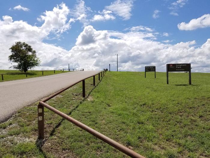
Longhorn Park Picnic Area overlooks Benbrook Lake & Dam in north-central Texas, easiley accessible from the Chisholm Trail Parkway and southwest Fort Worth. Along with a scenic overlook, a large group pavilion is available as well as picnicking, fishing and boat launching.

Recreation

The large group pavilion is popular for family and group activitries. Individual picnic sites and boat launching is also available in the park. The nearby spillway cut for the dam is a popular fossil-hunting locaiotn where visitors can search rof Cretaceous clams and coral remnants form 85 million yeats ago.

Facilities

The large picnic shelter can accommodate up to 100 guests, with restrooms and available parking. A volleyball court and horseshoe pit offer aditonal recreation opportunities.

Natural Features

Longhorn Park is on the high rocky bluffs of the Clear Fork, overlooking the southeast end of the dam.

Nearby Attractions

City lease areas on the lake’s north end offer golf courses, ball fields, tennis & volleyball courts, children’s play areas, trail access and other facilities. Fort Worth’s renowned Cultural & Museum District, Stockyards National Historic District, Botanical Gardens, Zoo, Bass Performance Hall, and downtown Sundance Square, are all only a short drive.

Reservation

More from CampingHiking.net:

CROW PASS CABIN, Alaska Campground Images, Info & Reservations

Listen Directions The cabin is located near Crow Pass in the Chugach Mountains, 3 miles from the Crow Pass Trailhead. Cabin users can expect to encounter small stream crossings during wet periods. Access: At mile 90, AK-1 S/Seward Highway (35 miles south of Anchorage). Turn left onto paved road leading

CAROLINA HEMLOCKS REC AREA, North Carolina Campground Images, Info & Reservations

Listen Directions From Asheville, North Carolina, take I-26 west to exit 9, onto 19 east toward Burnsville. Follow 19 to Micaville and turn right onto Highway 80. Follow 80 south approximately 8 miles to the Carolina Hemlocks Recreation Area. Phone 828-675-5509 Activities BIKING, CLIMBING, CAMPING, INTERPRETIVE PROGRAMS, FISHING, HIKING, PICNICKING,

ALTAMONT, Utah Campground Images, Info & Reservations

Listen Directions From Salt Lake City, Utah, travel south on I-15 to Alpine-Highland exit 284. Travel east on Highway 92 approximately 13 miles through American Fork Canyon, then 3 miles south on the Alpine Loop Scenic Byway. Campground is on the left. Phone PLEASANT GROVE RANGER DISTRICT 801-785-3563 OR UTAH

SHADY COVE GROUP CAMPGROUND, California Campground Images, Info & Reservations

Listen Directions From Running Springs, drive approximately one mile on Highway 18 to the Deerlick Ranger Station/Children’s National Forest Visitor Center. Turn right on Keller Peak Road and continue about five miles. Follow signs to the campground. Phone 909-866-8550 Activities BIKING, CAMPING, INTERPRETIVE PROGRAMS, FISHING, HIKING, WILDLIFE VIEWING Keywords SHAC,Shady

WATAUGA POINT RECREATION AREA, Tennessee Campground Images, Info & Reservations

Listen Directions From Elizabethton, take US 19E/321 south for five miles to Hampton. Turn left on US 321/TN 67 south for six miles, then turn left into Watauga Point.  Phone 423-735-1500 Activities BOATING, FISHING, HIKING, KAYAKING, CANOEING, STAR GAZING, NON-MOTORIZED BOATING, WATER ACCESS, SCENIC DRIVE Keywords WATAUGA POINT RECREATION AREA

BIG ROCK GROUP, Utah Campground Images, Info & Reservations

Listen Directions The campground is located 20 miles west of Huntington, Utah, along Utah Highway 31. Phone (435)384-2372 Activities BIKING, CLIMBING, CAMPING, FISHING, HIKING, HUNTING, WILDLIFE VIEWING Keywords BIGR,MANTI-LASAL NF -FS Related Link(s) Rec Area Info & Images Utah State Road Conditions Utah State Tourism Overview Big Rock Group Campground