WHITE PINE SOUTH GROUP CAMP, NC Campground Reservation, Info, Images, Map, Directions

WHITE PINE SOUTH GROUP CAMP, North Carolina Campground Images, Info & Reservations

Directions

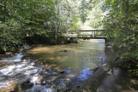
From the Asheville airport, take Highway 280 south to Brevard. Turn right on U.S. Highway 276. Go 1.75 miles to Forest Road 477 and turn right. Go 0.75-mile to the parking area on the right side of the road. Walk across the bridge to the campground entrance road.

Phone

828-552-8040

Activities

BIKING, CAMPING, INTERPRETIVE PROGRAMS, FISHING, HIKING, WATER SPORTS, SWIMMING SITE

Keywords

WHPS,SOUTH WHITE PINE GROUP CAMP,NFs IN NORTH CAROLINA – FS

Related Link(s)

Rec Area Info & Images

North Carolina State Road Conditions

North Carolina State Tourism

Overview

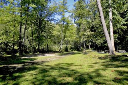
White Pine South Group Camp is one of two group campsites nestled along Avery Creek in the lush forests of the Appalachian Mountains. The facility provides tent camping year-round and can accommodate families, scout troops and other groups of up to 25 people.

Visitors have access to a number of recreation opportunities, including hiking, swimming, mountain biking, fishing and picnicking, in one of the most scenic areas in the state.

Recreation

The forest is known for its hiking and mountain biking trails, several of which are close to the campground. Avery Creek and the Davidson River offer great trout fishing. For visitors wishing to learn more about the area, interpretive programs may be available upon request.

Facilities

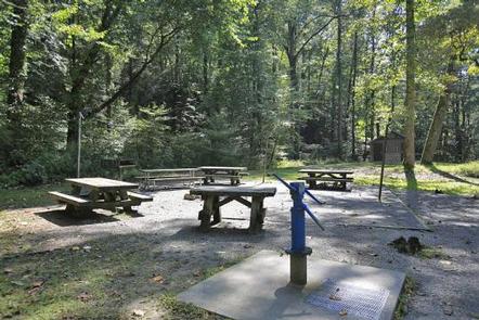
The site is equipped with picnic tables, vault toilets, lantern posts, campfire rings with grills and drinking water.

Natural Features

The campground lies in Pisgah National Forest at an elevation of 2,600 feet. The surrounding land boasts mile-high peaks, cascading waterfalls and slopes thickly forested with hardwoods. The group camping area is adjacent to Avery Creek and near the beautiful Davidson River.

Nearby Attractions

The city of Asheville is about an hour away and offers numerous cultural attractions, art galleries, shops and restaurants. The small town of Brevard is also nearby and has various amenities and services.

Reservation

More from CampingHiking.net:

MILLERS FERRY CAMPGROUND, Alabama Campground Images, Info & Reservations

Directions From Camden, Alabama, take State Route 28 northwest for 12 miles. Turn right before the Lee Long Bridge and follow signs into the campground. Phone 334-682-4191 Activities BOATING, CAMPING, FISHING, HUNTING, SWIMMING SITE Keywords MILF,EAST BANK,ALABAMA RIVERS,MILLERS FERRY LAKE,WILLIAM DANNELLY,ALABAMA RIV. – DAN Related Link(s) Rec Area Info &

JORDAN PINES, Utah Campground Images, Info & Reservations

Directions From I-215, take the 6200 south exit and travel a mile east to Wasatch Blvd. Take Wasatch Blvd a mile south to junction with Big Cottonwood Canyon/Highway 190. Make a left at the junction and travel up Big Cottonwood Canyon 9.2 miles to the campground. Phone SALT LAKE RANGER

Moonflower Canyon Group Site, Utah Campground Images, Info & Reservations

Directions From the center of Moab (at Center and Main) head south to Kane Creek Road. Turn right (west) on Kane Creek Road and drive 3.5 miles. You will see the Moonflower Campground on the left just past the King’s Bottom Campground. Phone (435)259-2100 Activities BIKING, HISTORIC & CULTURAL SITE,

ASPEN (AZ), Arizona Campground Images, Info & Reservations

Directions From Payson, take Highway 260 northeast toward Heber. Take a left at the sign for Woods Canyon Lake (Rim Road/Forest Road 300). Follow for about 5 miles and turn right onto the paved road at the sign toward Woods Canyon Lake (there is no road sign). Aspen Campground is

ALPINE NORTH LOOP, Idaho Campground Images, Info & Reservations

Directions From Alpine, Wyoming, travel 2 miles west on Highway 26 to the campground entrance. Phone 208-270-0150 OR 541-351-1182 Activities BIKING, BOATING, CAMPING, FISHING, HIKING, WATER SPORTS, WILDLIFE VIEWING Keywords ALPI,CARIBOU-TARGHEE NF – FS Related Link(s) Rec Area Info & Images Forest Service Concessionaire Idaho State Road Conditions Idaho State

PETTIT BAY, Oklahoma Campground Images, Info & Reservations

Directions From Tahlequah, OK, go 8.25 miles south on Highway 82, turn right on Indian Road and go two miles south. Then turn left and go one mile southeast on the paved access road. Phone 918-487-5252 Activities BOATING, CAMPING, SWIMMING SITE Keywords PETT,TENKILLER LAKE,TENKILLER FERRY LAKE,TENKILLER FERRY Related Link(s) Rec