Directions
From Brainerd, Minnesota. on Highway 25; turn right on County Road 3 and travel north to Cross Lake, Minn. The Day Use area entrance is to the left, directly across from intersections 3 and 66.
Phone
651-290-5793
Activities
HISTORIC & CULTURAL SITE, FISHING, PICNICKING, VISITOR CENTER, DAY USE AREA, SWIMMING SITE, KAYAKING, CANOEING
Keywords
PRDA,PINE RIVER DAY USE,CROSS LAKE DAM DAY USE,MISSISSIPPI HEADWATER
Related Link(s)
Minnesota State Road Conditions
Overview
In Central Minnesota’s popular lakes area, the Cross Lake Day Use has tremendous appeal for families and friends, with an array of activities and facilities perfect for a day outdoors.
Recreation
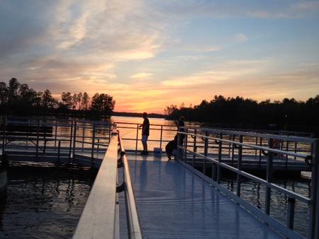
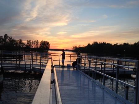
Swim or sunbathe at the beach, enjoy a meal at one of the numerous picnic sites, or for larger groups, reserve one of two group picnic shelters. Shore fishing is popular both upstream and downstream of the dam on accessible fishing piers, and canoe access is available for exploring the Pine River downstream of the dam.
Facilities
The area offers two group picnic shelters. The #1 shelter is located upstream of the dam and is smaller than the #2 shelter which is located downstream of the dam, along the Pine River. Canoe access is available along both shores of the Pine River downstream from the dam. A swimming beach and two accessible fishing piers are available within a short walk of the parking area. Other facilities include a playground, restrooms and parking facilities for up to 50 vehicles.
Natural Features
Surrounded by tall pines on the eastern bank of Cross Lake, the Day Use Area provides an ideal location to explore and enjoy the Whitefish Chain of Lakes, boasting 13,660 acres of water and 119 miles of scenic shoreline.
Nearby Attractions
The city of Crosslake is located within walking distance from the Day Use Area where you will find local shopping, a paved walking and biking trail and numerous other activities within town.


