CAROLINA HEMLOCKS REC AREA, NC Campground Reservation, Info, Images, Map, Directions

CAROLINA HEMLOCKS REC AREA, North Carolina Campground Images, Info & Reservations

Listen

Directions

From Asheville, North Carolina, take I-26 west to exit 9, onto 19 east toward Burnsville. Follow 19 to Micaville and turn right onto Highway 80. Follow 80 south approximately 8 miles to the Carolina Hemlocks Recreation Area.

Phone

828-675-5509

Activities

BIKING, CLIMBING, CAMPING, INTERPRETIVE PROGRAMS, FISHING, HIKING, PICNICKING, WATER SPORTS, SWIMMING SITE

Keywords

CAHE,NFs IN NORTH CAROLINA – FS

Related Link(s)

Rec Area Info & Images

Forest Service Concessionaire

North Carolina State Tourism

North Carolina State Road Conditions

Overview

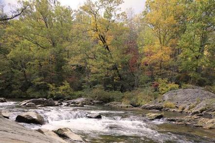
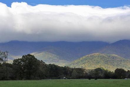
Carolina Hemlocks Recreation Area sits in the scenic mountains of Pisgah National Forest. This is a great place for small to medium-sized groups to swim, fish, tube, hike, camp, picnic and simply relax in the cool shade of the forest.

Recreation

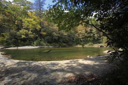
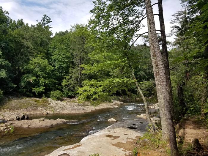
The river provides endless hours of fun for families and water enthusiasts, including swimming and tubing. Anglers can also try their luck for trout and smallmouth bass from the shore. Picnickers will enjoy relaxing in the shaded picnic shelter set amidst the deep woods. After eating, visitors can take a leisurely walk along a one-mile trail or get a workout on a 3.8-mile trail.

Facilities

Carolina Hemlocks Recreation Area offers 35 primitive campsites, sites equipped with picnic tables, tent pads, lantern posts and campfire rings with grills. The facility provides hot showers and restrooms with flush toilets. Campers can purchase firewood, ice, tee shirts, souvenirs and rent tubes.

Natural Features

As the name suggests, Carolina Hemlocks Recreation Area is shaded by a thick hemlock forest with a mix of deciduous trees and rhododendrons. The facility is adjacent to the South Toe River and sits at an elevation of 2,900 feet.

Nearby Attractions

Visitors can enjoy scenic driving along the Blue Ridge Parkway or hiking in Mount Mitchell State Park.

Reservation

More from CampingHiking.net:

BURNS RUN WEST, Oklahoma Campground Images, Info & Reservations

Listen Directions From Highway 75 in Denison, Texas, take Exit 72 to Highway 91, travel north on 91 across Denison Dam, 5 miles. Take the second left, follow signs for about 1.5 miles. Physical address: 825 West Burns Run Road, Cartwright, OK 74731 Phone 580-965-4922 Activities CAMPING, SWIMMING SITE Keywords

OH RIDGE, California Campground Images, Info & Reservations

Listen Directions Oh Ridge Campground is 350 miles north of Los Angeles and 150 miles south of Reno, Nevada. Take U.S. Highway 395 to its southern junction with Highway 158. Take 158 for 1 mile. Turn right on North Shore Drive. Go approximately 1 mile and turn left on Pine

THUNDER ROCK CAMPGROUND, Tennessee Campground Images, Info & Reservations

Listen Directions From the Ocoee Ranger Station, turn left onto Highway 64 eastbound and travel 10.9 miles to the TVA Ocoee Powerhouse Number 3. Turn right and cross the bridge to reach the campground on the right. Phone 423-338-3300 Activities BOATING, CAMPING, FISHING, HIKING, MOUNTAIN BIKING, KAYAKING, CANOEING, NON-MOTORIZED BOATING,

LONE BRANCH, Tennessee Campground Images, Info & Reservations

Listen Directions From Nashville, TN, take I-40 East to exit 229-B/Golden Bear Gateway. Continue straight on Golden Bear Gateway for approximately 9 miles. Entrance to the recreation area will be on your left just passed Cedar Creek Club. * Golden Bear Gateway turns into Benders Ferry Road at the US-70/Lebanon

HOOD PARK, Washington Campground Images, Info & Reservations

Listen Directions From Pasco, Washington, take Highway 12 east. After crossing the Snake River Bridge, take the next exit and continue to State Route 124. The park entrance is on the left just after the roundabout. Phone 509-547-2048 Activities BOATING, CAMPING, FISHING, HIKING, DAY USE AREA, SWIMMING SITE Keywords HOOD,MCNARY,LAKE

GRAYBACK, Idaho Campground Images, Info & Reservations

Listen Directions From Boise, take State Highway 21 north for 36 miles. Campground access road is located on the east side of the road, between mileposts 36 and 37. Turn right and travel a quarter-mile to the campground. Phone 208-392-6681 Activities CAMPING, FISHING, HIKING, HUNTING, VISITOR CENTER, WILDLIFE VIEWING Keywords