NAVAJO CLIFFS, UT Campground Reservation, Info, Images, Map, Directions

NAVAJO CLIFFS, Utah Campground Images, Info & Reservations

Listen

Directions

From Manila, Utah: Travel 7 miles south on Highway 44 to Sheep Creek Geological Loop. Site is a short distance from Carmel Campground on Sheep Creek.

Phone

435-784-3483

Activities

BIKING, BOATING, CAMPING, INTERPRETIVE PROGRAMS, FISHING, HIKING, WILDLIFE VIEWING, SWIMMING SITE

Keywords

NVJC,NAVAJO,NAVAJO CLIFFS,NAVAJO CLIFF,FLAMING GORGE,ASHLEY NF – FS

Related Link(s)

Rec Area Info & Images

Utah State Tourism

Forest Service Concessionaire

Utah State Road Conditions

Overview

Navajo Cliffs is an ideal group day-use site for weddings, reunions and large gatherings. It’s just 7 miles south of Manila, Utah, along the scenic Sheep Creek Geological Loop at an elevation of 6,200 feet.

Recreation

Sheep Creek offers rainbow trout and kokanee salmon fishing. Boating, fishing, canoeing, water skiing and swimming are popular activities on nearby Flaming Gorge.

Facilities

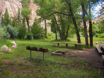
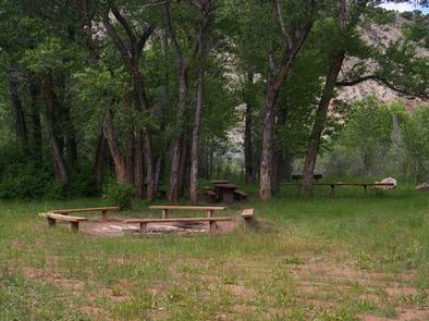
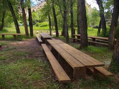
This group day-use site can accommodate up to 80 people. Large picnic tables, a serving table, grills and a campfire ring with benches are provided. A vault toilet and garbage service is provided but there is no water. Picnickers must bring their own supply.

Natural Features

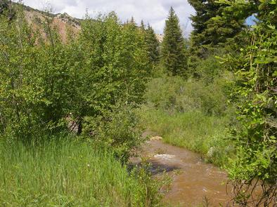
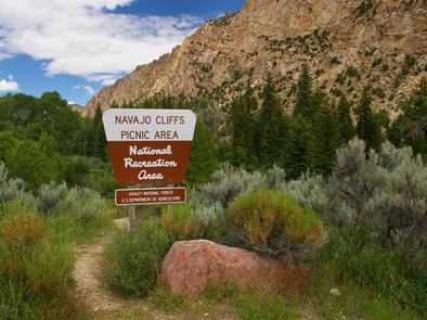
The site offers beautiful views of unique Navajo Cliffs. Shady trees line the banks of Sheep Creek, which runs through the site. Wildlife is plentiful in the area. Typical weather ranges from warm days to cool nights.

Nearby Attractions

Flaming Gorge National Recreation Area is known not only for its beautiful red cliffs, but also for its world-class fishing for lake, brown and rainbow trout. Boating, waterskiing, jet skiing, canoeing, kayaking, swimming and scuba diving are popular activities on the reservoir.

Flaming Gorge Dam offers guided tours of the working hydroelectric plant and the dam itself; The adjacent visitor center contains area history exhibits.

The Green River below the dam provides spectacular rafting opportunities. A trip down the river offers unique geology, outlaw history and Native American rock art.

Reservation

More from CampingHiking.net:

BIG ELK GUARD STATION, Oregon Campground Images, Info & Reservations

Listen Directions Drive east from Butte Falls on the Butte Falls-Fish Lake Highway (County Road #821) for approximately 19 miles to the junction with State Highway #140. Turn right, go .08 miles on Highway #140 to the junction with Forest Service Road #37. Turn left, and travel approximately 4 miles

KANZA VIEW PICNIC SHELTER, Kansas Campground Images, Info & Reservations

Listen Directions 1 mile north of Council Grove, Kansas on Highway 177. Then west 200 yards on Lake Road (goes across dam). Phone (620) 767-5195 Activities HISTORIC & CULTURAL SITE, CAMPING Keywords Related Link(s) Rec Area Info & Images Kansas State Road Conditions Kansas State Tourism Overview Kanza View Picnic

CRESCENT CREEK CAMPGROUND, Oregon Campground Images, Info & Reservations

Listen Directions From Crescent, OR: Travel 8.7 miles west on County Road 61/Crescent Cut-off Road. Phone 541-323-1746 Activities CAMPING Keywords Related Link(s) Rec Area Info & Images Oregon State Road Conditions Oregon State Tourism Overview Crescent Creek is a small campground that is somewhat isolated from other campgrounds in the

LEDGEFORK, Utah Campground Images, Info & Reservations

Listen Directions From Salt Lake City: From I 15, take I 80E past Park City to either Hwy 189 or Wanship. On 189, travel SE to Kearns Blvd/SR 248. Continue east on SR 248 to Browns Canyon Rd. Travel E/NE on Browns Canyon until it connects with SR 32 just

DENVER CABOOSE CABIN, Alaska Campground Images, Info & Reservations

Listen Directions The cabin is approximately 5.5 miles north of Skagway along the East Fork of the Skagway River. The cabin is beside the railroad tracks at the Denver Glacier Trailhead. Access is via the White Pass and Yukon Route Railroad from May 1 through September 30. Make reservations at

MAGRUDER RANGERS HOUSE, Montana Campground Images, Info & Reservations

Listen Directions From Darby, Montana, travel south on Highway 93 for 4 miles to West Fork Road/Highway 473. Continue on this road for approximately 14 miles to the Nez Perce Road/Magruder Corridor Road and go another 34 miles on the one-lane gravel, and partially paved road. Just before the Deep