LOWER PENSTEMON, ID Campground Reservation, Info, Images, Map, Directions

LOWER PENSTEMON, Idaho Campground Images, Info & Reservations

Directions

Travel south on Twin Falls County Road G3 which becomes Forest Road 515, commonly known as Rock Creek Road, for approximately 27 miles from Hansen.

Phone

208-678-0430

Activities

BIKING, CAMPING, HIKING, HORSEBACK RIDING, HUNTING, WILDLIFE VIEWING

Keywords

LOWP,SAWTOOTH NF – FS

Related Link(s)

Rec Area Info & Images

Idaho State Tourism

Idaho State Road Conditions

Overview

Lower Penstemon Campground is located along the scenic Rock Creek Road, in southern Idaho, at an elevation of 6,600 feet. Visitors come to the area to enjoy its abundant trails and natural beauty.

Recreation

Hiking, mountain biking, horseback riding and off-road vehicle trails crisscross the surrounding area. Third Fork, Pike Mountain, Rim View and Porcupine Spring trails all begin nearby. Rock Creek runs along the campground, offering good trout fishing.

Facilities

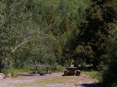
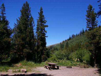
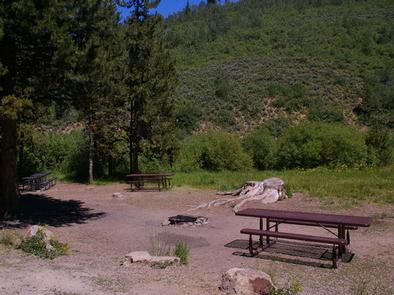
The campground contains single-family campsites with picnic tables and campfire rings. Vault toilets and drinking water are provided. Roads and parking spurs within the campground are gravel. Because the campground is situated along the main road, some noise from passing cars is to be expected.

Natural Features

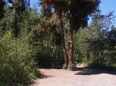
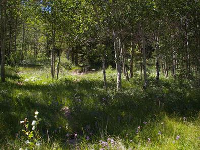
The campground is situated in a mixed conifer and aspen forest, just off Rock Creek Road. Most sites have partial shade. Summer wildflowers dot the landscape and wildlife can be seen frequently in the surrounding area.

Reservation

More from CampingHiking.net:

PINEKNOT, California Campground Images, Info & Reservations

Directions From I-10 in Redlands, take Highway 330 to Highway 18 in Running Springs. Continue east on Highway 18 at Big Bear Lake Dam, go straight at the dam and follow Highway 18. Turn onto Summit Boulevard and continue to a block wall. Turn left into the campground. Phone 909-866-8550

TE-AH, Utah Campground Images, Info & Reservations

Directions From Cedar City, Utah, take Highway 14 east for 25 miles. Turn south on Navajo Lake road and travel for 7 miles. Phone 801-226-3564 Activities BIKING, CAMPING, FISHING, HIKING, HUNTING, WILDLIFE VIEWING Keywords TEAH,CEDAR BREAKS NATIONAL MUT,NAVAJO LAKE,ASPEN FOREST TYPE,TE AH,DIXIE NF – FS Related Link(s) Rec Area Info

AIRPORT BEACH SHELTER, Texas Campground Images, Info & Reservations

Directions From I-35 take Lake Shore Drive exit (Exit 339) and drive west to Steinbeck Bend Road. Turn right and proceed to second stop light. At intersection with FM1637 (China Spring Highway) turn right. Go to next stop light (Flat Rock Road). Turn left and drive approximately 1 mile to

HEYBURN PARK, Oklahoma Campground Images, Info & Reservations

Directions From Bristow, go 9 miles east and turn left on to 257th West Ave. Follow the paved road about 3 miles to the campground. From Sapulpa, take State Highway 66 west to Kellyville, turn west on to 151st South Ave and go about 3.5 miles to the 4 way

RED FIR, California Campground Images, Info & Reservations

Directions Take Highway 50 east of Placerville for approximately 21 miles to Ice House Road. At the river take a left and go north 28 miles, then veer right at the fork in the road and continue 9 miles to Red Fir Group campground. Phone 831-245-6891 Activities BOATING, CAMPING, FISHING,

SILTCOOS SAND CAMPING, Oregon Campground Images, Info & Reservations

Directions From Florence Oregon, travel 7 miles south on Highway 101 to the Siltcoos Beach Access Road. Turn west on Siltcoos Beach Access Road and proceed 1 mile 1.5 miles to Driftwood II Campground on the right. The Sand Access is within the Campground. Phone 541-271-6000 Activities CAMPING, FISHING, HIKING,