Directions
From US-460/Shelbiana Road, continue approximately five miles, then make a slight right onto Kentucky Route 1789/Fishtrap Road. Continue three miles to the Fishtrap Lake Dam Site Recreation Area. Shelter # 1 is the first right turn after entering the dam site, located approximately one mile below the dam. Located along the same road, Shelter #2 is the second shelter on the right near the end of the recreation area.
Fishtrap Lakes’ Grapevine Recreation Area is located along State Route 194 at Phyllis, Kentucky. Shelter # 3 is located on the right approximately 1/4 mile from the entrance area.
Phone
606-437-7496
Activities
BOATING, CAMPING, FISHING, WILDLIFE VIEWING
Keywords
FITP,FISHTRAP LAKE
Related Link(s)
Kentucky State Road Conditions
Overview
Nestled among mountains and dense forests, the Fishtrap Lake area will appeal to anyone who loves boating, fishing or hiking. A man-made lake surrounded by natural beauty, Fishtrap Lake was created to help control flooding along the Ohio and Big Sandy Rivers.
The lake’s location allows visitors to choose from endless recreational opportunities, whether its water sports on the lake, hiking on nearby trails or picnicking in the picturesque group area.
Recreation
Boat ramps are available for fisherman and boating enthusiasts. The surrounding wildlife area provides numerous trails for hiking and horseback riding, and additional developed trails can be accessed at the nearby Lick Creek Recreation Area.
Facilities
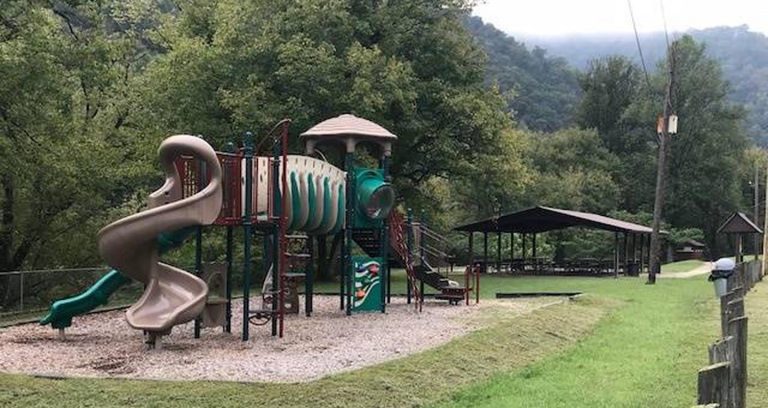
Fishtrap Lake Shelters provide covered picnic areas with playgrounds, perfect for kids. While everyone can appreciate the scenery provided by the lake, which serves as a breathtaking backdrop to any party or family get-together.
Two shelters are located at the Dam Site Recreation Area, and a third shelter is located at the Grapevine Recreation Area, a short drive away.
Camping is also available nearby at the Grapevine Recreation Area.
Natural Features
Fishtrap Lake sits in the rich coalfield country of Kentucky, surrounded by steep and lush mountainous terrain. The site is well-known for wildlife viewing and has become a haven for local animals, especially deer.
Nearby Attractions
Fishtrap Lake Marina, located at the Fishtrap Dam Site Recreation Area, provides visitors with docking facilities and a general store.Downtown Pikeville is 20 minutes North from project which provides; Hatfield Mccoy History tours, Dueling Barrel Brewery and Distillery, Kayaking, Horse Trails, Zipline, Jenny Wiley Theatre, and EXPO Center.

