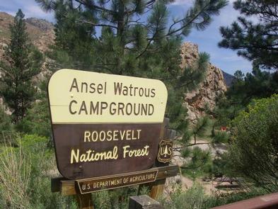
ANSEL WATROUS, CO Campground Reservation, Info, Images, Map, Directions

ANSEL WATROUS, Colorado Campground Images, Info & Reservations

Directions

From Fort Collins, take Highway 14 northwest for 13 miles.

Phone

970-295-6700

Activities

BIKING, BOATING, CAMPING, FISHING, HIKING, WILDLIFE VIEWING, MOUNTAIN BIKING, KAYAKING, CANOEING, BIRDING, RAFTING

Keywords

ANSE,ANSEL,WATROUS,ANSEL WATROUS,ARAPAHO AND ROOSEVELT NF – FS

Related Link(s)

Rec Area Info & Images

Colorado State Road Conditions

Forest Service Concessionaire

Colorado State Tourism

Overview

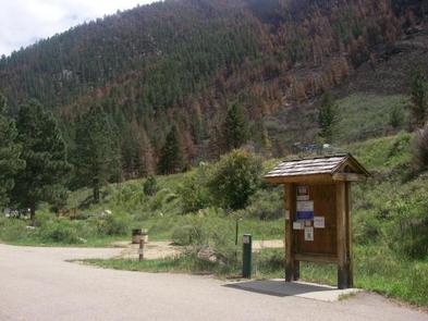
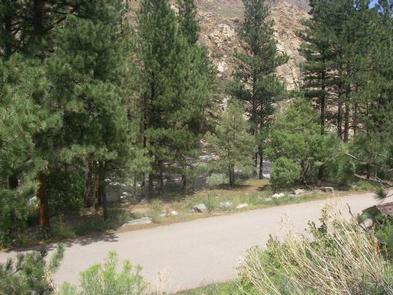
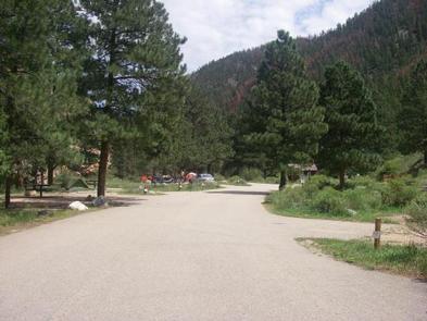
Ansel Watrous Campground is located on the Cache la Poudre River, 22 miles northwest of Fort Collins, Colo., along Highway 14. Visitors enjoy the area for its great rafting, fishing and hiking opportunities.

Recreation

The Cache la Poudre River offers whitewater rafting and fishing. Anglers cast for brown, cutthroat and rainbow trout, among other species of fish.

Hiking, biking and horseback riding trails are in the surrounding area, including the 4-mile Young Gulch Trail.

Other popular activities enjoyed by visitors to the campground include birding and wildlife viewing.

Facilities

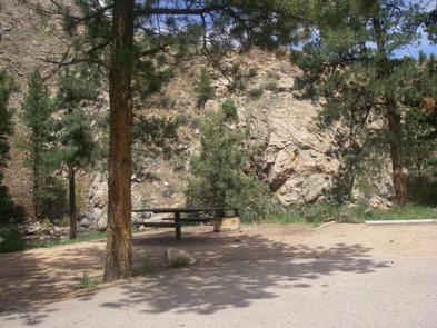
The campground offers accessible single-family sites, each equipped with a 12-by-15 tent pad, a picnic table and a campfire ring with grill.

Vault toilets and drinking water are provided. Dead and downed firewood may be gathered in the forest or purchased from the campground host.

Natural Features

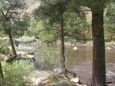
The canyon’s vegetation varies from dense forests to open meadows and the campground is surrounded by steep mountains. The campground is situated among Ponderosa pines on the banks of the Cache la Poudre River, Colorado’s first river designated as a National Wild and Scenic River.

Charges & Cancellations

A $10.00 service fee will apply if you change or cancel your reservation. Late cancellations are subject to additional fees. For full details see NRRS Reservation Policy.

Reservation

More from CampingHiking.net:

JIM HOGG PARK, Texas Campground Images, Info & Reservations

Directions From I-35, take Farm to Market Road 2338 west for 6 miles to Jim Hogg Road. Turn south and continue 2 miles to the park entrance. Phone 512-930-5253 Activities BOATING, CAMPING, FISHING, HIKING, HUNTING, WILDLIFE VIEWING, PADDLING, MOUNTAIN BIKING, BIRDING Keywords JIMH,LAKE GEORGETOWN,GEORGETOWN LAKE,LAKE GEORGETOWN Related Link(s) Rec Area

PINEY BAY, Arkansas Campground Images, Info & Reservations

Directions From London, Arkansas, take US-64 west for 3 miles to State Route 359 north. Continue for 3.5 miles and follow signs into the campground. Phone 479-885-3029 Activities BOATING, CAMPING, FISHING, DAY USE AREA, SWIMMING SITE Keywords PINB,DARDANELLE LAKE-ARK. RIV.NAV.,DARDANELLE LAKE Related Link(s) Rec Area Info & Images Arkansas State

RENEGADE, Utah Campground Images, Info & Reservations

Directions From Heber City, Utah, take Highway 40 east for 28 miles to Strawberry Bay Junction. Turn right and travel 12 miles to campground. Phone HEBER RANGER DISTRICT 435-654-0470 OR UTAH RECREATION COMPANY 385-273-1100 Activities BIKING, BOATING, CAMPING, FISHING, HIKING, WATER ACTIVITIES Keywords RENG,UINTA NF – FS Related Link(s) Rec

CEDAR SPRINGS CAMPGROUND (WA), Washington Campground Images, Info & Reservations

Directions From Naches, take Highway 410 to milepost 88.4. Turn left on Bumping Lake Road and go 0.6 miles to the campground. Phone 541-338-7869 Activities CAMPING, FISHING, HIKING Keywords CESP,Bumping River,Naches,OKANOGAN – WENATCHEE NF -FS,CEDAR SPRINGS,CEDAR SPRINGS CAMPGROUND Related Link(s) Rec Area Info & Images Forest Service Concessionaire Washington State

HECKMAN LAKE CABIN, Alaska Campground Images, Info & Reservations

Directions The cabin is located approximately 15 miles from Ketchikan within the Naha Recreation Area. It is located near the outlet of Heckman Lake at the terminus of the Naha Recreation Trail. It is 6 miles up the trail from Naha Bay. Access is by hiking the trail from Naha