COTTONWOOD GROUP PICNIC SITE, WY Campground Reservation, Info, Images, Map, Directions

COTTONWOOD GROUP PICNIC SITE, Wyoming Campground Images, Info & Reservations

Directions

From Afton, Wyoming, take Highway 89 south approximately 7 miles to Smoot and watch for signs for the Cottonwood Lake Campground.

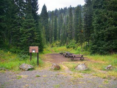
The forest boundary is about a mile up the access road, and the campground is 6 miles beyond that. Continue past the west first loop of the campground, then go right at the ‘Y’ intersection toward lake. The group picnic area is on the left side of the road.

Phone

307-886-5300

Activities

BIKING, CAMPING, HIKING, HUNTING, WILDLIFE VIEWING

Keywords

CGPS,BRIDGER-TETON NF – FS

Related Link(s)

Rec Area Info & Images

Overview

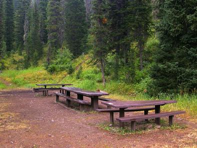
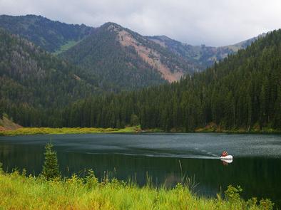
Cottonwood Group Picnic Site is located next to scenic Cottonwood Lake on the Salt River Mountains, surrounded by the forests of western Wyoming.

Recreation

The lake offers great canoeing and boating for smaller craft, as well as fishing for brook and cutthroat trout.

Hiking, mountain biking, off-road vehicle and horseback riding trails are in the area.

Facilities

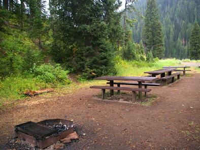
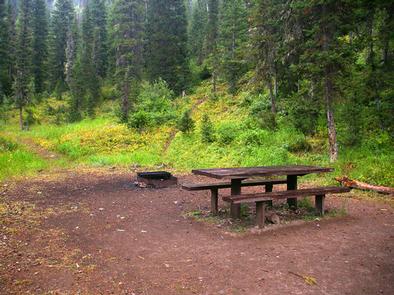
This day-use picnic site can accommodate up to 50 guests and 8-10 vehicles. Vault toilets and drinking water are provided.

A group overnight campsite is available for reservations here.

Natural Features

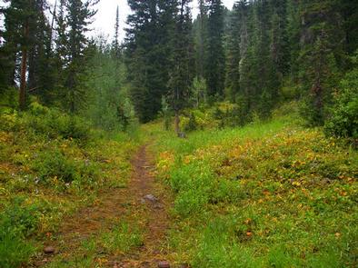
The picnic site is located above Cottonwood Lake, near the peaceful North Fork Creek. A forest of pines and aspens offers shade, and vibrant summer wildflowers are abundant.

The Bridger-Teton National Forest offers more than 3.4 million acres of public land for outdoor recreation. With its pristine watersheds, abundant wildlife and immense wildlands, the forest comprises a large part of the Greater Yellowstone Ecosystem, the largest intact ecosystem in the lower 48 United States.

Reservation

More from CampingHiking.net:

UPPER COFFEE POT, Idaho Campground Images, Info & Reservations

Directions From West Yellowstone, Montana, take Highway 20 south for 23 miles. From Ashton, Idaho, take Highway 20 north for 32 miles. Turn west onto Forest Road 130 and travel 2 miles to the campground. Phone 208-558-7658 OR 208-270-0094 Activities BOATING, CAMPING, FISHING, HIKING, WILDLIFE VIEWING Keywords UPCP,Coffee Pot,CARIBOU-TARGHEE NF

KETTLE FALLS CAMPGROUND, Washington Campground Images, Info & Reservations

Directions The campground is 87 miles north of Spokane, Washington. Take U.S. Highway 395 north to the town of Kettle Falls, turn south on Boise Road at Barney’s Bridge and travel three miles to the campground. Phone 509-754-7889 Activities BIKING, BOATING, HISTORIC & CULTURAL SITE, CAMPING, INTERPRETIVE PROGRAMS, FISHING, HIKING,

RAINBOW POINT, Idaho Campground Images, Info & Reservations

Directions From Boise, Idaho, travel north on Highway 55 for 95 miles to Donnelly. Turn west on West Roseberry Road and go 1.5 miles to Norwood Road. Turn south and continue a mile to Tamarack Falls Road. Turn west and go just over a mile to West Mountain Road. Turn

AMERICAN RIDGE LODGE, Washington Campground Images, Info & Reservations

Directions Please contact the Ranger District at 509-653-1401 prior to your arrival to check any restrictions or conditions, such as fire or road closures, or weather that may affect the quality of your visit. Access to the lodge is through a locked gate. The combination to the gate lock will

WASHINGTON IRVING SOUTH, Oklahoma Campground Images, Info & Reservations

Directions From Tulsa, Oklahoma, take Highway 412 west for 15 miles to Bears Glen exit. Turn left at stop sign onto the Frontage Road and drive 1 block. Turn right at first paved road and follow 2 miles to the campground entrance. Phone 918-865-2621 Activities BOATING, CAMPING, FISHING, HIKING, PICNICKING,

CEDAR CANYON, Utah Campground Images, Info & Reservations

Directions From Cedar City, Utah, take Highway 14 east for 11 miles. Campground is located just below the S turn on your left. Phone 801-226-3564 Activities CAMPING, HIKING, MOUNTAIN BIKING, SCENIC DRIVE Keywords CED2,CEDAR CITY,CEDAR BREAKS NAT. MONUMENT,DIXIE NF – FS Related Link(s) Rec Area Info & Images Utah State