CHEOAH POINT CAMPGROUND, NC Campground Reservation, Info, Images, Map, Directions

CHEOAH POINT CAMPGROUND, North Carolina Campground Images, Info & Reservations

Directions

From Robbinsville, North Carolina, continue on Highway 129 north for approximately 6 miles. Turn left on SR # 1145 – Thunderbird Mountain Road. Continue approximately 1.3 miles on Thunderbird Mountain Road to the Cheoah Point Campground.

Phone

828-479-6431

Activities

BOATING, CAMPING, FISHING, HIKING, SWIMMING, WATER ACTIVITIES, KAYAKING, CANOEING, NON-MOTORIZED BOATING, WATER ACCESS, JET SKIING

Keywords

CPCA,NFs IN NORTH CAROLINA – FS

Related Link(s)

Rec Area Info & Images

North Carolina State Road Conditions

North Carolina State Tourism

Overview

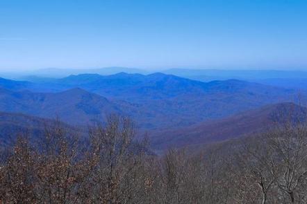
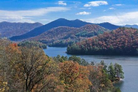
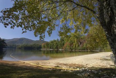
Cheoah Point Campground lies on a peninsula of the vast Lake Santeetlah in the hills of western North Carolina. The lake and surrounding landscape provide countless recreational opportunities for outdoor enthusiasts.

Recreation

Anglers enjoy fishing for trout, walleye, a variety of bass, bream and crappie and more in the 2,800-acre Lake Santeetlah. Boating, canoeing, jet skiing and swimming are also popular activities on the lake. Nearby, the Wauchecha Bald Trail, which begins as a an easy hike and gets progressively more difficult, provides access to the famed Appalachian Trail.

Facilities

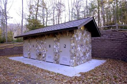
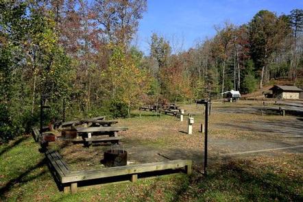
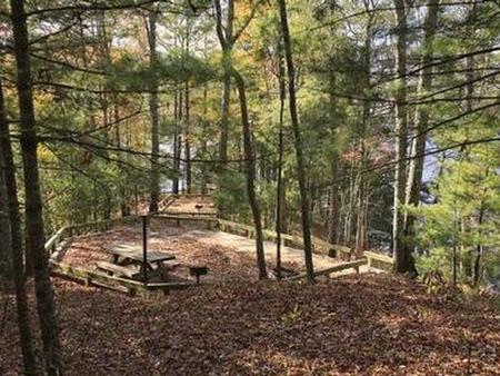
The campground provides multiple open and wooded campsites that can accommodate up to 10 guests and 2 vehicles per site. Six RV sites provide 15/30/50 amp electrical hookups. Tables and campfire rings with grills are provided at each site. Flush toilets, hot showers and drinking water are provided to help create a comfortable camping experience.

Natural Features

Lake Santeetlah sits in the Nantahala National Forest, which covers 1.3 million acres of mountain lands. Old forests grace the hills and valleys, with some of the canyons reaching deep into the earth, providing ample hiking opportunities in the beautiful terrain. Cheoah Point is situated in a forest of mature hardwoods at an elevation of 1,760 feet. The campground covers steep terrain and many of the campsites overlook the lake.

Nearby Attractions

Great Smoky Mountains National Park is just a short distance away, offering an ideal day trip from Cheoah point Recreation Area.

Reservation

More from CampingHiking.net:

Trapper Creek Campground, Oregon Campground Images, Info & Reservations

Directions From I-5 take exit 188A, heading west on Highway 58 for 62.4 miles, then continue 1.9 miles south on Road 5810 to the campground. Phone 541-323-1746 Activities BIKING, BOATING, CAMPING, FISHING, HIKING, WATER SPORTS, SWIMMING SITE Keywords TRPC,Trapper,Trap,Shelter Cove,Odell,Trapper Creek,Trapper Creek Campground Related Link(s) Rec Area Info & Images

BIG SPRINGS – CARIBOU, Idaho Campground Images, Info & Reservations

Directions Just east of Lava Hot Springs, Idaho, look for "Pebble Area" sign and turn left onto Blaser Highway/Old Highway 30. Go north on the paved highway 9 miles to Pebble Creek Road, known locally as Mike’s Place or Whiskey Mike’s. Turn left across railroad tracks on gravel Forest Road

SANTA BARBARA CAMPGROUND, New Mexico Campground Images, Info & Reservations

Directions From the junction with State Road 75, follow SR 73 1.4 miles to the Santa Barbara Road. Turn left onto the Santa Barbara Road. Then travel 6.2 miles to the campground. Santa Barbara Road becomes Forest System Road 116 when the pavement ends. Phone 435-245-6521 Activities CAMPING, HIKING, HORSEBACK

SUNNY GULCH CAMPGROUND, Idaho Campground Images, Info & Reservations

Directions From Stanley, Idaho, take Highway 75 south approximately 3 miles. Campground is on the north side of the road, between the highway and the Salmon River. Phone 928-537-8888 Activities CAMPING, FISHING, HIKING Keywords SUNN,SAWTOOTH NF – FS Related Link(s) Rec Area Info & Images Forest Service Concessionaire Idaho State

Walupt Lake Campground, Washington Campground Images, Info & Reservations

Directions Take I-5 to Highway 12 towards Packwood, then take Highway 21 to FS Road 2160 to the campground. Phone 541-338-7869 Activities BOATING, CAMPING, FISHING, SWIMMING SITE Keywords WALP,GIFFORD PINCHOT NF – FS Related Link(s) Rec Area Info & Images Washington State Road Conditions Forest Service Concessionaire Washington State Tourism

SHEEP TRAIL CAMPGROUND, Idaho Campground Images, Info & Reservations

Directions From Stanley, Idaho, take State Highway 21 west for approximately 10 miles. Turn south between mileposts 121 and 122. Take Forest Road 613 to Sheep Trail Campground, located adjacent to State Highway 21. Phone 928-537-8888 Activities BIKING, CAMPING, FISHING, HIKING, WILDLIFE VIEWING Keywords SHEE,SAWTOOTH NF – FS,”Flaming Gorge National