
Directions
From Malad, Idaho: take I-15 north 11 miles to Exit 22 (Devil Creek Reservoir). Go north on old Highway 191 for 3.2 miles (paved road). Turn west and cross over the interstate on Forest Service Road #041 and go about two miles (good graveled road), then turn left and go a few hundred feet to the guard station.
Phone
208-236-7500
Activities
BIKING, CAMPING, FISHING, HIKING, HORSEBACK RIDING, HUNTING
Keywords
MSGS,CARIBOU-TARGHEE NF – FS
Related Link(s)
Overview
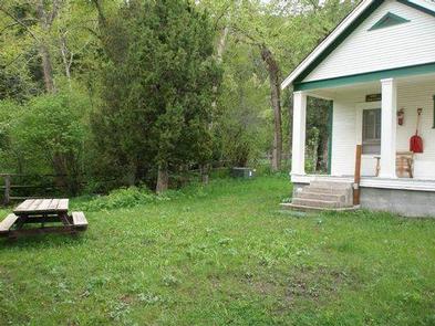
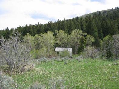
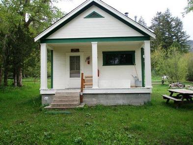
Malad Summit Guard Station is located 14 miles north of Malad, Idaho on Malad Pass just off I-15. The rustic one-room cabin is in a forested setting in narrow Mill Creek Drainage, and offers a secluded retreat on fenced acreage surrounded by scenic high country views.
The original guard station was established in 1908, but was replaced by the existing cabin in 1934. The cabin is accessible by car when there is no snow. Guests should be prepared in snowy conditions to ski, snowshoe or snowmobile half a mile from the plowed road to reach the cabin. The guard station offers many amenities for a comfortable stay, but fewer conveniences are available in winter.
Recreation
The surrounding area offers a variety of recreational activities. Trails are provided for hikers, mountain bikers, horseback riders and off-road vehicles (Idaho OHV safety message).
Anglers can fish for small brook trout in Mill Creek. Hunting for game and game birds is another popular pastime.
Facilities
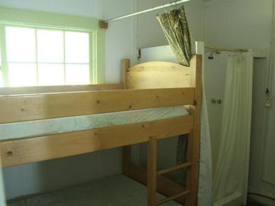
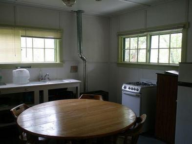
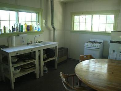
Cabin amenities include a wood stove, table and chairs, two bunkbeds with mattresses, two folding cots, a broom and dustpan, sink and propane appliances (space heater, water heater, stove/oven). Guests may find limited dishes and cookware. The mudroom is equipped with shower facilities.
A vault toilet outhouse, campfire ring and picnic table are outside. Corrals are available for stock. Parking is available for three RVs.
The cabin’s water is shut off Oct. 10th, depending on weather, so winter guests need to bring their own water. Bedding, cleaning supplies, towels, garbage bags, first aid supplies, matches and lanterns or flashlights are not provided. Guests are expected to clean the cabin and pack out their trash before leaving.
Natural Features
The rustic single-room cabin is tucked into a forest of deciduous and conifers at an elevation of about 6,000 feet. Mill Creek meanders through the site.
The front porch invites guests to sit and enjoy views of the forest and possible wildlife sightings. Black bears, wolves, elk, moose, mule deer, bison, grizzly bears, mountain lions and pronghorn are some of the species native to the area (bear safety tips).