COLUMBINE CAMPGROUND (NM), NM Campground Reservation, Info, Images, Map, Directions

COLUMBINE CAMPGROUND (NM), New Mexico Campground Images, Info & Reservations

Listen

Directions

Five miles east of Questa, New Mexico via NM highway 38.

Phone

435-245-6521

Activities

CAMPING, FISHING, HIKING, VISITOR CENTER, WILDLIFE VIEWING

Keywords

Related Link(s)

Rec Area Info & Images

New Mexico State Road Conditions

New Mexico State Tourism

Overview

Columbine Campground is located between Questa and Red River, New Mexico. The Red River flows past the campground and a trailhead leads into the Columbine-Hondo Wilderness area. Columbine Campground sits at 7,900 feet in elevation.

Recreation

The Columbine Twining hiking trail can be found at the south end of the campground and gives access to 14 miles of hiking trails, and leads into the Columbin-Hondo Wilderness area. The Red River runs near the campground and can be accessed near the first loop.

Facilities

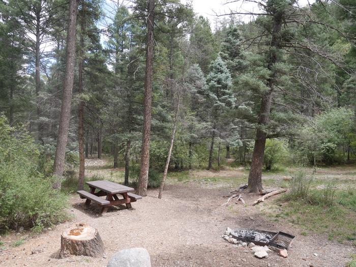
This campground offers 26 single sites, potable water, and vault toilets. Each site is has a fire ring, picnic table, and tent pad. Please note that no water can be filled directly into a trailer, rv, or motorhome anywhere in this campground – the potable water is only for filling containers you bring back to your site.

Natural Features

The campground is composed of two loops. One small loop at the campground entrance, has all open sites and views of the towering mountains. The other is a long loop up the canyon along the fast-flowing Columbine Creek. The campsites in this loop are tucked in among pine, spruce and some aspen providing ample shade and good privacy between campsites.

Nearby Attractions

Be sure to explore Red River, Questa, and the Enchanted Circle while in the area.

Reservation

More from CampingHiking.net:

PIPER ISLAND CABIN, Alaska Campground Images, Info & Reservations

Listen Directions Accessible year round by floatplane or boat, weather permitting. Located 30 miles north of Sitka within Schulze Cove, on the north side of Fish Bay, the northwest coast of Baranof Island. From Sitka, boat access is 90 minutes, air access is 20 minutes. For geographic features surrounding the

JEANETTE LAKE, Minnesota Campground Images, Info & Reservations

Listen Directions From Orr, Minnesota, take St. Louis County Road 23 for 16 miles to Buyck. At Buyck, County Road 23 turns into County Road 24. Continue on County Road 24 for 8 miles to the Echo Trail. Turn right onto the Echo Trail and continue 12 miles to Jeannette

TANNERS FLAT, Utah Campground Images, Info & Reservations

Listen Directions From I-215, take the 6200 South exit and travel a mile east to Wasatch Blvd. Take Wasatch Blvd 3 miles south to junction with Little Cottonwood Canyon/Highway 210. Take a left at the junction and travel up Little Cottonwood Canyon for 4.1 miles to the campground. Phone SALT

SOUTH OVERLOOK (IA), Iowa Campground Images, Info & Reservations

Listen Directions 1105 North HWY T15 Knoxville, Iowa 50138 From Pella, Iowa, follow county road T-15 southwest for 4 miles, then follow signs to South Overlook. Phone 641-828-7522 Activities BIKING, BOATING, CAMPING, HUNTING, WILDLIFE VIEWING Keywords Related Link(s) Rec Area Info & Images Iowa State Road Conditions Iowa State Tourism

STILLHOUSE, Texas Campground Images, Info & Reservations

Listen Directions From Interstate 35 in Belton, Texas take State Highway 190 west to the Simmons Road exit. Exit and turn left under 190 onto Simmons Road. Proceed about three miles to the park. Phone 254-939-6741 Activities BOATING, CAMPING, FISHING, SWIMMING SITE Keywords STIL,STILLHOUSE HOLLOW PARK,STILLHOUSE HOLLOW Related Link(s) Rec