NORTH SHORE PICNIC AREA, ID Campground Reservation, Info, Images, Map, Directions

NORTH SHORE PICNIC AREA, Idaho Campground Images, Info & Reservations

Directions

From Stanley, Idaho, take State Highway 75 south for 4 miles. Turn west onto Forest Road 214 at the Redfish Lake sign and travel approximately 2 miles. Turn right at the North Shore Picnic Area entrance sign.

Phone

928-537-8888

Activities

BIKING, BOATING, CAMPING, FISHING, HIKING, HORSEBACK RIDING, WATER SPORTS, WILDLIFE VIEWING, SWIMMING SITE

Keywords

NOSP,NORTH SHORE PICNIC AREA A B,SAWTOOTH NF – FS

Related Link(s)

Rec Area Info & Images

Idaho State Road Conditions

Idaho State Tourism

Forest Service Concessionaire

Overview

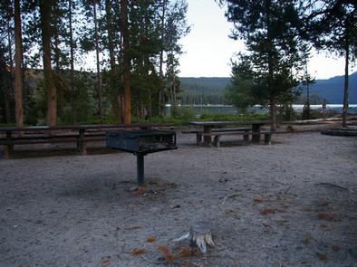
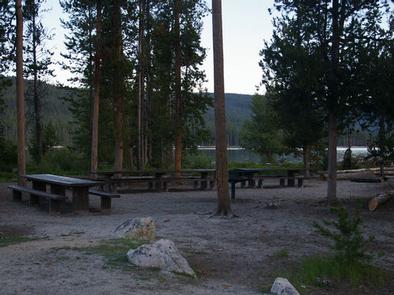
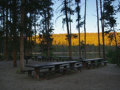
North Shore Picnic Area is located next to beautiful Redfish Lake at the foot of the Sawtooth Mountain Range. Stanley, Idaho, is conveniently close, only about 4 miles away.

Recreation

North Shore is in the heart of the beautiful Sawtooth National Recreation Area, where outdoor activities abound.

Redfish Lake offers excellent boating, water skiing, canoeing, kayaking and fishing for rainbow trout and Kokanee salmon. Little Redfish Lake is just down the road, providing additional fishing and canoeing opportunities.

In the immediate area are trailheads for the Alpine Way, Fishhook Creek, Redfish Lake Creek and Bench Lakes Trails. The Idaho Centennial Trail passes nearby

Facilities

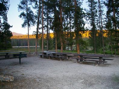
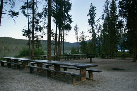
This day-use site offers two waterfront picnic sites. Site A can accommodate up to 100 people; Site B can accommodate up to 50 people. Vault toilets and drinking water are provided.

A designated swim beach is on-site. Sandy Beach Boat Ramp is less than 1/4 mile away. Firewood can be purchased at the picnic area.

Natural Features

Summer wildflowers are plentiful, lodgepole pines provide partial shade and Fishhook Creek is nearby. Temperatures are cool, with an average summer high of 78 degrees and a low of 40 degrees.

Nearby Attractions

The Sawtooth National Recreation Area offers a myriad of excellent hiking and biking opportunities, and an estimated 750 miles of trails crisscross the valley and surrounding mountains. .

The Salmon River offers excellent fishing for rainbow trout, Westslope cutthroat trout and occasional hybrid cutbows and bull trout.

Redfish Lake Lodge is nearby with a restaurant, general store, boat and kayak rentals, mooring services, lake tours and a lake shuttle.

Popular area events include an Arts and Crafts Fair in July, and Wagon Days, Salmon Festival, Quilt Fair, and Fireman’s Ball in September.

Reservation

More from CampingHiking.net:

SHADY COVE GROUP CAMPGROUND, California Campground Images, Info & Reservations

Directions From Running Springs, drive approximately one mile on Highway 18 to the Deerlick Ranger Station/Children’s National Forest Visitor Center. Turn right on Keller Peak Road and continue about five miles. Follow signs to the campground. Phone 909-866-8550 Activities BIKING, CAMPING, INTERPRETIVE PROGRAMS, FISHING, HIKING, WILDLIFE VIEWING Keywords SHAC,Shady Cove,Children’s

INDIAN RIDGE LOOKOUT, Oregon Campground Images, Info & Reservations

Directions From Blue River, OR, travel 4 miles east on Highway 126 to Aufderheide Drive/Forest Service Road (FSR) 19. Continue south on Aufderheide Drive, taking a right at the Y and climbing to the top of Cougar Reservoir. Continue south on Aufderheide Drive past Cougar Reservoir 7 miles to FSR

MATTERHORN, Colorado Campground Images, Info & Reservations

Directions From Telluride, travel approximately 7 miles south on Highway 145. Watch for campground signs; the turn off from the road is on the left. Phone 970-249-4552 Activities BIKING, CAMPING, FISHING, HIKING, HUNTING, WILDLIFE VIEWING Keywords MATT,MATTERHORN UNCOMPAHGRE N F,GUNNISON,GM,UNCOMP NF – FS Related Link(s) Rec Area Info & Images

LITHIA SPRINGS, Illinois Campground Images, Info & Reservations

Directions From Shelbyville, Illinois, go three miles east of Shelbyville on State Route 16 to County Road 2200E. Turn left and go two miles to County Road 1500N. Turn left again and drive 1.4 miles to the campground. Phone 217-774-3951 Activities BOATING, CAMPING, FISHING, VISITOR CENTER, DAY USE AREA, SWIMMING

BOLDING MILL, Georgia Campground Images, Info & Reservations

Directions From Atlanta, GA, take SR 400 north to Exit 17, turn right on GA Hwy 306, turn right on GA Hwy 53, turn left on Old Sardis Rd, and turn left on Chestatee Rd. Follow into campground. Phone 770-534-6960 Activities BIKING, BOATING, CAMPING, FISHING, PICNICKING, DAY USE AREA, SWIMMING

MORGANTON POINT, Georgia Campground Images, Info & Reservations

Directions Take U.S. Highway 515 north from Blue Ridge for 4 miles to Georgia Highway 60. Turn right (southwest) and continue 3 miles to the town of Morganton. In Morganton, turn right on County Road 616 (Lake Drive) and proceed for 1 mile. To enter the campground, take the first