CAMP HALE EAST FORK GROUP, CO Campground Reservation, Info, Images, Map, Directions

CAMP HALE EAST FORK GROUP, Colorado Campground Images, Info & Reservations

Directions

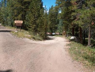
From I-70, take exit 171 toward Minturn. Turn south on Highway 24 and continue for approximately 19 miles, just beyond Camp Hale Memorial Site. Turn onto Old Highway East and follow for 2 miles to the campground.

Phone

970-468-7681

Activities

CAMPING, FISHING, HIKING, WILDLIFE VIEWING

Keywords

EAF1,WHITE RIVER NF -FS

Related Link(s)

Rec Area Info & Images

Colorado State Road Conditions

Forest Service Concessionaire

Colorado State Tourism

Overview

Located in the wide-open spaces of a lush green valley near the headwaters of the Eagle River and East Fork Eagle River, Camp Hale East Fork is the ideal spot for large group camping.

The surrounding White River National Forest offers campers a recreational oasis and an exciting Wilderness experience.

Recreation

The famous Colorado Trail winds within walking distance of the campground, offering hiking, horseback riding and opportunities for wildlife viewing to guests. Several paths throughout the campground also provide easy walking and biking areas.

Fishing is available in the numerous streams nearby, including both the Eagle and East Fork Eagle River, the Camp Hale Pond and several beaver ponds, with various types of trout available.

Facilities

Camp Hale East Fork can accommodate up to 200 guests, making it the perfect destination for large parties or family reunions. The group picnic area contains several tables, a large fire ring and grills.

Natural Features

Nestled in the heart of the Rocky Mountains, the 2.3 million acre White River National Forest is the top recreation forest in the nation. Known as the birthplace of wilderness and home to world-renowned skiing, the White River Forest has something to offer every outdoor enthusiast.

Nearby Attractions

The White River National Forest is home to several skiing and Wilderness areas, providing countless recreational opportunities for campers.

Reservation

More from CampingHiking.net:

MONTY CAMPGROUND, Oregon Campground Images, Info & Reservations

Directions From Sisters, OR: Travel 5.6 miles northwest on Highway 20, then 20.8 miles north on Forest Road 11, then 5.0 miles east on Forest Road 1170, and then 7.2 miles northwest on County Road 64. Phone 503-464-8515 Activities CAMPING, FISHING, WILDLIFE VIEWING Keywords Related Link(s) Rec Area Info &

RED BLUFF CAMPGROUND, Missouri Campground Images, Info & Reservations

Directions From St. Louis, Missouri, take I-44 west to Cuba. Continue on Highway 19 south to Cherryville. Take 49 south to Highway V, turn left to Davisville and travel approximately 1 mile and turn left into the campground. Phone 573-743-6042 Activities CAMPING, FISHING, WATER SPORTS Keywords REDB,MARK TWAIN NF -FS

LOON LAKE, California Campground Images, Info & Reservations

Directions Take Highway 50 east of Placerville for 21 miles to Icehouse Road turnoff. Turn left and go 28 miles to a fork. Take the right fork 5 miles to the campground. Phone 530-293-0827 Activities CAMPING, FISHING, HIKING Keywords LOON,ELDORADO NF – FS Related Link(s) Rec Area Info & Images

RANCHERIA, California Campground Images, Info & Reservations

Directions From Clovis, take Highway 168 north 70 miles to Huntington Lake Campground office at Eastwood. Check in at office prior to setting up camp. Phone 559-893-2111 Activities BOATING, HISTORIC & CULTURAL SITE, CAMPING, INTERPRETIVE PROGRAMS, FISHING, HIKING, WATER SPORTS, DAY USE AREA, SWIMMING SITE Keywords RANC,HUNTINGTON LAKE,SIERRA NF –