Directions
The park is located on Brownsville’s north side, near the city of Los Fresnos. It is just north of the intersection of FM 1847 (Paredes Line Rd.) and FM 511/FM 550.
Phone
(956) 541-2785
Activities
BIKING, HISTORIC & CULTURAL SITE, HIKING, WILDLIFE VIEWING
Camping Reservations
Reserve your campsite at these camping areas:
Hiking Trails
Looking for nice hiking areas to take a hike? Choose from these scenic hiking trails:
Related Link(s)
Palo Alto Battlefield National Historical Park Official Website
Palo Alto Battlefield National Historical Park Map
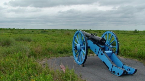
On May 8, 1846, United States and Mexican troops clashed on the prairie of Palo Alto. The battle was the first in a two-year long war that changed the map of North America. Palo Alto Battlefield National Historical Park preserves the site of this notable battle and provides an understanding of the causes, events, and consequences of the U.S.-Mexican War.

