Directions
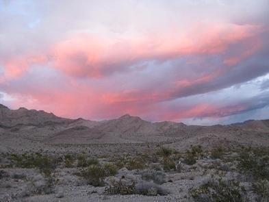
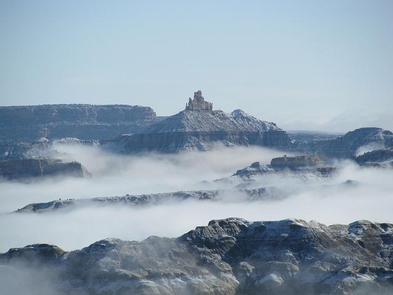
Indian Creek Special Recreation Management Area is located along Hwy 211, 15 miles north of Monticello and 40 miles south of Moab, Utah. This 26-mile stretch of spectacular scenic country borders the Needles District of Canyonlands National Park.
Phone
435-587-1500
Activities
AUTO TOURING, CLIMBING, CAMPING, HIKING, WILDLIFE VIEWING, PHOTOGRAPHY
Camping Reservations
Reserve your campsite at these camping areas:
Hiking Trails
Looking for nice hiking areas to take a hike? Choose from these scenic hiking trails:
Related Link(s)
Indian Creek Special Recreation Management Area encompasses the Indian Creek Unit of the Bears Ears National Monument. Indian Creek affords many opportunities for rock climbing on world class splitter cracks formed in Wingate sandstone. Indian Creek draws climbers from around the world to test their crack climbing technique. Bouldering is also available throughout the valley. Campgrounds include Superbowl, Creek Pasture, and Hamburger Rock. Large groups may reserve groups sites at Indian Creek Falls, Creek Pasture and at Superbowl Campground through recreation.gov. Free dispersed camping at Bridger Jack Mesa is limited to designated sites only. In other areas please limit dispersed camping to previously disturbed sites.
Alteration of rock surfaces and removal or vegetation is prohibited. Several popular climbs can only be reached by crossing private land. Please use existing trails and respect private land signs and fences. Climbing on petroglyphs is unlawful and destructive. Please Respect and Protect cultural resources.
See Mountain Project for climbing beta / route information https://www.mountainproject.com/area/105716763/indian-creek
Camping: Numerous campgrounds in the vicinity. See georeferenced map.
https://www.blm.gov/sites/blm.gov/files/documents/files/BLMUtahBearsEarsNationalMonumentMap.pdf
KNOW BEFORE YOU GO
Safety Tips / Water
Please do not climb when the rock is wet. Wet sandstone will erode much faster, widening cracks and leaving rope grooves. More importantly, climbing on wet sandstone weakens anchors and has been linked to cams failing. Protect and conserve scarce desert water sources. Camp at least 300 feet from isolated water sources to allow for wildlife access. Leave gates open or closed as you find them. Beware of rattlesnakes.
Weather Information and Tips
It is extremely hot in the summer (triple digits) and cold in the winter with snow at higher elevations. The terrain can be sandy or forested, can contain copious amounts of slick rock or clay, and ranges from relatively flat to vertical.
Educational Information / Environmental Protection
As you are planning your next desert adventure to climb, learn how to take care of this environment and minimize your impact. The desert environment demands some very specific minimum impact behaviors due to its unique and fragile terrain. Take care when traveling to and from the cliffs and boulders not to trample fragile cryptobiotic soil, which is a living crust that plays an important ecological role in many desert environments. Always pack out human waste, as desert soil lacks the necessary microorganisms to biodegrade it. Wait 24-48 hours to climb on sandstone following rain.
Historical Information / Cultural Resource Protection
Leave historic sites, Native American rock art, ruins and artifacts untouched for the future. Admire rock art from a distance, but never touch it. Stay out of ruins, leave artifacts in place, and report any violations to the BLM Monticello Field Office at (435) 587-1500. Respect and Protect cultural and natural resources. Learn more about Archaeological Site Etiquette.
Scientific Information / Wildlife Safety
When encountering wildlife, maintain your distance and remain quiet. Teach children not to pick up, chase, or approach animals. Keep pets under control.
Leave No Trace / Wilderness Ethics
Tread lightly when traveling and leave no trace of your camping. Drive and ride only on roads and trails where such travel is allowed. Hike only on established trails, on rock, or in washes. Camp at designated sites, or at previously used sites where dispersed camping is allowed. Avoid placing tents on top of vegetation. Use a camp stove instead of making a campfire. Unless signs indicate otherwise, leave gates open or closed as you find them.


