CIRCLE PARK CAMPGROUND, Wyoming Campground Reservation, Info, Images, Map, Directions

CIRCLE PARK CAMPGROUND, Wyoming Campground Images, Info & Reservations

Listen

Directions

From Buffalo, WY, take US Hwy 16 west for 13.4 miles to FS Road 20 (Circle Park Road), turn right, go 2.1 miles.

Phone

406-587-9054

Activities

BIKING, BOATING, FISHING, HIKING, MOUNTAIN BIKING, WATER ACTIVITIES, CANOEING, STAR GAZING, BIRDING, WATER ACCESS, SCENIC DRIVE, BACKPACKING

Keywords

Related Link(s)

Rec Area Info & Images

Overview

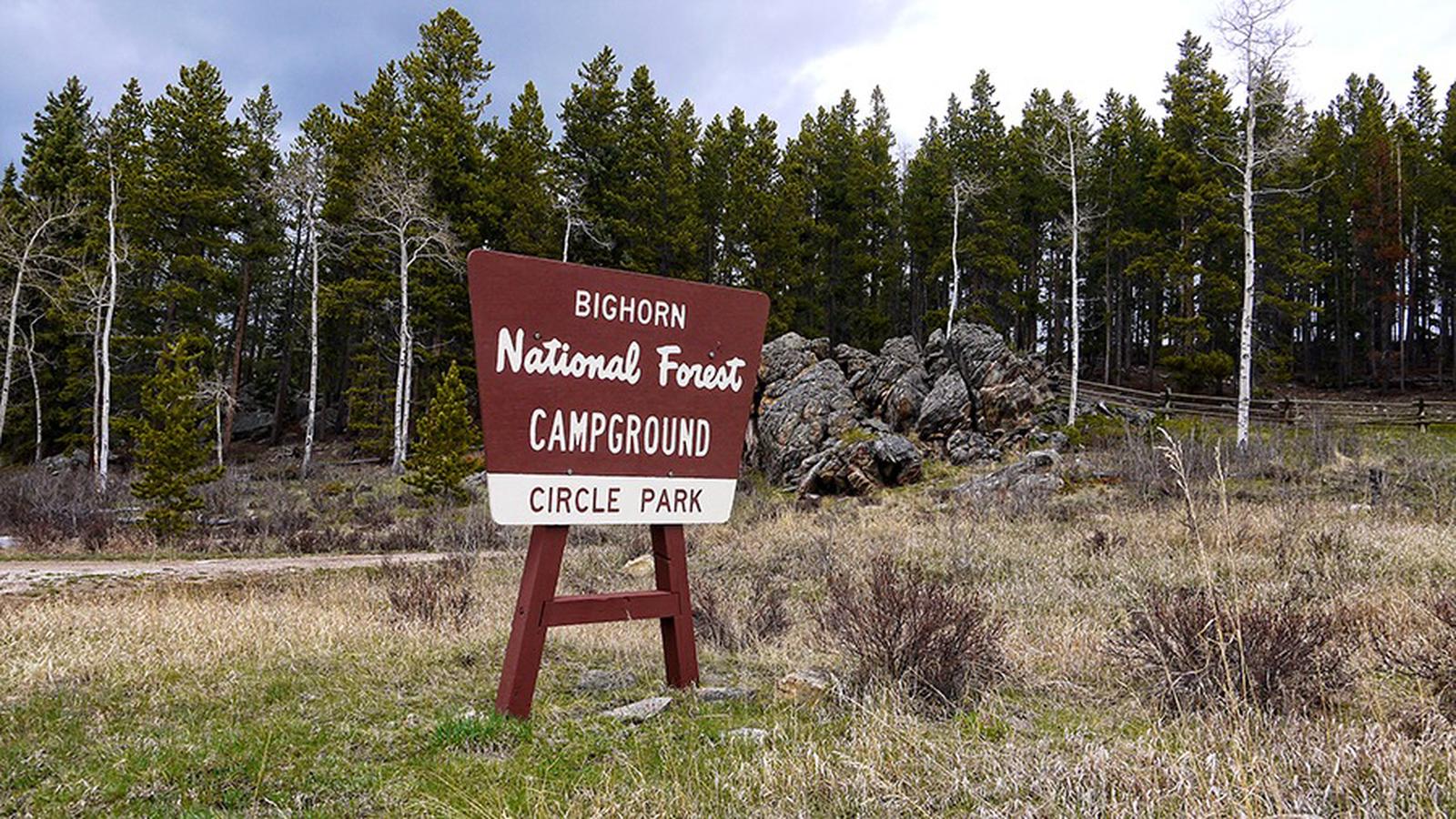
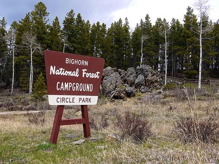
Circle Park Campground is located about 15 miles west of Buffalo, Wyoming, on the east side of scenic Cloud Peak Skyway, near the Cloud Peak Wilderness Area. Part of the Bighorn National Forest, the area offers a wide variety of activities, including hiking, fishing, scenic driving and a number of historic sites. The administering organization is Gallatin Canyon Campgrounds; e-mail: gccampgrounds13@gmail.com

Recreation

Scenic off-road driving is available on nearby Elgin Park, Pole Creek and Crazy Woman Canyon Roads. Hiking and mountain biking are allowed on these roads as well. High Park Lookout, a short hike east of Meadowlark Lake, is an old fire lookout offering panoramic views of the area. There is fishing at nearby streams and lakes including Tie Hack Reservoir, a non-motorized lake, and Meadowlark Lake for rainbow, cutthroat, brown, and brook trout. Many additional hiking trails are available in the Cloud Peak Wilderness.

Facilities

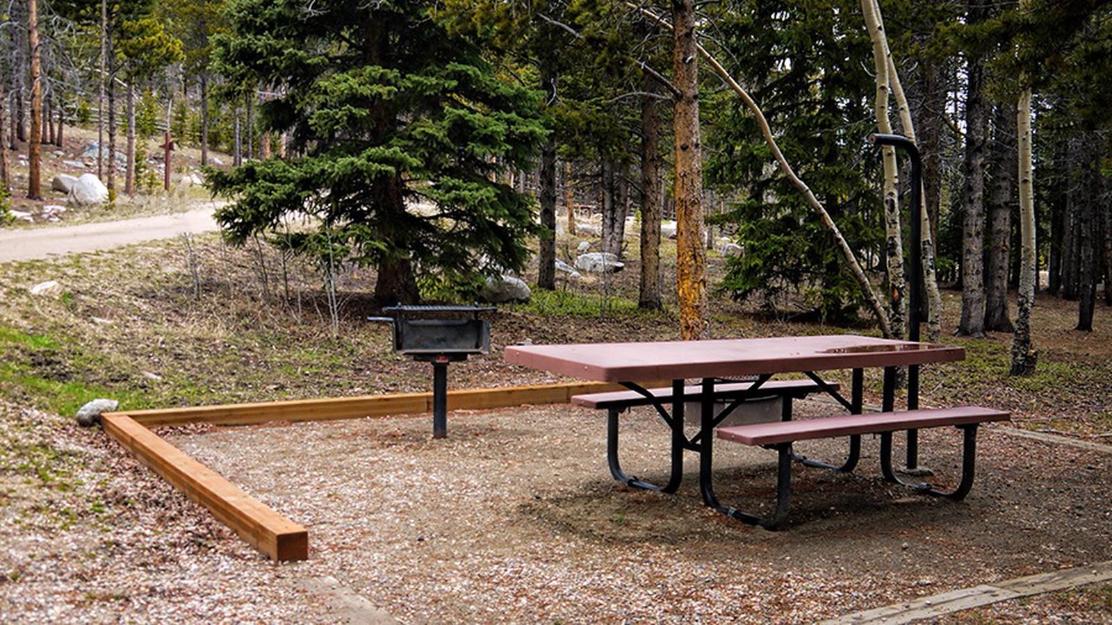
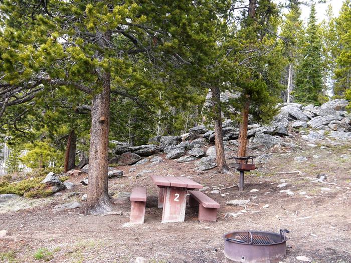
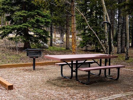
The campground offers several single-family sites each equipped with a picnic table and campfire ring with grill. Vault toilets, drinking water from a hand pump, fire wood sales, and trash collection are provided.

The nearest dump station is 27 miles away on Powder River Pass.

Natural Features

The campground sits at the edge of a meadow tucked in a dense forest of lodgepole pine and aspen with widely spaced sites. Circle Park Trailhead leading into the Cloud Peak Wilderness is nearby.

Nearby Attractions

The adjacent Cloud Peak Skyway provides for scenic driving. Many additional hiking trails are available in the Cloud Peak Wilderness. Fishing is popular in the campground and nearby streams and Tie Hack Reservoir.

Charges & Cancellations

Refunds: Refund requests made through www.recreation.gov will be charged a $10 processing fee. This cancellation processing fee is retained by the reservation service contractor along with the non-refundable reservation fee. All requests for the return of the non-refundable reservation fee and the cancellation processing fee will be declined by the campground concessionaire as they did not receive these fees (these are the fees retained by the reservation contractor, a different entity).

Reservation

More from CampingHiking.net:

ALUM CREEK BELOW DAM AREA, Ohio Campground Images, Info & Reservations

Listen Directions From Columbus, Ohio, take I-71 north to exit 121 for Polaris. Turn right on Polaris Parkway, left on Worthington Road, left on Africa Road, then left on Lewis Center Road. Shelters are in the Below Dam Area. Phone 740-548-6151 Activities BIKING, BOATING, CAMPING, INTERPRETIVE PROGRAMS, FISHING, HIKING, HORSEBACK

WARM RIVER CABIN, Idaho Campground Images, Info & Reservations

Listen Directions From Ashton ID, travel east-northeast on Highway 47 (also known as the Mesa Fall Scenic Byway) for approximately 15 miles to the intersection of Highway 47 and Forest Road 150. Turn right onto Forest Road 150 and travel approximately 2.5 miles to the intersection of Forest Road 150

FOSCUE CREEK, Alabama Campground Images, Info & Reservations

Listen Directions From Demopolis, Alabama, drive three miles west on U.S. Highway 80, and turn right at Maria Street. Go approximately two miles and follow signs to the campground entrance. Phone 334-289-5535 Activities BOATING, CAMPING, FISHING, WATER SPORTS Keywords DAMF,DEMOPOLIS LAKE,FOSCUE CREEK PARK,FOSCUE PARK,BLACK WARRIOR Related Link(s) Rec Area Info

POTWISHA CAMPGROUND, California Campground Images, Info & Reservations

Listen Directions Potwisha Campground is easily accessed from Visalia, California, and Highway 99. Follow Highway 198 east from Visalia for 36 miles, until you reach the Ash Mountain Entrance Station. The campground is located 4 miles beyond the entrance station on the left, or north, side of the road. Please

LAKESIDE (TX), Texas Campground Images, Info & Reservations

Listen Directions From Coleman, TX, take Hwy 153 west 8 miles to the main entrance to Hords Creek Lake. Follow signs into the campground. Phone 325-625-2322 Activities BIKING, BOATING, CAMPING, FISHING, RECREATIONAL VEHICLES, SWIMMING SITE, PADDLING, SWIMMING, MOTOR BOAT, MOUNTAIN BIKING, PADDLE BOATING, WATER ACTIVITIES, KAYAKING, CANOEING, NON-MOTORIZED BOATING, WATER

MCKEEVER CABIN, Michigan Campground Images, Info & Reservations

Listen Directions Mckeever Cabin does not have a physical address. Vehicle access from the North: Take M-28 to FH 13, which is 3 miles east of Munising. Proceed south on FH 13 for 11 miles to FR 2163, located across from the road from Widewaters Campground. Vehicle access from the