
Directions
From Buffalo, Wyoming, take U.S. Highway 16 west for 15 miles to Forest Service Road 337. Follow Forest Service Road 337 east for .25 miles to the campground.
Phone
406-587-9054
Activities
BIKING, BOATING, CAMPING, FISHING, HIKING, HORSEBACK RIDING, HOTEL/LODGE/RESORT PRIVATELY OWNED, OFF ROAD VEHICLE TRAILS
Keywords
SOU1,SOUTH FORK WYOMING,BIGHORN NF – FS
Related Link(s)
Overview
South Fork Campground is located 15 miles west of Buffalo, Wyoming on the east side of scenic Cloud Peak Skyway, near the Cloud Peak Wilderness Area. The surrounding Bighorn National Forest offers a wide variety of activities, including hiking, fishing, scenic driving and a number of historic sites. The administering organization is Gallatin Canyon Campgrounds; e-mail: gccampgrounds13@gmail.com
Recreation
Tie Hack Reservoir is nearby, offering a great location for canoeing and fishing. Anglers will find rainbow, cutthroat, brown and brook trout in the lake.
The Circle Park Trailhead is 3 miles from the campground. This beautiful trail accesses numerous alpine lakes and two 12,000′ peaks within the Cloud Peak Wilderness. Many additional hiking trails are available in the area.
Scenic off-road driving is available at nearby Elgin Park, Pole Creek and Crazy Woman Canyon Roads. Hiking and mountain biking are allowed on these roads as well.
Facilities
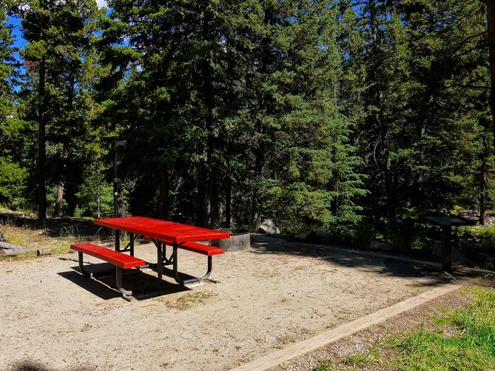
This fully accessible campground offers single-family sites each equipped with a picnic table and campfire ring with grill. Vault toilets, drinking water and trash collection are provided.
Natural Features
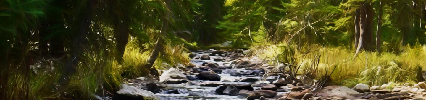
The campground is situated on the banks of South Fork Clear Creek at an elevation of 7,800 feet. A dense forest of lodgepole pine covers the campground.
Nearby Attractions
South Fork Lodge is located across the highway from the campground, offering dining options, lodging, guided horseback riding, a fishing pond and a small store with fishing and camping supplies.
Charges & Cancellations
Refunds: Refund requests made through www.recreation.gov will be charged a $10 processing fee. This cancellation processing fee is retained by the reservation service contractor along with the non-refundable reservation fee. All requests for the return of the non-refundable reservation fee and the cancellation processing fee will be declined by the campground concessionaire as they did not receive these fees (these are the fees retained by the reservation contractor, a different entity).