
Directions
From Buena Vista, Colorado, take Highway 285 south to Nathrop. Turn west on County Road 162 and travel 9 miles to the campground.
Phone
CAMPGROUNDS DO NOT HAVE PHONE SERVICE, CALLING TO CHECK AVAILABILITY PRIOR TO ARRIVAL IS NOT POSSIBLE. FOR RESERVATIONS CALL: 1-877-444-6777
Activities
HISTORIC & CULTURAL SITE, CAMPING, FISHING, HIKING, HORSEBACK RIDING, HUNTING, OFF HIGHWAY VEHICLE, MOUNTAIN BIKING, GOLD PANNING, MOUNTAIN CLIMBING
Keywords
CASC,SAINT ELMO,CHALK CREEK,CASCADE COLORADO,PIKE AND SAN ISABEL NF- FS
Related Link(s)
Colorado State Road Conditions
Overview
Cascade Campground is located in beautiful Chaffee County, Colorado. This popular facility sits near Cascade Falls and is within 5 miles of a private hot springs resort, making it an ideal location for rest and relaxation.
Recreation
Stream fishing is best above Cascade Falls, just accross the road from the campground. Nearby Chalk Lake is heralded as a great family fishing lake with rainbow, brook and brown trout. Plenty of off-road vehicle trails are a short distance away. Recommended rides include Mount Antero, Baldwin Lake, Tincup Pass, Hancock Pass, Pomeroy Lakes, Hancock Lakes. Hiking in the area includes the Colorado Trail, The Narrow Gauge trail and the Cascade Loop Trail (Across from Chalk Lake Campground)
Facilities
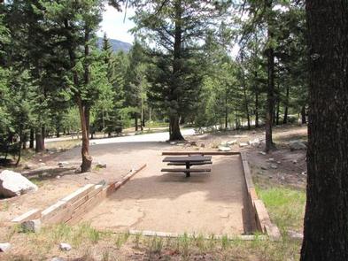
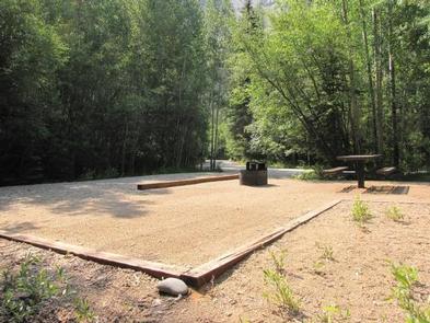
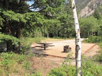
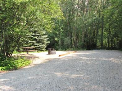
The campground offers 21 single-family sites, each equipped with a picnic table and campfire ring. Vault toilets and drinking water are provided. Firewood is sold on-site. Sites #2- 7 and 11, 12 are “walk-up” first-come, first served. All other sites are reservable. Site #1 is used by the host from mid-May to Labor Day weekend. After that time it is available as a “walk-up”, first-come, first-served site.
Natural Features
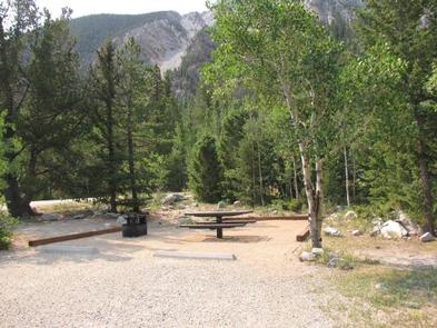
The campground is situated in a dense forest of Douglas fir and aspen at an elevation of 9,000 feet in Chalk Creek Canyon, which gets its name from the soft, white, chalk-like kaolinite canyon walls. Kaolinite is a clay mineral that was deposited by percolating hot springs.
Chalk Creek is just across the road from the campground. It flows 27 miles eastward from the Collegiate Peaks before joining the Arkansas River. Chalk Lake is a mile east of the campground.
Nearby Attractions
Take a day trip to the historic ghost town of St. Elmo, just 15 minutes from the campground. An old saloon, county courthouse and many other historic structures remain from the days of its mining glory. The city of Salida and Town of Buena Vista are only a short drive away where visitors can enjoy distinctive restaurants, unique shops, incredible art galleries and a large selection of antique shops. The area boasts more than 100 miles of Arkansas River to raft, fish, float or kayak in. as well as fifteen 14,000 ft mountains. Visitors choose from recreational activities like hiking, biking, ATVing, kayaking, rafting, fishing, horseback riding, zipping, swimming