PINE LAKE CAMPGROUND, UT Campground Reservation, Info, Images, Map, Directions

PINE LAKE CAMPGROUND, Utah Campground Images, Info & Reservations

Listen

Directions

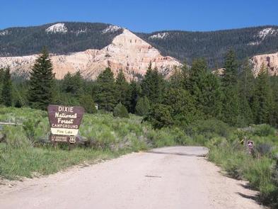
Travel Utah Highway 12 to the junction with SR 63 and CR 1660. Turn north at sign pointing toward Antimony. Travel 10.5 miles and turn right at Pine Lake turnoff. Travel 5.5 miles on a gravel road to the campground.

Phone

801-226-3564

Activities

AUTO TOURING, CAMPING, FISHING, HIKING, HUNTING, WILDLIFE VIEWING, DAY USE AREA, PHOTOGRAPHY, MOUNTAIN BIKING, OFF ROAD VEHICLE TRAILS, CANOEING, WATER ACCESS

Keywords

PINL,Pine Lake Campground,DIXIE NF – FS,Pine Lake,DIXIE NF-FS Park,Pine Lake Campground,Yellow Pine,Wild Iris,Johns Valley,Clay Creek,Dry Creek

Related Link(s)

Rec Area Info & Images

Utah State Road Conditions

Utah State Tourism

Forest Service Concessionaire

Overview

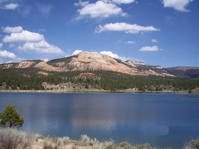
Pine Lake Campground is located next to its scenic namesake lake high on the Colorado Plateau at an elevation of 8,100 feet. Visitors enjoy canoeing, fishing and exploring local hiking and off-road vehicle trails.

Recreation

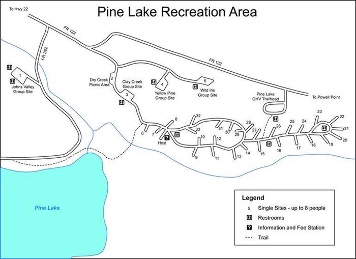
A short trail leads from the campground to Pine Lake, which offers excellent canoeing and kayaking, as well as fishing for rainbow, cutthroat and brook trout. Hiking and off-road vehicle trails are plentiful within the area, however off-road vehicles are not allowed in the campground.

The Pine Lake OHV Trailhead is located adjacent to the campground. A loading ramp is provided.

Facilities

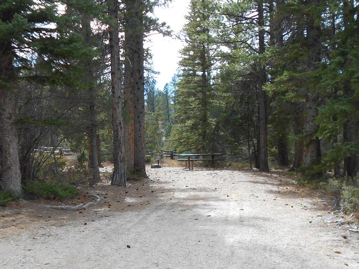
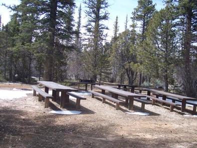
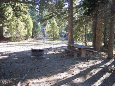
The campground offers four group sites and 17 family sites. Accessible vault toilets and drinking water are provided. A well-maintained gravel road leads to the campground, providing good access for cars and RVs alike.

Natural Features

Pine Lake is situated at the foot of beautifully forested peaks banded with red and white layers of sandstone. The campground is nestled among a forest of spruce and towering ponderosa pines, and is adjacent to Pine Lake.

Nearby Attractions

Bryce Canyon National Park is approximately 30 minutes from the campground, offering breathtaking scenery and excellent hiking opportunities. Kodachrome Basin State Park is an hour away, with towering rock spires, a natural arch and great hiking trails.

Reservation

More from CampingHiking.net:

GREEK CREEK CAMPGROUND, Montana Campground Images, Info & Reservations

Listen Directions From Bozeman, travel south on Highway 191 for 30 miles, to the campground. From West Yellowstone, travel north on Highway 191 for about 59 miles. Phone (406)646-1012 Activities CAMPING, FISHING, WILDLIFE VIEWING, PHOTOGRAPHY, KAYAKING, STAR GAZING, BIRDING, WATER ACCESS, RAFTING Keywords GREK,GALLATIN NF – FS Related Link(s) Rec

PLATTE RIVER CAMPGROUND, Michigan Campground Images, Info & Reservations

Listen Directions From the east (Traverse City): Take State Highway M-72 west to Empire. Turn south on State Highway M-22. Proceed 10 miles and turn right on Lake Michigan Road. Follow the signs to Platte River Campground. From the south (US-31/M-115): At the junction of U.S. Route 31 and M-115,

Toto Creek Campground, Georgia Campground Images, Info & Reservations

Listen Directions Physical address is 154 Toto Creek Park Rd., Dawsonville, GA 30506 From Georgia Highway 400 North, exit left for Harmony Church Rd. heading east; stay straight onto Price Rd.; turn right on Toto Creek Park Rd.; turn right to continue on Toto Creek Park Rd.; road dead ends

JUNIPER SPRINGS REC AREA, Florida Campground Images, Info & Reservations

Listen Directions From I-75, take Highway 40 east through Ocala and Silver Springs for approximately 36 miles to the Juniper Springs Recreation Area. From I-95, take the Ocala/Silver Springs Exit (Highway 40) west for approximately 37 miles to the Juniper Springs Recreation Area. From the intersection of Highway 40 and

WEST ROLLING HILLS, Kansas Campground Images, Info & Reservations

Listen Directions Take I-70 to exit 290, then 5 miles to 244, then east 1/2 mile to park entrance. Phone 785-784-4447 Activities BOATING, CAMPING, SWIMMING SITE Keywords ROLH,MILFORD LAKE,MILFORD LAKE Related Link(s) Rec Area Info & Images Kansas State Tourism Kansas State Road Conditions Overview West Rolling Hills is a