REUNION FLAT, WY Campground Reservation, Info, Images, Map, Directions

REUNION FLAT, Wyoming Campground Images, Info & Reservations

Listen

Directions

From Driggs, Idaho, travel 9 miles east. Turn east at the Key Bank on Little Avenue and follow the road to the forest boundary. Turn right on Forest Road 009 and go 3 miles to the campground.

Phone

208-270-0150 OR 541-351-1182

Activities

BIKING, CAMPING, FISHING, HIKING, WILDLIFE VIEWING

Keywords

REUN,CARIBOU-TARGHEE NF – FS

Related Link(s)

Rec Area Info & Images

Forest Service Concessionaire

Overview

Reunion Flat Campground is located in beautiful Teton Canyon in the Caribou-Targhee National Forest. Hiking, backpacking and horseback riding are popular activities in this scenic region.

Recreation

The towering Teton Range and Jedediah Smith Wilderness are adjacent to the canyon, offering excellent hiking, backpacking and horseback riding opportunities.

Trails begin just up-canyon at Teton Canyon Campground. Teton Creek offers fishing for brook and Yellowstone cutthroat trout.

Facilities

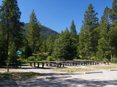
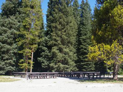
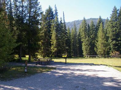
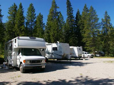
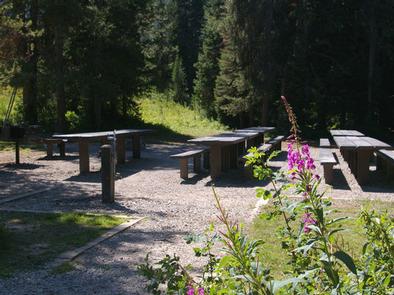
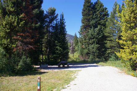
This fully accessible campground offers three group sites with large picnic tables, campfire rings, grills and ample parking. Site A can accommodate up to 150 guests; Sites B and C can accommodate 65 people each. Four additional single family sites are also available.

Vault toilets, drinking water and trash collection are provided, but there is no electricity. Roads and parking spurs are gravel.

Natural Features

The campground is situated along Teton Creek in a forest of pine, spruce, fir and the occasional aspen, which provides partial shade. Vibrant summer wildflowers dot the landscape. A variety of wildlife makes its home in the area, including moose and deer.

Nearby Attractions

Popular activities in the area include the Teton Valley Summer Festival over the Fourth of July in Driggs, Idaho, complete with a hot air balloon festival, parade, rodeo, bike races and antique and craft booths.

Grand Targhee Resort is nearby and hosts annual music festivals, including Targhee Fest in mid-July and Targhee Bluegrass Festival in mid-August. The resort also offers lift-served hiking and mountain biking, scenic lift rides, guided horseback riding, a climbing wall and an 18-hole disc golf course.

Grand Teton and Yellowstone National Parks are both within a few hour’s drive.

Reservation

More from CampingHiking.net:

THREE LAKES, Michigan Campground Images, Info & Reservations

Listen Directions From Strongs Corner, turn south on Forest Road 3142 and travel approximately two miles. The campground is on the east side of the road. Phone (906) 643-7900 Activities BOATING, CAMPING, FISHING, HIKING, SWIMMING SITE Keywords THRE,Three Lake Campground,Softball Campground,HIAWATHA NF – FS Related Link(s) Rec Area Info &

KIRBY COVE CAMPGROUND, California Campground Images, Info & Reservations

Listen Directions From San Francisco (travelling north):  Cross the Golden Gate Bridge and take exit 442 onto Alexander Avenue. This will be the exit after the Vista Point. Continue straight for about a mile, and then turn left onto Bunker Road. Travel through the Baker-Barry Tunnel and continue straight until

DEVILS GARDEN CAMPGROUND, Utah Campground Images, Info & Reservations

Listen Directions From I-70, take Exit 182. Travel south for 26 miles to the park entrance. Take the park road 18 miles to Devils Garden. From Moab, take Highway 191 north for 4.5 miles to the park entrance. Take the park road 18 miles to Devils Garden. Phone 435-719-2299 Activities

EAST DAVIS CAMPGROUND, Oregon Campground Images, Info & Reservations

Listen Directions From Crescent, OR: Travel 8.8 miles west on County Road 61, then 7.7 miles north on Highway 46, then 2.6 miles west on Forest Road 4600 850. Phone 541-323-1746 Activities CAMPING Keywords Related Link(s) Rec Area Info & Images Oregon State Tourism Oregon State Road Conditions Overview East

Denny Creek Campground, Washington Campground Images, Info & Reservations

Listen Directions From Seattle, take Interstate 90 east to exit 47. Go north over the freeway and follow signs 3 miles to campground. Phone 360-804-1103 Activities CAMPING, FISHING, HIKING Keywords DENN,MT. BAKER-SNOQU NF – FS Related Link(s) Rec Area Info & Images Washington State Road Conditions Washington State Tourism Forest

BERGER, California Campground Images, Info & Reservations

Listen Directions From Sierraville, drive 18 miles south on Highway 49, turn right at Bassett, and drive approximately 1.5 miles to the Sardine Lake turnoff. Turn right at the Packer Lake turnoff (Forest Road 93) and continue to the campground. Phone (530)478-6253 Activities BIKING, BOATING, CLIMBING, CAMPING, HIKING, HORSEBACK RIDING,