HORSE HEAVEN GROUP, CA Campground Reservation, Info, Images, Map, Directions

HORSE HEAVEN GROUP, California Campground Images, Info & Reservations

Listen

Directions

The campground is located 50 miles east of San Diego, California. Take I-8 to Sunrise Highway exit. Go approximately 14 miles until you see the Horse Heaven Group Campground sign and turn down the campground entrance road.

Phone

619-445-6235

Activities

BIKING, CAMPING, HIKING, HORSEBACK RIDING, WILDLIFE VIEWING, MOUNTAIN BIKING, BIRDING, SCENIC DRIVE

Keywords

HORG,HORSE HEAVEN GRP,CLEVELAND CA,CLEVELAND NF – FS

Related Link(s)

Rec Area Info & Images

California State Tourism

California State Road Conditions

Overview

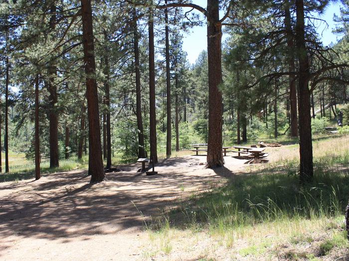
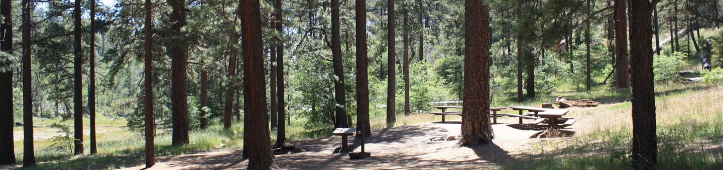
Contrary to its name, Horse Heaven Group Campground has no equestrian sites. Instead, this tent-only facility can accommodate gatherings of up to 100 people. It provides a great mountain getaway for city dwellers to relax and enjoy cool summer temperatures, hiking and other outdoor recreation, just one hour east of San Diego.

Recreation

The Laguna Mountain region is known for its great horseback riding, mountain biking and hiking trails. Visitors can get their boots dusty on a segment of the 2,650-mile Pacific Crest Trail, which runs from California to the State of Washington, and access other trails within a short drive. Many picnic areas are located nearby.

Facilities

This site offers three areas for group gatherings: Lupine Loop can accommodate 40 people and 10 vehicles; Buttercup Loop can hold 100 people and 16 vehicles; Hollyhock Loop can hold 70 people and 12 vehicles. The facility is equipped with vault toilets and drinking water. A general store is located 2.3 miles away at Mt. Laguna and Pine Valley.

Natural Features

The campground is nestled in the pines at an elevation of 5,600 feet within the Laguna Mountains in the southern portion of Cleveland National Forest. The area is home to many species of birds and wildlife.

Nearby Attractions

Pacific Crest National Scenic Trail, Big Laguna Trail System, Storm Canyon Overlook

Reservation

More from CampingHiking.net:

ELK CREEK CAMPGROUND, Colorado Campground Images, Info & Reservations

Listen Directions Elk Creek is located off of US Hwy 50 between Gunnison and Montrose, along Blue Mesa reservoir. Phone 970-641-2337 Activities BIKING, BOATING, CAMPING, INTERPRETIVE PROGRAMS, FISHING, HIKING, HUNTING, VISITOR CENTER, WATER SPORTS, WILDLIFE VIEWING, DAY USE AREA, SWIMMING SITE Keywords ELKC,CURECANTI NATIONAL RECREATION,ELK CREEK CURECANTI NRA,CURECANTI Related Link(s)

DEARHAMER CAMPGROUND, Colorado Campground Images, Info & Reservations

Listen Directions From Basalt, travel east on Frying Pan River Road for approximately 20 miles, just past Ruedi Reservoir to Dearhamer Campground. Phone 970-927-0107 Activities BIKING, CAMPING, INTERPRETIVE PROGRAMS, HIKING, WATER SPORTS, WILDLIFE VIEWING Keywords Related Link(s) Rec Area Info & Images Forest Service Concessionaire Colorado State Road Conditions Colorado

JACOB LAKE RECREATION AREA, Arizona Campground Images, Info & Reservations

Listen Directions The facility is 30 miles southeast of Fredonia, Arizona on U.S. Route 89A. It is 0.1 miles from the intersection of U.S. Route 89A and State Route 67. Phone 928-643-7770 Activities BIKING, HISTORIC & CULTURAL SITE, CAMPING, HIKING, HORSEBACK RIDING, HUNTING, PICNICKING, DAY USE AREA Keywords JACB,KAIBAB NF

TWIN LAKE CAMPGROUND, Utah Campground Images, Info & Reservations

Listen Directions Travel east out of Mayfield, UT on "Canyon Road" to the Forest Service boundary of Twelve Mile Canyon. Stay on Forest Development Road 22, approximately 7.5 miles from Mayfield. Phone 435-283-4151 Activities CAMPING Keywords None Related Link(s) Rec Area Info & Images Utah State Tourism Utah State Road