PARADISE IN OREGON, OR Campground Reservation, Info, Images, Map, Directions

PARADISE IN OREGON, Oregon Campground Images, Info & Reservations

Listen

Directions

From Eugene, Oregon, take I-105 east to McKenzie Highway 126 and drive 55 miles to McKenzie Bridge. The campground is located on the left side of Highway, 4 miles beyond McKenzie Bridge.

Phone

801-226-3564

Activities

BIKING, FISHING, HIKING, DAY USE AREA, WHITEWATER RAFTING

Keywords

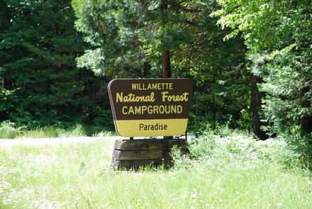
PARO,PARADISE CAMPGROUND,WILLAMETTE NF -FS,PARADISE

Related Link(s)

Rec Area Info & Images

Oregon State Tourism

Forest Service Concessionaire

Oregon State Road Conditions

Overview

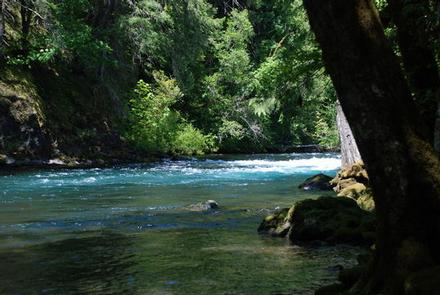
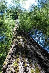
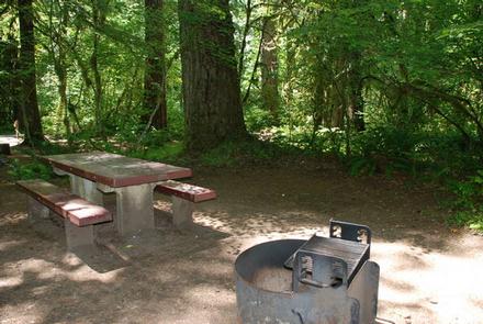
Paradise Campground is indeed a paradise for campers. Tucked within a lush, old-growth forest of Douglas fir and western red cedar, the area portrays a sub-tropical vibe along the banks of the McKenzie River, where catch-and-release trout and steelhead fishing is a popular activity, along with whitewater rafting and kayaking.

Recreation

Rafters and kayakers live it up in the whitewater of the McKenzie River. A boat ramp is located on-site.

The McKenzie River National Recreation Trail begins nearby, and is a favorite among hikers and mountain bikers.

Facilities

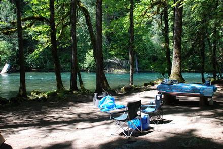
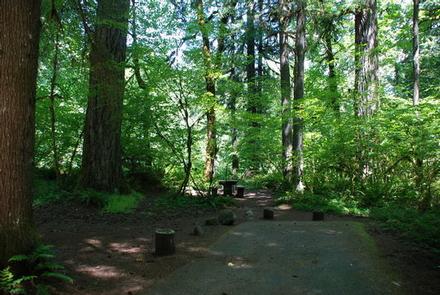
A number of sites face the river, while many others are tucked into the scenic forest. Flush toilets are dispersed throughout the campground and parking spurs are paved. Educational programs are provided at the amphitheater.

Natural Features

Paradise sits on a bend of the river at an elevation of 1,600 feet. Ferns and other moisture loving plants cover the ground, and mosses drape the trees. The campground is in the heart of Willamette National Forest, which spans 1.6 million acres on the western slopes of the Cascade Range.

Nearby Attractions

A golf course is located about 7 miles west of the campground.

Reservation

More from CampingHiking.net:

CHERRY GLEN PICNIC, Iowa Campground Images, Info & Reservations

Listen Directions Utilize address 4586 NW 94th Avenue Polk City IA 50223 (Not a valid mailing address). From I-35, take Exit 92 in Ankeny and turn right on East 1st Street. Travel approximately 5 miles west to NW 94th Ave. Continue across HWY 415 approximately .5 miles to Cherry Glen

ALMANOR, California Campground Images, Info & Reservations

Listen Directions From Chester, take Highway 36 west to Highway 89 South. Turn left on Highway 89 and continue south about 6 miles, to Almanor Drive West (not to be confused with Almanor West development and Almanor West Drive). Turn left on Almanor Drive West (directly across from the Almanor

SAMSING COVE CABIN, Alaska Campground Images, Info & Reservations

Listen Directions Accessible year round, weather permitting. Located 5.5 miles south of Sitka, on the shore of Samsing Cove off Sitka Sound. Access is by boat only, and takes about 20 minutes from Sitka. For geographic features surrounding the cabin, refer to USGS topographic maps Port Alexander D-5 and D-4.

Superbowl Group Site, Utah Campground Images, Info & Reservations

Listen Directions Turn west off US 191 onto Highway 211 and travel approximately 26 miles. The turn off to the campground is on the south side of the highway. The campground is located approximately 8.5 miles east of Canyonlands National Park and 13.5 miles northwest of Newspaper Rock. The group

ASPEN GROUP AREA, New Mexico Campground Images, Info & Reservations

Listen Directions In southeast New Mexico, approximately 20 miles east of Alamagordo. From Alamagordo take US 82 east and go 16 miles. Just before Cloudcraft turn right (South) on NM 130. Go 1.4 miles. Turn left (east) on Forest Road 24B, go 0.5 miles. Aspen Group Area is on the

FISH CREEK CAMPGROUND, Montana Campground Images, Info & Reservations

Listen Directions Important: Please do not rely on GPS for directions to Fish Creek Campground. Please use these directions: Fish Creek is located four miles northwest of the west park entrance near West Glacier, Montana. Access is from U.S. Highway 2, approximately 32 miles northeast of Kalispell, Montana. Phone 406-888-7800