KUYKENDALL GROUP CAMP, NC Campground Reservation, Info, Images, Map, Directions

KUYKENDALL GROUP CAMP, North Carolina Campground Images, Info & Reservations

Directions

From Asheville, take State Highway 280 south to Brevard. At the junction of U.S. Highway 276/64/280, follow Highway 64 west through Brevard to Cathy’s Creek Road/Forest Road 471. Take a right and go 1.25 miles to campground entrance.

Phone

(828) 552-8040

Activities

BIKING, CAMPING, FISHING, HIKING, WATER SPORTS, SWIMMING SITE

Keywords

KUYK,NFs IN NORTH CAROLINA – FS

Related Link(s)

Rec Area Info & Images

North Carolina State Road Conditions

North Carolina State Tourism

Overview

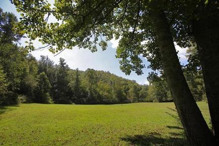
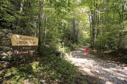
Large groups enjoy this cozy mountain campground in the Pisgah National Forest of western North Carolina. Ample opportunities for recreation exist in the area, including hiking, picnicking, scenic driving, swimming, fishing, mountain biking and more.

Recreation

This is a great place for campers to simply relax in the woods and listen to the sound of the creek. Visitors can also explore the area’s numerous hiking trails, check out crystal clear waterfalls or fish for trout in the creek and a nearby lake.

Facilities

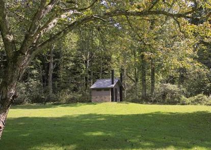
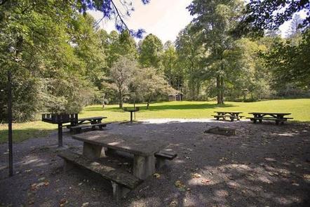
Kuykendall Group Camp has a shaded camping area for tents and RVs. The site is equipped with picnic tables, vault toilets, lantern posts, campfire rings with grills and drinking water.

Natural Features

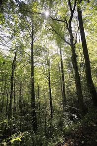
Kuykendall Group Camp is just 4 miles from the town of Brevard and about an hour from the city of Asheville. The site is located in the Appalachian Mountains at an elevation of 2,600 feet. The surrounding national forest boasts mile-high peaks, cascading waterfalls and slopes thickly forested with hardwoods. The group camping area is adjacent to Kuykendall Creek.

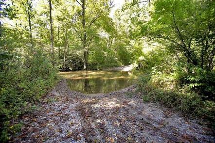
Visitors should note that creek crossing is required on the road leading to the campground. Heavy rains may temporarily make crossing difficult; a four-wheel drive or high clearance vehicle is recommended.

Nearby Attractions

The city of Asheville is about an hour away and offers numerous cultural attractions, art galleries, shops and restaurants. The quaint mountain community of Brevard is also nearby and has various amenities and services.

Reservation

More from CampingHiking.net:

TAILWATER, Kentucky Campground Images, Info & Reservations

Directions From Glasgow, KY: Take 31-E south for 4 mi; turn right on 252, which will cross the dam in 8 mi. The Tailwater entrance road is at the south end of the dam. Follow signs into recreation area. Approximately 19 miles from Bowling Green, KY. Phone 270-622-7732 Activities CAMPING,

EAGLE ROCK CAMPGROUND, Oregon Campground Images, Info & Reservations

Directions From Roseburg, Oregon, travel east on Highway 138 East (North Umpqua Highway)/ NE Diamond Lake Blvd. for 50.5 miles. Turn left into Eagle Rock Campground. Once in the campground, just after the fee kiosk turn right for the reservable sites and left for the first come first serve sites.

RATCLIFF LAKE RECREATION AREA, Texas Campground Images, Info & Reservations

Directions From Crockett, take State Highway 7 east for 15 miles. The recreation area is on the left between the towns of Ratcliff and Kennard. Phone 936-655-2299 Activities BOATING, HISTORIC & CULTURAL SITE, CAMPING, FISHING, HIKING, DAY USE AREA, SWIMMING SITE, KAYAKING, CANOEING Keywords RATC,NFs IN TEXAS -FS Related Link(s)

PICKENSVILLE CG (PICKENSVILLE AL), Alabama Campground Images, Info & Reservations

Directions From Tuscaloosa, Alabama, take Highway 82 west to the junction with Highway 86. Turn left on 86 west to Pickensville. The entrance road to the campground is 2.5 miles from the yellow caution light. Phone 205-373-6328 Activities BIKING, CAMPING, INTERPRETIVE PROGRAMS, FISHING, HIKING, HUNTING, WILDLIFE VIEWING Keywords PICK,TENNESSEE- TOMBIGBEE

EMIGRATION CAMPGROUND, Idaho Campground Images, Info & Reservations

Directions From Montpelier, drive west on U.S. Highway 89 to Ovid, Idaho. At the junction of U.S. 89 and State Highway 36, take the right fork of the "Y" onto State Highway 36 and travel approximately 12 miles northwest to the campground. A left hand turn is required to enter