HORSESHOE RECREATION AREA, WV Campground Reservation, Info, Images, Map, Directions

HORSESHOE RECREATION AREA, West Virginia Campground Images, Info & Reservations

Listen

Directions

From Parsons, take State Route 72 northeast to State Route 5 to St. George. In St. George, turn south on State Route 1. Follow State Route 1 to the intersection of State Route 7. Turn left on State Route 7 and continue past the YMCA Camp Horseshoe to the Horseshoe Recreation Area entrance.

Phone

304-478-2481

Activities

CAMPING, FISHING, HUNTING

Keywords

HORR,MONONGAHELA NF -FS

Related Link(s)

Rec Area Info & Images

Forest Service Concessionaire

West Virginia State Tourism

West Virginia State Road Conditions

Overview

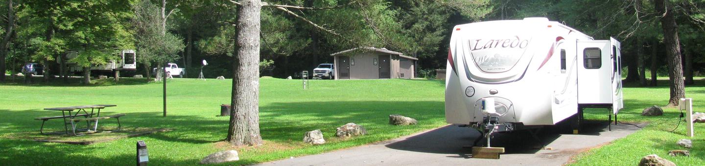
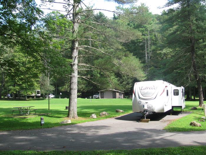
Horseshoe Recreation Area is located in north-central West Virginia, 7 miles from the town of St. George. The campground is tucked in a valley along the Horseshoe Run River, providing excellent opportunities for fishing and wildlife viewing.

Recreation

Day hiking options include the 1.8-mile Losh Trail, the Dorman Ridge Trail at 1.3 miles, and Two Camp, a short 0.3 mile hike. Fishing for trout is a popular pastime and hunting is allowed in an area about a mile beyond the recreation area.

Facilities

Each site offers picnic tables, grills, and waste receptacles and standard sites have electric hookups. There are accessible vault toilets and non-accessible flush toilets. Hand pumps and a drinking fountain with faucet are available. The camp store sells firewood and ice. The two group picnic shelters are accessible. The large electric pavilion has an occupancy limit of 75, and the small non-electric pavilion has an occupancy limit of 10.

Natural Features

Within the recreation area, open fields are mowed and gravel roads are maintained along the river. The Monongahela Forest extends over the north central highlands of the state, straddling many of the region’s highest peaks. Elevation ranges from 1,000 to 4,863 feet above sea level.

Variations in terrain and precipitation have created one of the most ecologically diverse national forests in the country.

Nearby Attractions

Take a scenic drive throughout the forest. Fall brings incredible foliage colors to the region.

Reservation

More from CampingHiking.net:

VAN HOOK GLADE, North Carolina Campground Images, Info & Reservations

Listen Directions From Highlands, North Carolina, follow Highway 64 west approximately 4.5 miles. The campground entrance is on the right. Phone 828-526-5918 Activities CAMPING, FISHING, HIKING, SWIMMING SITE Keywords VANH,HIGHLANDS,NFs IN NORTH CAROLINA – FS Related Link(s) Rec Area Info & Images Forest Service Concessionaire North Carolina State Tourism North

BELKNAP, California Campground Images, Info & Reservations

Listen Directions From Springville, California, proceed east on State Highway 190 for approximately 15 miles. Turn east on Nelson Drive and continue about a mile to the campground. Phone 559-539-5230 Activities BIKING, CAMPING, FISHING, HIKING Keywords BELK,GIANT SEQUOIA NATIONAL MONUMEN,SEQUOIA NF – FS Related Link(s) Rec Area Info & Images

Iron Creek Campground, Washington Campground Images, Info & Reservations

Listen Directions Take Highway 12 from I-5 and proceed 40 miles to Randle, turn south on Forest Road 25 and continue for 12 miles to the campground. Phone 541-338-7869 Activities CAMPING Keywords IRCR,RANDLE,MT. ST. HELENS,GIFFORD PINCHOT NF – FS Related Link(s) Rec Area Info & Images Washington State Road Conditions

LAKE ALVA CAMPGROUND, Montana Campground Images, Info & Reservations

Listen Directions From the junction of Montana Highways 200 and 83 (locally referred to as Clearwater Junction), travel north on Highway 83 for approximately 15 miles to the town of Seeley Lake. Continue north on Highway 83 for about 11 miles. The campground entrance is located on the west side

Moonflower Canyon Group Site, Utah Campground Images, Info & Reservations

Listen Directions From the center of Moab (at Center and Main) head south to Kane Creek Road. Turn right (west) on Kane Creek Road and drive 3.5 miles. You will see the Moonflower Campground on the left just past the King’s Bottom Campground. Phone (435)259-2100 Activities BIKING, HISTORIC & CULTURAL

OUTLET CAMPGROUND, Idaho Campground Images, Info & Reservations

Listen Directions Take State Highway 75, from Stanley, Idaho, 4 miles south. Go west on Forest Road 214 for a short distance, and turn right at Outlet Campground entry sign. Phone 928-537-8888 Activities BOATING, CAMPING, FISHING, HIKING, HORSEBACK RIDING, SWIMMING SITE Keywords OUTA,SAWTOOTH NF – FS Related Link(s) Rec Area