AMANITA, ID Campground Reservation, Info, Images, Map, Directions

AMANITA, Idaho Campground Images, Info & Reservations

Listen

Directions

From Boise, Idaho, take Highway 55 north for 95 miles to Donnelly. Turn west on West Roseberry Road and travel 1.5 miles to Norwood Road. Turn south and continue one mile to Tamarack Falls Road. From there, turn west and go just over a mile to West Mountain Road. Turn south and go a mile to the campground.

Phone

208-382-7400

Activities

BOATING, CAMPING, FISHING, WATER SPORTS, WILDLIFE VIEWING, SWIMMING SITE

Keywords

AMAN,BOISE NF – FS

Related Link(s)

Rec Area Info & Images

Idaho State Tourism

Idaho State Road Conditions

Overview

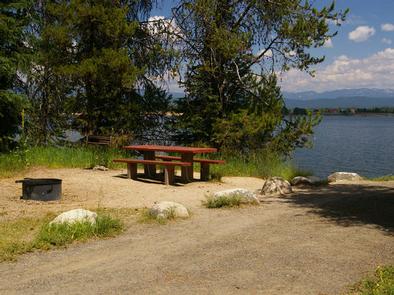
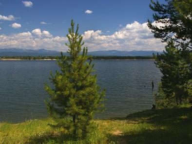
Amanita Campground is located next to scenic Lake Cascade in west-central Idaho. It is near the town of Donnelly, at an elevation of 4,850 feet. Boating, fishing, swimming and hiking are popular activities in this scenic region.

Recreation

Lake Cascade offers excellent opportunities for boating, water skiing, canoeing, windsurfing and sailing. Anglers enjoy casting for rainbow trout, coho salmon, smallmouth bass and perch. A boat ramp is located at the neighboring Rainbow Point Campground. Many hiking and ATV trails are in the area as well.

Facilities

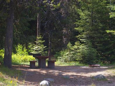
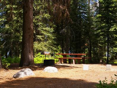
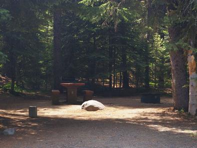
This small campground contains single-family campsites, with picnic tables, campfire rings and grills. Some sites have lake views and shoreline access.

Vault toilets, drinking water and trash collection are provided, but there is no electricity at the campground. Roads and parking spurs within the facility are gravel. A campground host can be located at Rainbow Point Campground.

Natural Features

The campground is situated on the west shore of the lake, among a mixed-growth conifer forest that towers over the campground. Summer wildflowers are abundant in the area.

A wide variety of wildlife makes its home around the lake. Waterfowl and songbirds can also be seen in the area, as well as pelicans and bald eagles.

Reservation

More from CampingHiking.net:

FORT SPOKANE, Washington Campground Images, Info & Reservations

Listen Directions Take State Highway 2 west of Spokane for 32 miles. Turn north on State Highway 25 at the town of Davenport and travel 24 miles. Follow the signs to the campground. Phone 509-754-7889 Activities BIKING, BOATING, HISTORIC & CULTURAL SITE, CAMPING, INTERPRETIVE PROGRAMS, FISHING, HIKING, PICNICKING, VISITOR CENTER,

MURRELL PARK, Texas Campground Images, Info & Reservations

Listen Directions Grapevine Lake is located in the Dallas-Fort Worth Metroplex, south of Denton, Texas. The north side of the lake is almost entirely within the town boundaries of Flower Mound, Texas in Denton county. The south side of the lake is located in Grapevine, Trophy Club and Southlake, Texas

SEELY CREEK GUARD STATION, Utah Campground Images, Info & Reservations

Listen Directions From Orangeville, travel west on State Highway 29 to Joe’s Valley Reservoir. At the reservoir, turn right and follow the road around to the other side. When you start heading away from the reservoir and toward the plateau, you’ll pass Orange Olsen Administrative Site on the right and

OUTLET PARK (KS), Kansas Campground Images, Info & Reservations

Listen Directions Take I-70 to exit 295, then 4.5 miles north to Hwy. 57, then east approximately 3.2 miles to park entrance. Phone 785-238-5714 Activities CAMPING, WILDLIFE VIEWING, SWIMMING SITE Keywords Related Link(s) Rec Area Info & Images Kansas State Road Conditions Kansas State Tourism Overview Outlet Park is a

COPPERAS CREEK, Texas Campground Images, Info & Reservations

Listen Directions From Comanche, Texas, take HWY 67/377 northeast for 5 miles, then turn left on FM 2861. Follow for 2.5 miles to the park entrance. Park entrance is on the North side of FM 2861. Phone 254-879-2498 Activities BOATING, CAMPING, FISHING, HIKING, HUNTING Keywords COPP,PROCTOR LAKE,LAKE PROCTOR,COPPERAS COVE,PROCTOR LAKE