DEER HAVEN, UT Campground Reservation, Info, Images, Map, Directions

DEER HAVEN, Utah Campground Images, Info & Reservations

Listen

Directions

From Cedar City, Utah, take Highway 14 east for 16 miles. Turn south on Webster Flat Road and travel 3 miles to the campground.

Phone

801-226-3564

Activities

BIKING, CAMPING, HIKING, WILDLIFE VIEWING, DAY USE AREA

Keywords

DEEH,DIXIE NF – FS

Related Link(s)

Rec Area Info & Images

Utah State Tourism

Forest Service Concessionaire

Utah State Road Conditions

Overview

Deer Haven Campground is situated high on the western edge of the Colorado Plateau, close to Cedar City, Utah. Visitors enjoy hiking, biking and day-tripping to nearby Cedar Breaks National Monument.

Recreation

The 34-mile Virgin River Rim Trail passes near the campground and is open to hiking, mountain biking and horseback riding.

Deer Haven is just 11 miles from Cedar Breaks National Monument, with hiking trails, guided tours and breathtaking scenery.

Just outside Cedar Breaks is the Ashdown Gorge Wilderness Area, where hikers will find 10 miles of trails and the Twisted Forest, a stand of ancient bristlecone pine.

Facilities

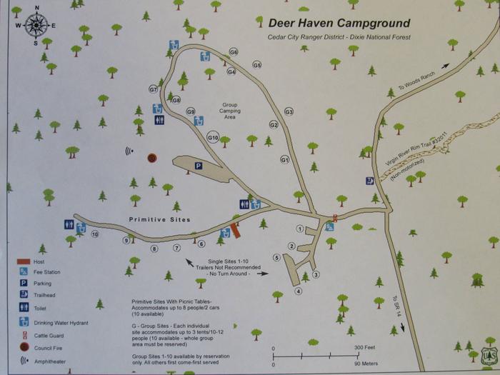
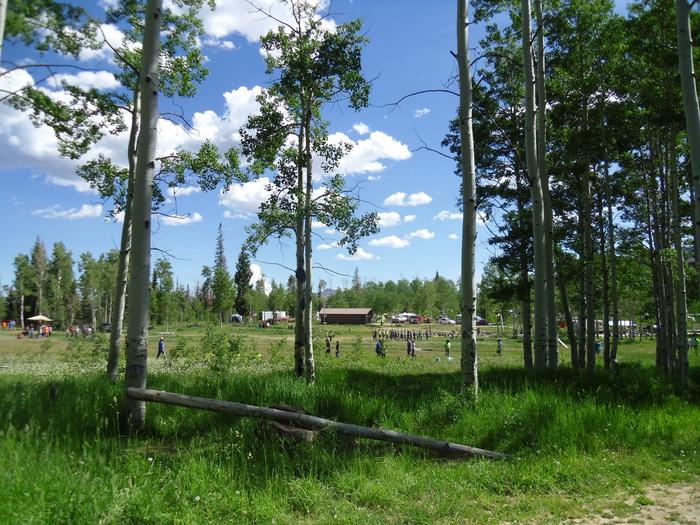
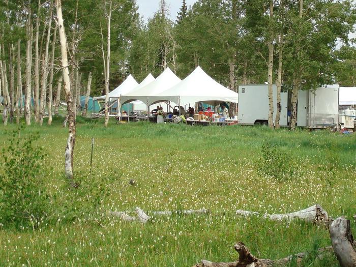
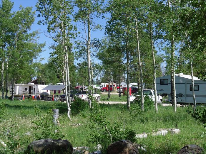
This campground offers one large group area for family reunions, youth and church groups and other large organizations of up to 200 people. Ten single sites are available on a first-come, first-served basis.

Flush and vault toilets are provided. Drinking water is piped from a spring, but there is not an abundant supply. Campers area urged to conserve water in all activities.

OHV/ATV’s are allowed in the campground for ingress and egress only. No joy riding is allowed in the campground.  

Natural Features

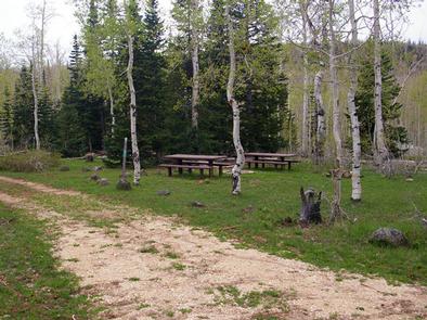
Deer Haven is at an elevation of 8,900 feet. This peaceful and scenic campground is surrounded by a forest of aspen and pine trees. Summer wildflowers are abundant throughout the site.

Nearby Attractions

Deer Haven is close to many areas with excellent recreational opportunities. Navajo Lake and Duck Lake are both within 30 minutes, offering boating, canoeing and fishing. The Duck Creek/Markagunt ATV Trail System begins nearby.

Reservation

More from CampingHiking.net:

OLD HICKORY BEACH, Tennessee Campground Images, Info & Reservations

Listen Directions From Nashville, take I-65 North to exit 92, TN-45/Old Hickory Blvd toward Madison, continue until you cross over the Cumberland River then take the 2nd left onto Bridgeway Ave., travel approximately 0.2 miles and turn left onto Ensley Ave., continue approximately 0.3 miles and turn left onto Swinging

SADDLEHORN CAMPGROUND, Colorado Campground Images, Info & Reservations

Listen Directions Driving: Westbound on Highway I-70 towards Grand Junction, Exit 31 (Horizon Drive): Follow signs through Grand Junction to the east entrance. The visitor center and campground are 19 miles from the east entrance. Eastbound on Highway I-70 take Exit 19 (Fruita): Turn south on Highway 340 to the

DAVIS LAKE CAMPGROUND, Mississippi Campground Images, Info & Reservations

Listen Directions From Tupelo, drive 17 miles south on the Natchez Trace Parkway to the Davis Lake Recreation Area Exit at milepost 243. Turn right on Davis Lake Road and continue 4 miles to the campground. Phone 662-285-3264 Activities BIKING, BOATING, CAMPING, FISHING, HIKING, WATER SPORTS, WILDLIFE VIEWING, SWIMMING SITE

EDNA CREEK CAMPGROUND, Idaho Campground Images, Info & Reservations

Listen Directions Hayfork Group Cg (ID) HIGHWAY 21 Idaho City ID 83706 Phone 208-392-6681 Activities CAMPING, FISHING, VISITOR CENTER, WILDLIFE VIEWING Keywords None Related Link(s) Rec Area Info & Images Idaho State Tourism Idaho State Road Conditions Overview Edna Campground is located 56 miles northeast of Boise, Idaho, in a

LEWIS CANYON, Arizona Campground Images, Info & Reservations

Listen Directions Drive to Pinedale, Arizona, on State Highway 260, approximately 14 miles northwest of Show Low. Turn south on Forest Road 130 and continue approximately 2.3 miles to Junction 130A. Turn right to the group site, following the signs.  Phone 928-368-2100 Activities BIKING, CAMPING, HIKING Keywords LEWI,APACHE-SITGREAVES NF-FS Related

Miller River Group Camp, Washington Campground Images, Info & Reservations

Listen Directions From I-5 north, take exit 194 to Highway 2. Continue for about 48 miles, then turn south at the Money Creek Campground sign. Continue about 3 miles to the campground. Phone 360-804-1103 Activities BIKING, CAMPING, FISHING, HIKING, WILDLIFE VIEWING Keywords MILR,MT. BAKER-SNOQU NF – FS Related Link(s) Rec