LOON LAKE, CA Campground Reservation, Info, Images, Map, Directions

LOON LAKE, California Campground Images, Info & Reservations

Listen

Directions

Take Highway 50 east of Placerville for 21 miles to Icehouse Road turnoff. Turn left and go 28 miles to a fork. Take the right fork 5 miles to the campground.

Phone

530-293-0827

Activities

CAMPING, FISHING, HIKING

Keywords

LOON,ELDORADO NF – FS

Related Link(s)

Rec Area Info & Images

California State Road Conditions

California State Tourism

Forest Service Concessionaire

Overview

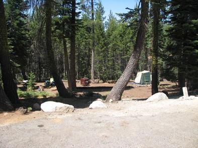
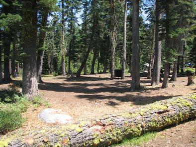
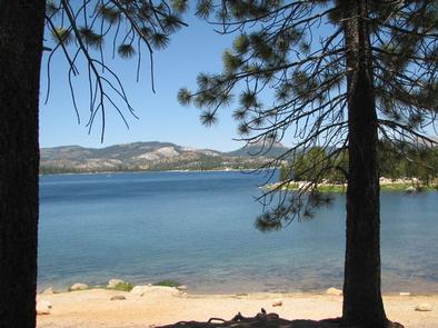
Loon Lake Campground is situated on the south shores of Loon Lake, and attracts many visitors with its variety of campsites and beautiful waterfront setting. Popular activities include boating, swimming, fishing, hiking, horseback riding and exploring off-road vehicle trails.

Recreation

Anglers delight in fishing for rainbow and brown trout, while boaters head out for water skiing. Five picnic areas in the campground and a day-use area provide visitors with nice lake views.

Facilities

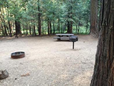
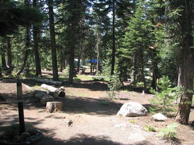
Campsites come with picnic tables, grills, campfire rings and bear-proof food storage lockers. Firewood is sold on-site.

Natural Features

The campground sits just west of Lake Tahoe in the Sierra Nevada Mountains at an elevation of 6,500 feet. The climate is similar to that of the Mediterranean with warm, dry summers and cold, wet winters.

Nearby Attractions

The 18-mile Rubicon Jeep Trail begins nearby. An exciting stretch of scenic, un-maintained, rocky road awaits off-road thrill seekers.

Reservation

More from CampingHiking.net:

OLD HIGHWAY 86, Missouri Campground Images, Info & Reservations

Listen Directions From Branson, Missouri, take Highway 65 and turn west onto Highway 86. After 6 miles turn north on Highway UU and follow signs to the campground. Phone 417-779-5376 Activities BIKING, BOATING, CAMPING, FISHING, HIKING, PICNICKING, VISITOR CENTER, WATER SPORTS, WILDLIFE VIEWING, DAY USE AREA, SWIMMING, KAYAKING Keywords OL86,TABLE

ALAVA BAY CABIN, Alaska Campground Images, Info & Reservations

Listen Directions The cabin is approximately 20 air miles southeast of Ketchikan on Revillagigedo Island. Accessible by floatplane, kayak or boat with mooring buoy. Navigation is challenging due to tides, merging currents and open ocean waters. Please check tide tables in advance. Refer to USGS Ketchikan A-4. Phone 907-225-2148 Activities

NORTH FORK (KY), Kentucky Campground Images, Info & Reservations

Listen Directions Begin at ramp onto I-64 West toward New Albany/St. Louis, traveling 22.3 miles. Take the IN-135, Exit Number 105, toward Palmyra/Corydon, onto IN-135 South toward Corydon, traveling 16.7 miles. Continue on Bypass Road KY-79 for 2.1 miles. Turn right onto KY-79, traveling 10.1 miles. Continue on 1st Avenue,

PIONEER POINT, California Campground Images, Info & Reservations

Listen Directions From Bakersfield, California, take Highway 178 east to the town of Lake Isabella. From Lake Isabella take 155 north about 1.5 miles to Pioneer Point Campground. Phone 760-376-1815 Activities BOATING, CAMPING, FISHING Keywords PIOP,LAKE ISABELLA,KERN VALLEY,SEQUOIA NF – FS Related Link(s) Rec Area Info & Images California State

CULTUS LAKE CAMPGROUND, Oregon Campground Images, Info & Reservations

Listen Directions From Bend, OR: Travel 46 miles southwest on Cascade Lakes Hwy (46), then west on Forest Road 4635 for 2 miles. Phone 541-323-1746 Activities BIKING, BOATING, CAMPING, FISHING, HIKING, MOTOR BOAT, MOUNTAIN BIKING, JET SKIING, AMPHITHEATER Keywords Related Link(s) Rec Area Info & Images Oregon State Road Conditions