
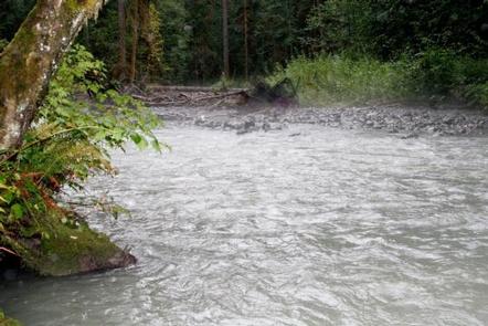
Directions
From Seattle, go north on I-5 to Burlington. Take Exit 230 on State Highway 20. Go past the Mt. Baker Ranger District Office in Sedro-Woolley and follow State Route 20 east for 16 miles to milepost 82. Turn left (north) on the Baker Lake Highway (Forest Service Road 11). Continue for approximately 18 miles to the sign for Park Creek Campground Road (Forest Service road 1144). Turn left and travel less than 1/4 mile to access the campground.
Phone
425-374-1211
Activities
FISHING, HIKING
Keywords
PARC,PARK CREEK WASHINGTON,MT. BAKER-SNOQU NF – FS
Related Link(s)
Washington State Road Conditions
Overview
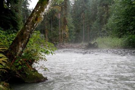
Park Creek Campground sits along the banks of Park Creek in the stunning Mt. Baker-Snoqualmie National Forest. The unique setting offers many recreational activities and scenic views. Baker Lake is close by, and many hiking trails and climbing routes are within a short driving distance.
Recreation
In addition to being a great basecamp for hiking, boating and fishing in summer and early fall, Park Creek can be a starting point for snowshoeing in the winter months. Trails in the area can entice any hiker to get outdoors. From smooth paths meandering through deep quiet forests to challenging ascents up boulder-studded mountains, opportunities abound for every skill level. Shadow of the Sentinels Trail, a barrier-free interpretive trail winding through dense forest growth, is a short drive away. Huge Douglas fir and cedar trees tower above a forest floor of ferns, moss and berry bushes, and interpretive signs along the route explain the dynamics of this 500-year-old ancient forest. The trail is constructed of asphalt and boardwalks with grades no greater than 8 percent. The nearby Baker Lake Trail is an easy family hike that begins in a majestic stand of Douglas fir. In 1843, a small eruption of Mt. Baker caused a forest fire, and visitors can still see the burned snags of virgin cedar trees that once dominated the area. The trail contours above the eastern shoreline of Baker Lake.
Facilities
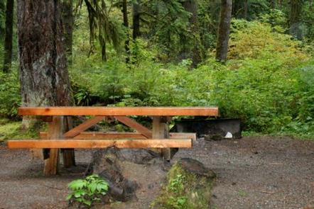
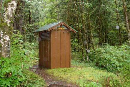
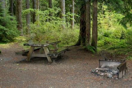
Park Creek campground offers standard sites, accommodating both tent and RV camping. The campground is equipped with tables, vault toilets and campfire rings with grills.
Natural Features
The Mt. Baker-Snoqualmie National Forest showcases rugged peaks, sparkling alpine lakes and old-growth forests, providing visitors with unique and surprising landscapes. Mt. Baker, the most prominent feature of the Mt. Baker Wilderness, dominates the landscape on a clear day. Rising to an elevation of 10,781 feet, the active volcano is perpetually snow-capped and mantled with an extensive network of creeping glaciers. Mt. Baker’s summit, Grant Peak, is a 1,300-foot-deep mound of ice, which hides a massive volcanic crater. Wildlife in the area includes mountain goats traversing the higher elevations to squirrels and black bears in the forests. Migratory birds and native fish find ample habitat in the surrounding ecosystems.
Nearby Attractions
Hike in the mountains above the lake in the Mt. Baker National Recreation Area or Mt. Baker Wilderness, or take some time to visit North Cascades National Park. This unique park is like no other place on earth. It features a deep blue lake surrounded by sheer, 2,000′ cliffs, two picturesque islands and a violent volcanic past. Hiking trails, a visitor center and educational programs are available.