
Directions
From Seattle, go north on I-5 to Burlington. Take Exit 230 on State Highway 20. Go past the Mt. Baker Ranger District Office in Sedro-Woolley and follow State Route 20 east for 16 miles to milepost 82. Turn left (north) on the Baker Lake Highway (Forest Service Road 11). Continue for 23.3 miles to the sign for Shannon Creek Campground on the right.
Phone
360-804-1103
Activities
BOATING, FISHING, HIKING, WATER SPORTS, SWIMMING SITE
Keywords
SHAN,MT. BAKER-SNOQU NF – FS
Related Link(s)
Washington State Road Conditions
Overview
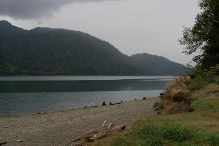
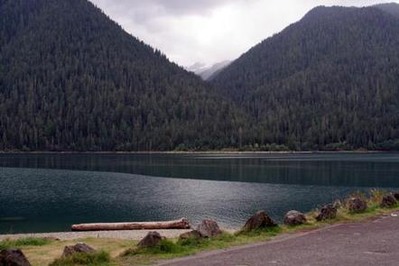
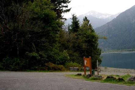
Shannon Creek Campground is nestled along the western shore of Baker Lake in the Mt. Baker-Snoqualmie National Forest on the west side of the Cascades. The area is one of the most spectacular in the country, showcasing glacier-covered peaks, broad mountain meadows and old-growth forests.
Recreation
The surrounding area is a prime location for hiking, climbing, boating, fishing, picnicking and horseback riding in summer and early fall, and snowmobiling in the winter months. Baker Lake is a popular destination for boating, water skiing, canoeing, fishing and swimming. Anglers cast for a number of fish species. The nearby Baker Lake and Baker River Trails are family friendly hikes that wind through majestic old growth Douglas Fir and western red cedar trees. The Baker Lake trail contours above the eastern shoreline of Baker Lake. The Baker River Trail leads to North Cascades National Park.
Facilities
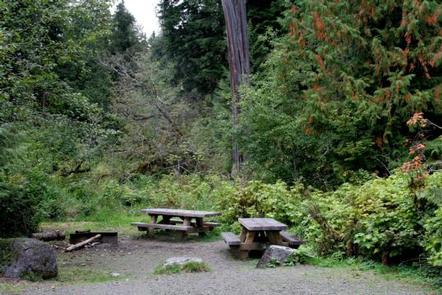
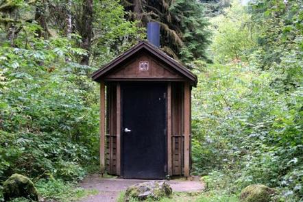
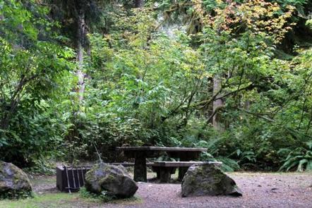
Shannon Creek Campground offers single and double-family sites for both tent and RV camping. Picnic tables, campfire rings, vault toilets and drinking water are provided. No electrical hookups are available.
Natural Features
Rugged peaks, scenic rivers and abundant wildlife define the Mt. Baker-Snoqualmie National Forest and surrounding designated wilderness areas. On a clear day visitors can see Mt. Baker, which rises to an elevation of 10,781 feet. The active volcano is perpetually snow-capped. Mt. Baker’s summit, Grant Peak, is actually a 1,300-foot-deep mound of ice, which hides a massive volcanic crater.
Wildlife in the area ranges from mountain goats in the higher elevations to pine marten and porcupine on the forest floor. Migratory birds and native fish find ample habitat in the varied ecosystems as well.
Nearby Attractions
Hike in the mountains above the lake in the Mt. Baker National Recreation Area or Mt. Baker Wilderness, or take some time to visit North Cascades National Park. This unique park is like no other place on earth. It features a deep blue lake surrounded by sheer, 2,000′ cliffs, two picturesque islands and a violent volcanic past. Hiking trails, a visitor center and educational programs are available.