TIPSAW LAKE, IN Campground Reservation, Info, Images, Map, Directions

TIPSAW LAKE, Indiana Campground Images, Info & Reservations

Directions

From St. Croix, Indiana, travel south on State Route 37 about 5 miles to the Tipsaw Lake sign. Turn right and continue about 3 miles to the campground. Tipsaw Lake is only 3 miles from Interstate 64.

Phone

812-843-4891

Activities

BIKING, BOATING, CAMPING, FISHING, HIKING, HUNTING, SWIMMING SITE

Keywords

TIPS,HOOSIER NF – FS

Related Link(s)

Rec Area Info & Images

Indiana State Road Conditions

Forest Service Concessionaire

Indiana State Tourism

Overview

The Tipsaw Lake Recreation Area is located on the shores of its namesake lake in south-central Indiana’s Hoosier National Forest. It offers camping, picnic areas, boating, swimming, hiking, biking and educational programs. Visitors enjoy the scenic views of the forest and all it has to offer.

Recreation

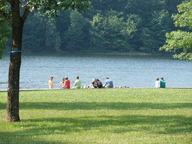
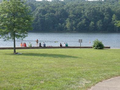
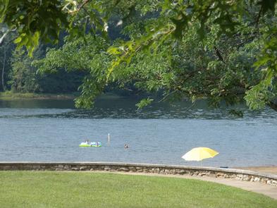
Boating, fishing and swimming in the lake are popular activities. Electric motors are allowed, and fishing for pan fish is considered excellent. The boat ramp and parking area is open year-round.

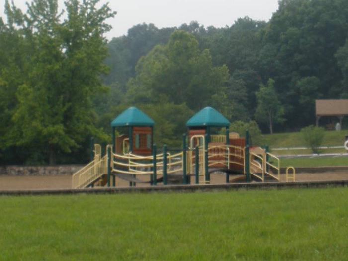
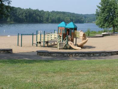
A beautiful swimming beach with playground equipment and a modern bathhouse is also available. The beach offers a combination of sand and sun or a shady, grass-covered hillside.

A 5.9-mile trail for hiking and mountain biking runs from the day-use area around the lake. The trail includes scenic overlooks of the lake and valley and traverses a variety of forest types. A trail permit is available for purchase and is required for mountain bikers age 17 and older.

Facilities

The area offers dozens of individual, double and group campsites, available for tent and RV camping. Group sites can accommodate up to 65 people.

Each site is equipped with tables and campfire rings with grills. Accessible flush toilets, showers and drinking water are provided. A beach area is fully accessible and is equipped with washing stations and changing rooms. Electric and water hookups are available at some sites and parking surfaces are paved.

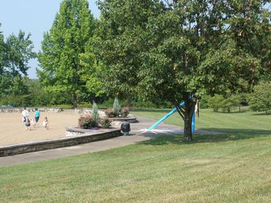
A day-use area is also available and provides access to the beach and picnic areas and shelters, as well as the boat ramp. Horseshoe pits and and open areas for games are nearby.

Natural Features

The campground is adjacent to 131-acre Tipsaw Lake, in a hardwood and pine forest. Situated at an elevation of 380 feet, the campground is composed of five loops that offer dozens of campsites. Some sites are shaded and the roads are paved.

Reservation

More from CampingHiking.net:

PRAIRIE CREEK (AL), Alabama Campground Images, Info & Reservations

Directions From Montgomery, Alabama, follow Highway 80 west for approximately 25 miles. Turn right on County Road 29 and follow the signs into the campground. Phone 334-418-4919 Activities BIKING, BOATING, CAMPING, FISHING, HIKING, WATER SPORTS, WILDLIFE VIEWING, SWIMMING SITE Keywords PRA1,JONES BLUFF,ALABAMA RIVERS,WOODRUFF,ROBERT F. HENRY,ROBERT F HENRY,ALABAMA RIV. – WO

BOULDER PARK CAMPGROUND, Wyoming Campground Images, Info & Reservations

Directions From Worland, Wyoming: Take U.S. Highway 16 east for 48 miles, then turn onto West Tensleep Lake Road (Forest Road 27) and travel 0.5 miles west. Campground is on the left. From Buffalo, Wyoming: Take U.S. Highway 16 west for 43 milesthen turn onto West Tensleep Lake Road (Forest

KEOWEE PARK SHELTER, North Carolina Campground Images, Info & Reservations

Directions From Charlotte, North Carolina, take I-77 North (approximately 60 miles) before merging onto Highway 421 North towards Wilkesboro/Boone. Continue to Exit 286B (approximately 20 miles), turn left onto Highway 268 and continue for approximately 7.5 miles. Turn the first right after the bridge. (You will see a sign for

PINEY POINT, Texas Campground Images, Info & Reservations

Directions From Texarkana, take Highway 59 south to Wright Patman Lake. Just south of Sulphur River Dam, turn right into the park area, following signs. Proceed one mile to the park. Piney Point is just north of Rocky Point Park. Phone 903-796-0684 Activities BOATING, CAMPING, FISHING, HIKING, WATER SPORTS Keywords

Agua Piedra Campground, New Mexico Campground Images, Info & Reservations

Directions From Las Vegas, New Mexico, take State Highway 518 approximately 51 miles to the Agua Piera Campground. From Penasco, New Mexico, travel east on State Route 75 about 5 miles, to an intersection. Turn right, onto State Route 518 (unmarked) and continue about 7 miles to campground entrance. From