
Directions
From Ten Sleep, Wyoming: Take Hwy 16 east for approximately 20 miles to Forest Service Road 432. Turn left on FSR 432 and continue about a mile to campground.
Phone
406-587-9054
Activities
BIKING, CAMPING, FISHING, HIKING, WILDLIFE VIEWING
Keywords
SITT,BIGHORN NF – FS
Related Link(s)
Overview
Sitting Bull Campground is located 51 miles east of Worland, Wyoming on the west side of scenic Cloud Peak Skyway, near the Cloud Peak Wilderness Area. The Bighorn National Forest offers a wide variety of activities, including hiking, fishing, scenic driving and a number of historic sites. The administering organization is Gallatin Canyon Campgrounds; e-mail: gccampgrounds13@gmail.com
Recreation
Nearby Meadowlark Lake covers 325 acres and is open to boating at a wake-less speed, making it a perfect location for canoeing and fishing. Anglers will find rainbow, cutthroat, brown and brook trout in the cool waters of the lake.
Off-road vehicle trails, scenic jeep roads, hiking and additional fishing streams are available in the surrounding area. Diverse hikes vary from loop trails to treks along creeks and over mountain peaks; many trails access the Cloud Peak Wilderness.
Facilities
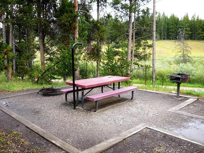
The campground offers several single-family sites each equipped with a picnic table and campfire ring with grill. Site 006 meets established accessibility standards. Accessible vault toilets, drinking water and trash collection are also provided.
Natural Features
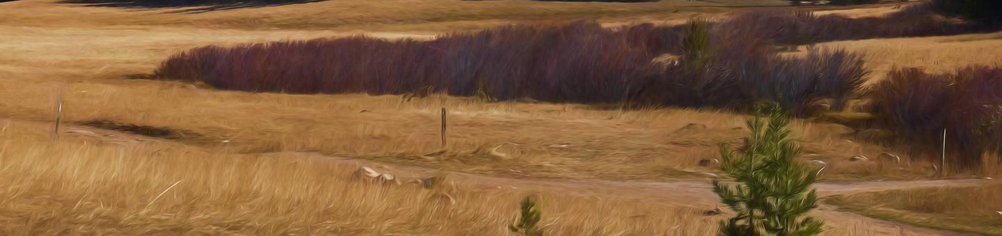
Sitting Bull is situated on the edge of a forest of lodgepole pine, adjacent to a beautiful mountain meadow, a prime location for wildlife viewing. Most sites afford expansive views of the surrounding Bighorn Mountains.
Nearby Attractions
The High Park Lookout is located just east of Meadowlark Lake. This old fire lookout was built by the CCC decades ago and is no longer active. A short hike leads to the lookout, where hikers are awarded panoramic views of the surrounding area.
West Tensleep Lake is about 10 miles north of the campground and is open to non-motorized craft only. The popular West Tensleep Lake Trail begins here and leads into the Cloud Peak Wilderness.
Deer Haven Lodge and Meadowlark Lodge are nearby, offering dining options, lodging, guided horseback riding and fishing and camping supplies.
Charges & Cancellations
Refunds: Refund requests made through www.recreation.gov will be charged a $10 processing fee. This cancellation processing fee is retained by the reservation service contractor along with the non-refundable reservation fee. All requests for the return of the non-refundable reservation fee and the cancellation processing fee will be declined by the campground concessionaire as they did not receive these fees (these are the fees retained by the reservation contractor, a different entity).