


Directions
From Orr, Minnesota, take St. Louis County Road 23 for 16 miles to Buyck. At Buyck, County Road 23 turns into County Road 24. Continue on County Road 24 for 8 miles to the Echo Trail. Turn right onto the Echo Trail and continue 12 miles to Jeannette Lake Campground.
Phone
(218) 666-0020
Activities
BOATING, CAMPING, FISHING, HIKING
Keywords
JEAN,SUPERIOR NATIONAL FOREST,SUPERIOR NF – FS
Related Link(s)
Minnesota State Road Conditions
Overview
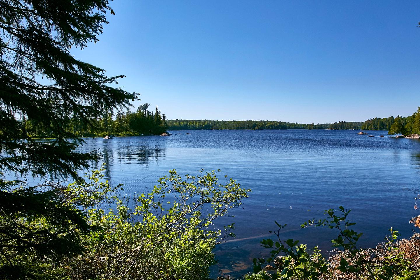
Jeanette Lake Campground is a small, single-loop campground on a peninsula reaching out onto the glacier-carved Lake Jeanette in Superior National Forest. Originally built by the Civilian Conservation Corps in the 1930s, this sweet, picturesque campground is well worth the drive.
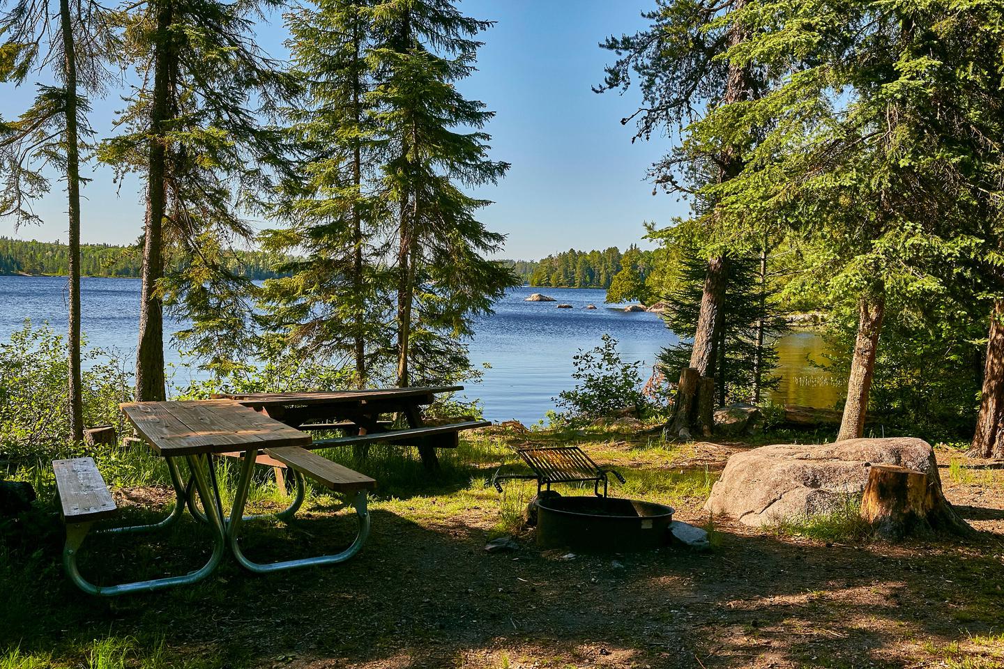
The facility provides sites that are usually accessible to RVs and tent trailers along with tent-only and hike-in sites.
Superior National Forest, located in northeastern Minnesota’s arrowhead region, is comprised of three million acres. The forest spans 150 miles along the United States-Canada border. Visitors can find recreation opportunities year-round, including travel in the famous Boundary Waters Canoe Area Wilderness.
Recreation
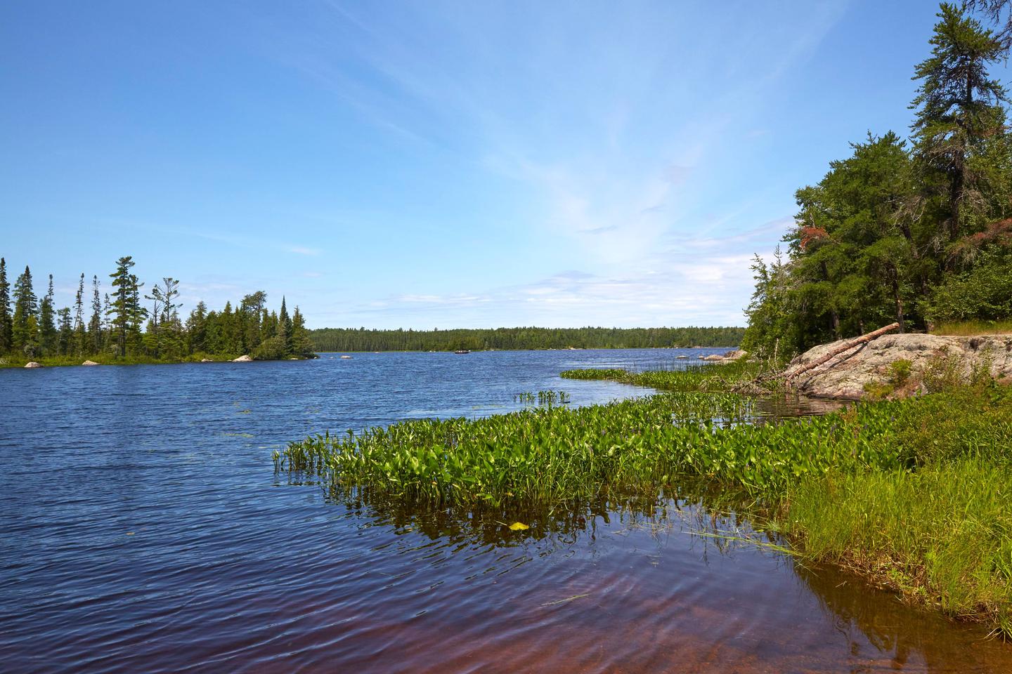
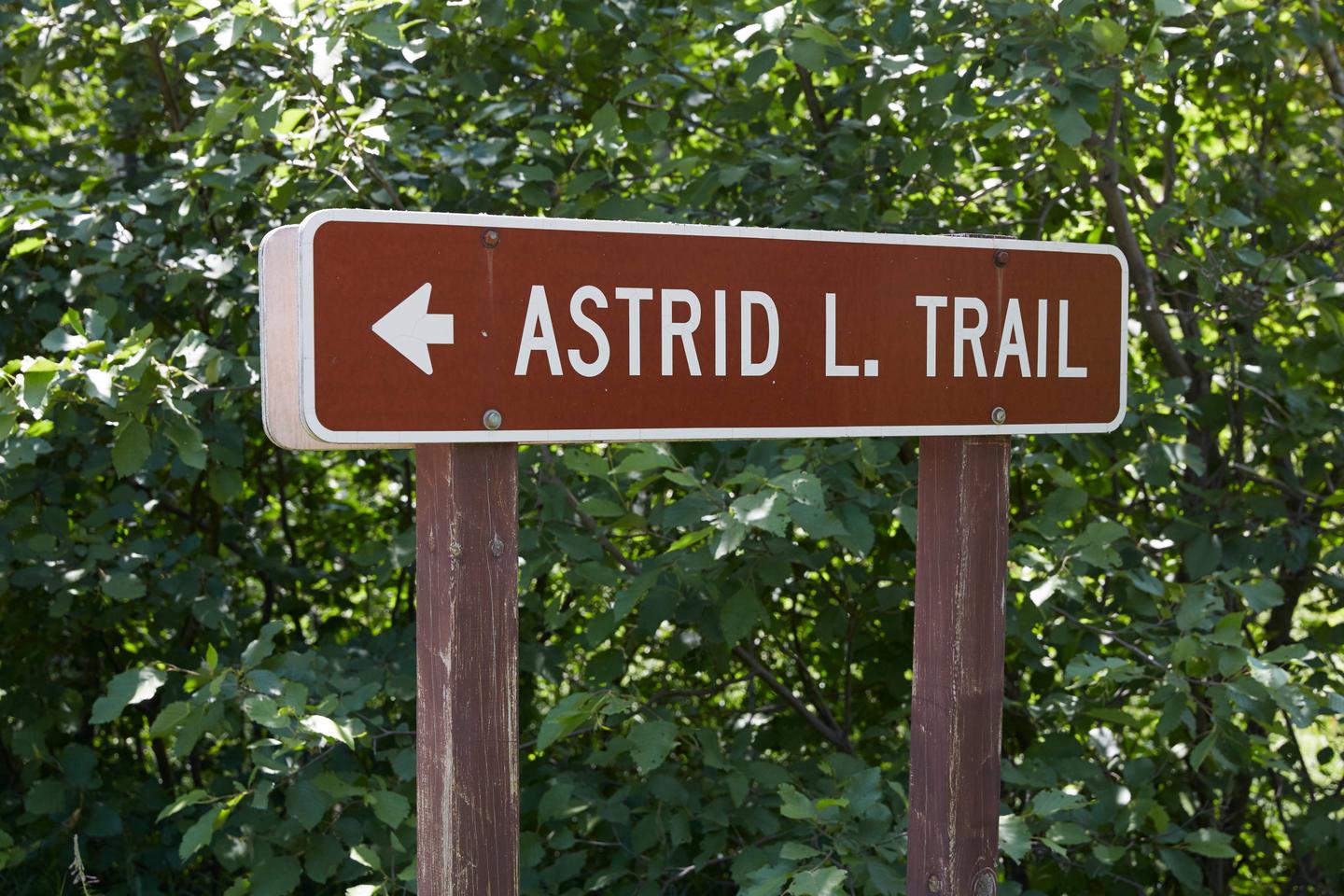
The winding shoreline and islands make the 638-acre Lake Jeanette a great place to explore in a canoe or kayak. Fishing opportunities include walleye, northern pike and perch. The campground provides access to the Astrid Lake Hiking Trail for those who want to stretch their legs.
The surrounding national forest offers a wide variety of recreational opportunities, including hiking in secluded woodlands and canoeing in pristine lakes and rivers.
View recreation guides and maps of hiking trails and canoe routes in the national forest.
Facilities
There are 12 sites total with three reservable standard sites, one reservable tent-only site and eight management sites, which are first-come, first-served. Most sites have a view of the lake and some are located on the lakeshore. The campsites are close together providing fair privacy, except for walk-in sites which enjoy excellent privacy. The walk-in tent sites have a nearby “open air” vault toilet (campers may want to bring toilet paper). Lake Jeanette also has several primitive backcountry sites that are first-come, first-served and accessible only by boat.
Natural Features
Lake Jeanette is not the largest or most isolated lake in the national forest, but it feels like it is both. Created long ago by a massive glacier, this lake is considered by many to be a special location.
The campground is wooded with a pleasant mix of hardwoods, pine and spruce providing shade for most sites. The understory of fern, wildflowers and grass is kept under control by mowing, giving the campground a manicured appearance.
Glacial “erratics” (massive boulders) left behind by the receding glacier give the campground character and a place for moss to grow.
Nearby Attractions
Possible day trips from the campground include Voyageurs National Park, Crane Lake and Vermillion Falls.
Numerous outdoor recreation opportunities lie within Superior National Forest’s 77 lake accesses, 13 fishing piers, 10 swimming beaches and 22 picnic areas. The forest is also home to three scenic byways and the Boundary Waters Canoe Area Wilderness.