WATERVILLE CAMPGROUND, NH Campground Reservation, Info, Images, Map, Directions

WATERVILLE CAMPGROUND, New Hampshire Campground Images, Info & Reservations

Listen

Directions

From Highway 93, take exit 28. Follow Highway 49 east for 10 miles, then turn left on Tripoli Road. The campground is 0.25 miles on the left.

Phone

603-536-6100

Activities

BIKING, BOATING, CAMPING, FISHING, HIKING, HORSEBACK RIDING, WINTER SPORTS, SWIMMING SITE

Keywords

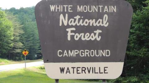
WATE,WHITE MOUNTAIN NF -FS

Related Link(s)

Rec Area Info & Images

Forest Service Concessionaire

New Hampshire State Road Conditions

New Hampshire State Tourism

Overview

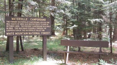
Waterville Campground is a popular home base for hikers who want to explore the southern White Mountains, including the scenic Pemigewasset Wilderness.

The tremendous choice of local attractions and the proximity to outdoor recreation opportunities – fishing, swimming, hiking and whitewater paddling to name a few – bring campers back to Waterville again and again.

The White Mountains boast pristine forests, clear mountain streams and rivers and the tallest peaks in the Northeast. The forest encompasses nearly 800,000 acres in New Hampshire and western Maine, and is one of the most popular in the country.

Recreation

Hikers are drawn to the many trails in the area. Campers can easily access the Drakes Brook Trail (4.4 miles) and Sandwich Trail (3.9 miles), which form a loop that begins and ends near the campground.

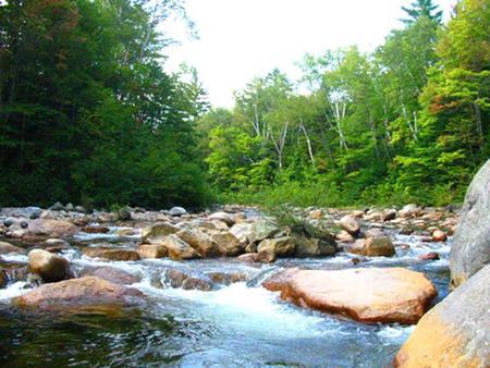
Water sports include fishing and kayaking. Anglers can cast a line for brook trout in the Mad River. A bit farther away is the Winnipesaukee River, which has a great 2.1-mile category I-II section of whitewater.

Other activities such as summer concerts, a swimming area, golf course and the Gunstock ski resort are close by.

Learn more about recreation in the national forest.
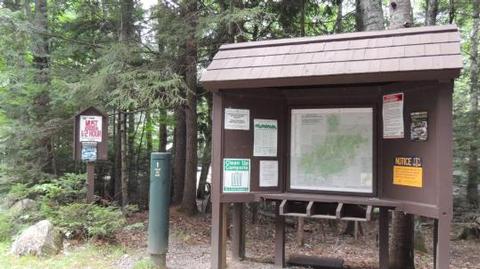
Facilities

A mix of standard and tent-only sites are well-spaced around a single loop. The facility provides the basic amenities of restrooms and drinking water. Many other amenities such as showers and laundry facilities are within a short drive.

Natural Features

The campground sits in a thick forest of northern hardwood trees, adjacent to the Mad River and surrounded by mountains.

The national forest is home to many species of northern wildlife, including moose, white-tailed deer and black bear. Almost 200 species of birds, including the rare Bicknell’s Thrush, live in the White Mountains.

Nearby Attractions

Campers may want to take an afternoon to visit Gilford Beach, Dixon Point and Sandwich Beach, all near Waterville Campground.

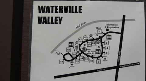
The facility is also close to Waterville Valley Resort, which offers night life, summer concert tours, restaurants, horseback riding, canoeing, mountain bike rentals and shops.

The White Mountains region hosts four alpine and five nordic ski areas, which provide year-round recreation opportunities.

Reservation

More from CampingHiking.net:

MOUNTAIN OAK, California Campground Images, Info & Reservations

Listen Directions From Wrightwood, CA, take State Rt. 2 west 2.4 miles to Palmdale/Jackson Lake sign (County Rt. N4/Pines Highway). Turn right onto Rt. N4 and go 3.1 miles to campground sign. Turn right into campground. Phone 760-249-3526 Activities BOATING, CAMPING, FISHING, HIKING, WILDLIFE VIEWING, SWIMMING SITE, CANOEING, BIRDING, SCENIC

COTTONWOOD (CA), California Campground Images, Info & Reservations

Listen Directions From Reno, Nevada, travel north on Highway 395, then merge onto Highway 70 west and travel 5 miles to Chilcoot. Turn north on Highway 284 and continue for 8 miles to the Frenchman Lake Reservoir, then turn left before crossing the dam and travel 2.5 miles to the

BLUE MEADOW, West Virginia Campground Images, Info & Reservations

Listen Directions From White Sulphur Springs, travel 8 miles north on State Route 92. Turn left (west) at Alvon, West Virginia, onto State Route 16. Travel 4 miles to the recreation area. Phone 304-536-2144 Activities CAMPING, FISHING, HIKING, WILDLIFE VIEWING, SWIMMING SITE Keywords BLUM,MONONGAHELA NF -FS Related Link(s) Rec Area

ALSEK RIVER CABIN, Alaska Campground Images, Info & Reservations

Listen Directions This cabin is located 55 miles southeast of Yakutat, just north of Alsek River. Access is by wheeled plane only, on an 1,800×50-ft. airstrip. Phone (907) 784-3359 Activities CAMPING, HUNTING, WILDLIFE VIEWING Keywords ALSE,TONGASS NF – FS Related Link(s) Rec Area Info & Images Alaska State Tourism Alaska

MAGONE LAKE, Oregon Campground Images, Info & Reservations

Listen Directions From John Day, Oregon, take U.S. Highway 26 east for approximately 9 miles. At the junction of County Road 18, travel north approximately 10 miles. At Forest Road 3620, turn left and drive approximately 1 mile to Forest Road 3618. The campground is 1 mile from the turnoff.

LONE ROCK CAMPGROUND (CO), Colorado Campground Images, Info & Reservations

Listen Directions From Denver, Colorado, take Highway 285 southwest to Pine Junction, Colorado. Turn south on Jefferson County 126 and travel 28 miles. Look for signs into campground. Phone 303-275-5610 Activities BOATING, CAMPING, FISHING, HIKING Keywords LONR,ANTELOPE LAKE,SUSANVILLE,TAYLORSVILLE,JANESVILLE,DECKERS,SOUTH PLATTE RIVER,PLUMAS NATIONAL FOREST,PIKE AND SAN ISABEL NF- FS Related Link(s) Rec