RIVERSIDE (ID - TARGHEE), ID Campground Reservation, Info, Images, Map, Directions

RIVERSIDE (ID – TARGHEE), Idaho Campground Images, Info & Reservations

Listen

Directions

From Ashton, Idaho, travel north on Highway 20 for 15 miles, take Riverside Campground turnoff, travel 1 mile to the campground entrance.

Phone

208-558-7658 OR 208-270-0094

Activities

CAMPING, FISHING, WILDLIFE VIEWING

Keywords

RIV1,RIVERSIDE TARGHEE,CARIBOU-TARGHEE NF – FS

Related Link(s)

Rec Area Info & Images

Idaho State Road Conditions

Forest Service Concessionaire

Idaho State Tourism

Overview

Riverside Campground is on the banks of the Henry’s Fork of the Snake River, just 15 miles north of Ashton, Idaho. Beautiful Island Park is nearby, where visitors enjoy boating, fishing and exploring local trails.

Please click here for further information about the facility and recreation opportunities in the area.

Recreation

Henry’s Fork has great fly-fishing for rainbow and brook trout. Tubing, canoeing, kayaking and rafting are also popular activities on the river.
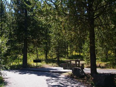
Facilities

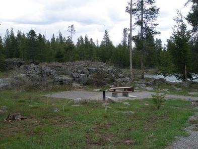
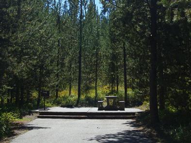
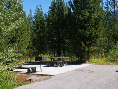
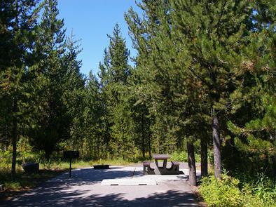
The campground offers one group site that can accommodate up to 40 people. Several single family sites are also available, each equipped with a picnic table, campfire ring and grill.

Vault toilets, drinking water and trash collection are provided but there is no electricity. Firewood is available for purchase from the host. Gas and groceries are 8 miles away.

Natural Features

The campground is situated along the Henry’s Fork at an elevation of 6,200 feet. Lodgepole pines provide partial shade and aspens dot the landscape. Summer wildflowers are abundant. A variety of wildlife, including moose and deer, is frequently spotted throughout the area.

Nearby Attractions

Island Park has outdoor activities for visitors of all ages. Hundreds of miles of hiking, biking, horseback riding and ATV trails crisscross the area. Island Park Reservoir and Henry’s Lake are nearby, with boat ramps, fish cleaning stations, boating, water skiing and fishing.

Yellowstone and Grand Teton National Parks are close enough for a day trip. Both parks offer hiking and fishing in breathtaking natural settings.

Reservation

More from CampingHiking.net:

BUCKSAW, Missouri Campground Images, Info & Reservations

Listen Directions From Highway 7, take Highway U south for 3 miles. Turn left at SE 803. Stay on the paved road and follow signs into the campground. Phone 660-477-3402 Activities BOATING, CAMPING, FISHING, SWIMMING SITE Keywords BUCS,TRUMAN LAKE,HARRY S TRUMAN Related Link(s) Rec Area Info & Images Missouri State

DAM WEST DAY USE, Illinois Campground Images, Info & Reservations

Listen Directions From I-70, take State Route 127 south to Carlyle and turn east on Williams Road/1840 E. Williams Road will turn into Lake Road/1430 N. Continue on Lake Road south to the day use area, located on the left. Phone 618-594-5253 Activities BIKING, BOATING, CAMPING, INTERPRETIVE PROGRAMS, FISHING, HIKING,

CANYON CREEK CABIN, Montana Campground Images, Info & Reservations

Listen Directions From Melrose, travel west on Forest Road 187 for about 13 miles, then continue southwest for 6 miles on Forest Road 7401. Four-wheel drive or high clearance vehicles are required to access the cabin. Depending on conditions, skis and snowmobiles may be necessary to complete the route. Maps

DEER LAKE, Minnesota Campground Images, Info & Reservations

Listen Directions From Deer River, travel northwest on Highway 46. Turn on Eagle Nest Road and continue west for four miles, past East Seelye and West Seelye campgrounds. Deer Lake Campground is on the left. Take Highway 46 northwest from Deer River, MN. Turn on Eagle Nest Road (Old CR

SAVENAC BUNKHOUSE, Montana Campground Images, Info & Reservations

Listen Directions From Missoula, travel west on Interstate 90 for 90 miles, to Exit 16 for Haugan. Turn right at the stop sign. At the frontage road turn right and take the first left across the cattleguard. Signs are present onsite to follow. Maps are available online or for purchase