HAYWARD FLAT, CA Campground Reservation, Info, Images, Map, Directions

HAYWARD FLAT, California Campground Images, Info & Reservations

Directions

From Redding, CA: Go west on Highway 299 to Weaverville, then north on Highway 3 for 15 miles. Turn right at Hayward sign and travel approximately 2 miles to campground entrance.

From Eureka, CA: Go east on Highway 299 to Weaverville, then north on Highway 3 for 15 miles. Turn right at Hayward sign and travel approximately 2 miles to campground entrance.

Phone

530-275-8113

Activities

BOATING, CAMPING, INTERPRETIVE PROGRAMS, FISHING, WATER SPORTS, DAY USE AREA, SWIMMING SITE

Keywords

HAYW,CLAIR ENGLE LAKE,SHASTA-TRINITY -FS

Related Link(s)

Rec Area Info & Images

Forest Service Concessionaire

California State Tourism

California State Road Conditions

Overview

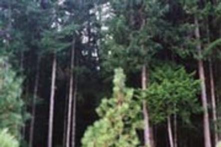
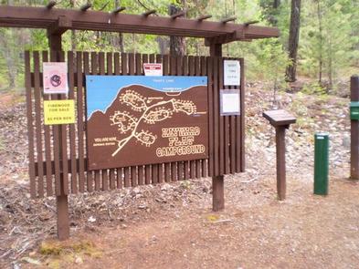
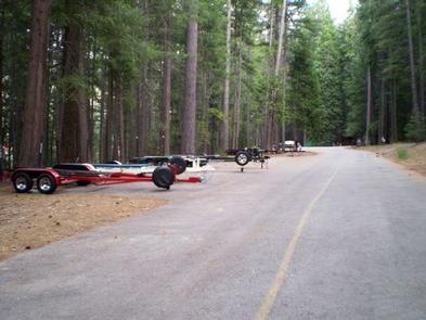
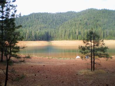
Hayward Flat is one of the most popular campgrounds on Trinity Lake, offering excellent lake access and plenty of shade from Ponderosa pines and Douglas firs. Located on one of the best arms of the lake for water skiing, Hayward is favored by visitors interested in water sports.

Relics from the area’s Placer mining history are scattered throughout the campground, with interpretive signs providing explanations.

Recreation

A boat ramp and marina are located 3 miles away, but mooring may be available at the campground. Popular activities include power and non-motorized boating, fishing, swimming and water skiing.

Anglers can fish for catfish, as well as a variety of bass, trout and salmon.

Facilities

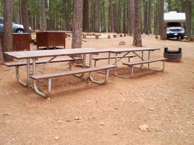
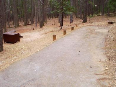
The 98-unit family campground is comprised of 5 loops. The Dogwood and Elderberry loops provide lake views and informal mooring for boats. Every campsite has a paved spur, table and campfire ring. Most campsites also provide a bear-proof food storage locker. Additional amenities include flush toilets and drinking water. The site also offers an amphitheater with educational interpretive programs offered seasonally. Program dates and times will be posted at the campground.

Natural Features

The Shasta-Trinity is the largest national forest in California with a diverse landscape ranging from 1,000 to 14,162 feet. The 2.1 million acre forest encompasses five wilderness areas, hundreds of mountain lakes and 6,278 miles of streams and rivers.

Trinity Lake sits at an elevation of 2,370 feet and is surrounded by the Trinity Alps. Black bears are frequently spotted in the area, as well as bobcats, mountain lions and a variety of bird species.

Nearby Attractions

The nearby town of Weaverville is listed on the National Register of Historic Places. This former mining town offers restaurants, shopping and self-guided walking tours.

Reservation

More from CampingHiking.net:

SURRY MOUNTAIN LAKE BEACH, New Hampshire Campground Images, Info & Reservations

Directions Surry Mountain Lake Beach is located on Route 12A in Surry, New Hampshire. Phone 603-352-4130 Activities BOATING, FISHING, HUNTING, PICNICKING, WILDLIFE VIEWING, DAY USE AREA, PHOTOGRAPHY, SWIMMING, KAYAKING, CANOEING, ICE FISHING Keywords Surry Mountain Lake Beach,Surry Mountain Lake,Surry Mountain Dam Related Link(s) Rec Area Info & Images New Hampshire

RICHARDSON LAKE CAMPGROUND, Wisconsin Campground Images, Info & Reservations

Directions From Wabeno, drive north 0.8 miles on Highway 32 to Highway 52. Turn left (west) on Highway 52 and drive 2.4 miles to Richardson Lake Road (FR2880). Turn right (north) on Richardson Lake Road and continue 0.4 miles to the campground. Phone 715-674-4481 Activities CAMPING Keywords Related Link(s) Rec

WILLIAM KENT CAMPGROUND, California Campground Images, Info & Reservations

Directions William Kent Campground is 2 miles south of Tahoe City on California Highway 89. Phone 530-583-3642 Activities BIKING, BOATING, CAMPING, INTERPRETIVE PROGRAMS, FISHING, VISITOR CENTER, WATER SPORTS, SWIMMING SITE Keywords WILK,TAHOE CITY,WEST SHORE,LAKE TAHOE,LAKE TAHOE BASIN – FS Related Link(s) Rec Area Info & Images California State Tourism California

QUAIL PRAIRIE LOOKOUT, Oregon Campground Images, Info & Reservations

Directions From Brookings and U.S. Highway 101, drive east on North Bank Chetco River Road (County Road 784). This becomes Forest Service Road 1376 in approximately 8 miles. Turn left after crossing the South Fork Bridge (16 miles from Brookings). Turn right on Forest Service Road 1917, approximately 1 mile

JEMEZ FALLS CAMPGROUND, New Mexico Campground Images, Info & Reservations

Directions From Alburquerque: Take Interstate 25 north for 12 miles; exit onto NM State Highway 550 northwest for approximately 20 miles then exit onto NM Highway 4. The campground is accessed off NM Highway 4, approximately 15 miles northeast of Jemez Springs. Phone (575) 829-3535 Activities BIKING, HISTORIC & CULTURAL

Crooked Creek Lake, Pennsylvania Campground Images, Info & Reservations

Directions Address: 114 Park Main Rd, Ford City, PA 16226 From Pittsburgh: Head northeast on Grant St toward Sixth Avenue. Turn right onto Seventh Ave. Use the left lane to keep right at the fork, follow signs for PA-380 E/Bigelow Boulevard/Interstate 579 N and merge onto Bigelow Blvd. Take the