GURNSEY CREEK, CA Campground Reservation, Info, Images, Map, Directions

GURNSEY CREEK, California Campground Images, Info & Reservations

Listen

Directions

From the town of Chester, follow Highway 36 west for about 14 miles. Gurnsey Creek Campground is located on the right side of the highway, about 2 miles past the Highway 32 turnoff.

Phone

530-258-2141

Activities

CAMPING, FISHING, HIKING

Keywords

GURN,LASSEN NF – FS

Related Link(s)

Rec Area Info & Images

California State Road Conditions

California State Tourism

Overview

Gurnsey Creek Campground is located in the mountains of northern California. It offers access to a variety of nearby recreational opportunities, including hiking, fishing and picnicking.

Recreation

The area provides access to plentiful hiking trails, picnic spots and rainbow trout fishing.

Facilities

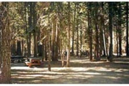
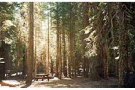
Dozens of individual campsites and two reservable group sites are available at Gurnsey Creek Campground. Group Site 1 can accommodate up to 56 people; Group Site 2 can accommodate up to 112 people.

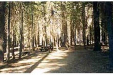
Picnic tables and campfire rings with grills are provided, as are accessible vault toilets and drinking water. No utility hookups are provided. A water-filling station is located at the campground entrance. Parking is limited within the campground.

Natural Features

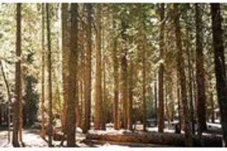
The campground is nestled in a mixed conifer forest in the Lassen National Forest at an elevation of 4,700 feet. It is located next to Gurnsey Creek.

Nearby Attractions

The campground is located 14 miles west of the town of Chester and Lake Almanor, where boating, fishing, sailing and water skiing are popular activities.

The southwest entrance to Lassen Volcanic National Park is about 14 miles north. The park is known for its active hissing fumaroles and boiling mud pots that continually shape and alter the landscape.

Reservation

More from CampingHiking.net:

RAINBOW POINT, Idaho Campground Images, Info & Reservations

Listen Directions From Boise, Idaho, travel north on Highway 55 for 95 miles to Donnelly. Turn west on West Roseberry Road and go 1.5 miles to Norwood Road. Turn south and continue a mile to Tamarack Falls Road. Turn west and go just over a mile to West Mountain Road.

RAYBURN, Texas Campground Images, Info & Reservations

Listen Directions From Pineland, TX, take FM 83 west 10 miles, then go south on FM 705 for 11 miles to FM 3127, then west for 1.5 miles and make a left into the park entrance. Phone 409-384-5716 Activities BOATING, CAMPING, FISHING, HIKING, HUNTING Keywords RAYB,SAM RAYBURN RESERVOIR,SAM RAYBURN LAKE,RAYBURN

INDIAN HOLLOW, Massachusetts Campground Images, Info & Reservations

Listen Directions Driving directions to the campground: Address: 200 Indian Hollow Rd, Chesterfield, MA 01012 From intersection of State Route 143 and South Street in the center of Chesterfield, turn south on South Street. Follow for approx. 2 miles and turn right onto Indian Hollow Road. Follow Indian Hollow Road

BANDITS ROOST, North Carolina Campground Images, Info & Reservations

Listen Directions From Winston-Salem, North Carolina, take Highway 421 North (approximately 55 miles) to Exit 286B, turn left onto Highway 268 and continue for approximately 5 miles. Turn right onto Jess Walsh Road. Campground entrance is located at the end of the road. From Charlotte, North Carolina, take I-77 North