
Directions
From Boise, Idaho, take Highway 55 north to Horseshoe Bend. Turn left on Highway 52 and drive west 9 miles to the junction at Sweet/Ola Highway (no road number), then take a slight right. Take this road north 17 miles to Ola. Make a slight left and continue north through Ola on Road 618 (Third Fork Road) to the Third Fork Cabin. This road changes from pavement to gravel a few miles north of Ola. Third Fork Cabin will be on the right-hand side of Rd. 618.
Phone
541-351-1182
Activities
BIKING, CAMPING, FISHING, HIKING, HUNTING, WILDLIFE VIEWING
Keywords
THIR,BOISE NF – FS
Related Link(s)
Overview
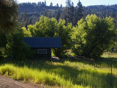
Third Fork Cabin is a former guard station, first established in 1906 as Station 10 and renamed Third Fork in 1908. A cabin was built at that time, which
existed until the site was rebuilt by the Civilian Conservation Corps in 1933. The current cabin’s exterior has changed little since that time, with the exception of a metal roof being added sometime before 1984.
The cabin is available between mid-April until late-October, and is accessible by car. Many modern comforts are provided at the cabin, but guests may need to bring some additional supplies and gear for their stay.
Recreation
Anglers can fish in adjacent Squaw Creek, and big game hunting is also a popular pastime.
Facilities
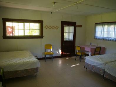
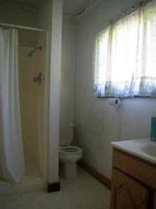
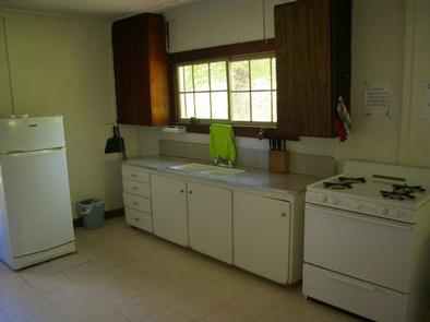
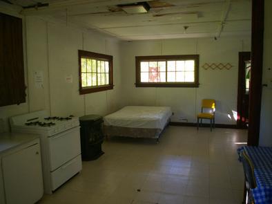
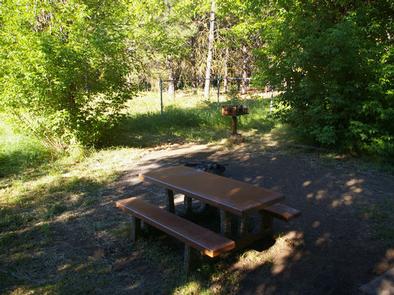
This rustic cabin sleeps four people with one double bed and two single beds with mattresses. Other amenities include a propane cook range, table with chairs, hot water heater, indoor flush toilet, shower and propane heater and refrigerator. A picnic table, campfire ring and pedestal grill sit within the fenced yard.
A camp host is located at Antelope Campground, 18 miles east in the Sagehen Reservoir area, where firewood can be purchased.
While the water at the cabin is potable, guests should bring their own supply of drinking water as a back-up. Bedding, lighting, cookware and utensils are not provided. Guests are expected to clean the cabin before leaving.
Natural Features
Third Fork Cabin sits in a steep mountain landscape heavily forested with old-growth Ponderosa pine at an approximate elevation of 4,700 feet. Tall grasses and various hardwoods grow on the site. Small mountain streams containing native fish flow nearby, and the area is marked by unusual juxtapositions of basalt and granitic rock.
Wildlife watchers may spot elk or deer wandering through the area during dawn or dusk, as well as glimpse a bear or moose. Birders can look for a wide variety of bird species.
Nearby Attractions
Sagehen Reservoir is a popular recreation area about 18 miles east of the cabin, offering numerous trails for off-road vehicles, hiking, mountain biking and horseback riding. Click here for an Idaho OHV safety message. Fishing and boating are permitted in the reservoir, and there is also a picnic area at Sagehen Dam.