PINE FLATS (ID), ID Campground Reservation, Info, Images, Map, Directions

PINE FLATS (ID), Idaho Campground Images, Info & Reservations

Listen

Directions

From Boise, Idaho, take Highway 55 to Banks. Turn east and travel on the Banks-Lowman Highway for 28 miles to the campground.

Phone

208-259-3361

Activities

BIKING, BOATING, HISTORIC & CULTURAL SITE, CAMPING, FISHING, HIKING, HUNTING, VISITOR CENTER, WILDLIFE VIEWING

Keywords

PINF,BOISE NF – FS

Related Link(s)

Rec Area Info & Images

Idaho State Tourism

Idaho State Road Conditions

Overview

Pine Flats Campground is located a few miles west of Lowman, Idaho, along the Banks-Lowman Highway at an elevation of 3,700 feet. Visitors enjoy rafting, kayaking and fishing on the South Fork Payette River, and soaking in the hot springs at the river’s edge.

Recreation

The South Fork Payette River flows next to the site, down a small hill, and offers trout fishing, rafting and kayaking. The Danskin River Access area is 5 miles west of the campground.

A 1/4-mile nature trail begins in the campground and leads to a natural hot springs soaking pool on the riverside.

Facilities

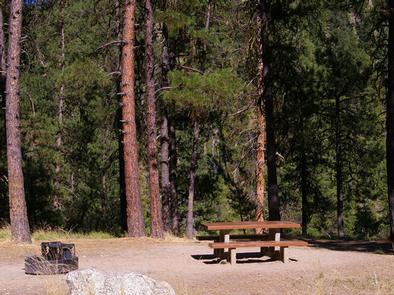
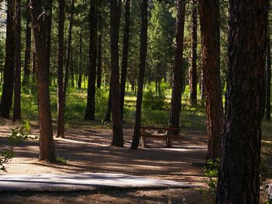
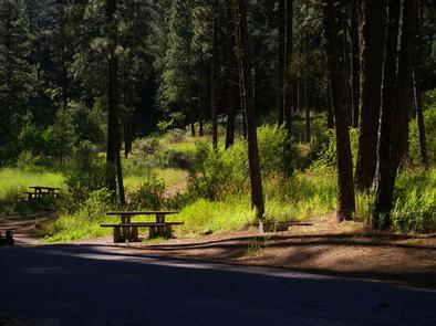
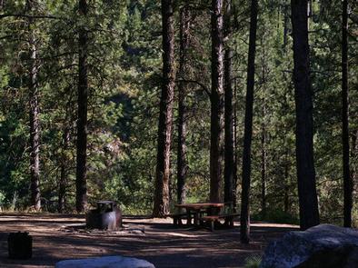
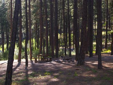
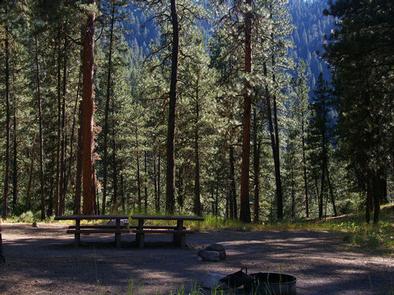
The campground contains several single and double-family sites, most of which are accessible, each with a picnic table and campfire ring with grill. Vault toilets, drinking water and trash collection are provided. Roads and parking spurs are paved, as are some campsite pads.

Natural Features

Towering Ponderosa pines cover the campground, offering partial shade in most sites. Summer wildflowers dot the landscape. Deer and elk may be seen wandering through the campground on occasion.

Nearby Attractions

Numerous natural hot springs pools can be found along the Banks-Lowman Highway, also known as the Wildlife Canyon Scenic Byway. The area offers scenic views, wildlife watching, historical information kiosks and several trail opportunities.

Whitewater rafting and kayaking are popular activities on the South Fork and Main Payette Rivers. Several companies in the area offer guided half and full-day trips.

Reservation

More from CampingHiking.net:

KANGA BAY CABIN, Alaska Campground Images, Info & Reservations

Listen Directions Accessible year round, weather permitting. Located 12 air miles south of Sitka on Baranof Island within Kanga Bay. From Sitka, floatplane access is 10 minutes, boat access is 40 minutes. For geographic features surrounding the cabin, refer to USGS topographicmaps Port Alexander D-5 and D-4. Please consult local

GUT ISLAND 2 CABIN, Alaska Campground Images, Info & Reservations

Listen Directions The Gut Island Cabins are located on Gut Island, adjacent to the western tip of Farm Island on the Stikine River delta in the Stikine-LeConte Wilderness. The cabin is 12 miles by float plane or shallow draft boat from Wrangell, or 7 miles from the boat ramp on

CARTER COVE, Arkansas Campground Images, Info & Reservations

Listen Directions From Plainview, Arkansas, take Route 60 for 3 miles east to the Access Road. Continue 1 mile south and follow signs into campground. Phone 479-272-4983 Activities BOATING, CAMPING, FISHING, SWIMMING SITE Keywords CART,NIMROD LAKE,NIMROD LAKE Related Link(s) Rec Area Info & Images Arkansas State Road Conditions Arkansas State

ASPEN GROUP AREA, New Mexico Campground Images, Info & Reservations

Listen Directions In southeast New Mexico, approximately 20 miles east of Alamagordo. From Alamagordo take US 82 east and go 16 miles. Just before Cloudcraft turn right (South) on NM 130. Go 1.4 miles. Turn left (east) on Forest Road 24B, go 0.5 miles. Aspen Group Area is on the

BOOMER PARK SHELTER, North Carolina Campground Images, Info & Reservations

Listen Directions From Charlotte, North Carolina, take I-77 North (approximately 60 miles) before merging onto Highway 421 North towards Wilkesboro/Boone. Continue to Exit 286B (approximately 20 miles), turn left onto Highway 268 and continue for approximately 6 miles. Turn left onto Boomer Road and the park will be on the