
Directions
From Potosi, take Highway P south for 10 miles to C Highway junction. Continue on C Highway for less than a mile to DD Highway junction. Turn left on DD Highway and continue for approximately 7 miles to the recreation area entrance.
Phone
(573)766-5765
Activities
CAMPING, FISHING, HUNTING, WILDLIFE VIEWING, SWIMMING SITE
Keywords
WILD,CHAPEL HILL BEAC PAVILION,WILD BOAR CAMPGROUND,COUNCIL BLUFF REC AREA,CHAPEL HILL BEACH PAVILION,WILD BOAR RIDGE CAMPGROUND,COUNCIL BLUFF REC AREA,MARK TWAIN NF -FS
Related Link(s)
Missouri State Road Conditions
Overview
The Council Bluff Recreation Area is perfect for anyone looking to enjoy the outdoors. The Wild Boar Campground and sheltered picnic area, available for individual families or large groups, is next to the largest lake in the Mark Twain National Forest. The area provides ample opportunities for camping, picnicking, hiking, fishing, swimming and more.
Recreation
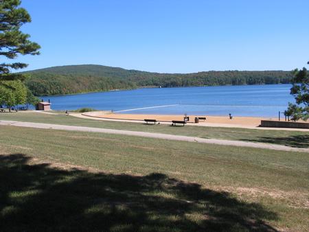
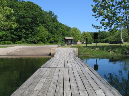
Boating is a popular pastime on the lake, but all boats on the lake must operate at a no-wake speed. Visitors can access the water via the two boat ramps located at the lake.
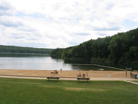
Canoeing, swimming and fishing are also available. Anglers can expect a catch of a variety of freshwater fish, including bass bluegills, catfish and crappies.
The 12-mile Council Bluff Trail encircles the lake, with spurs to the campground. Hikers can enjoy scenic views of the lake and a look at the Mark Twain wilderness.
Waterfowl hunting is permitted on Council Bluff Lake and the nearby Enough Fields provide upland game opportunities. A variety of wildlife makes its home in the heavily wooded area.
Facilities
The Wild Boar Ridge Campground offers multiple single-family, large group and walk-in sites, available for tent and RV camping. Each is equipped with tables, lantern posts and campfire rings or campfire circles, with grills.
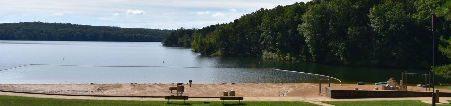
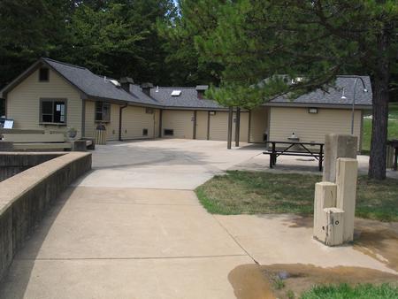
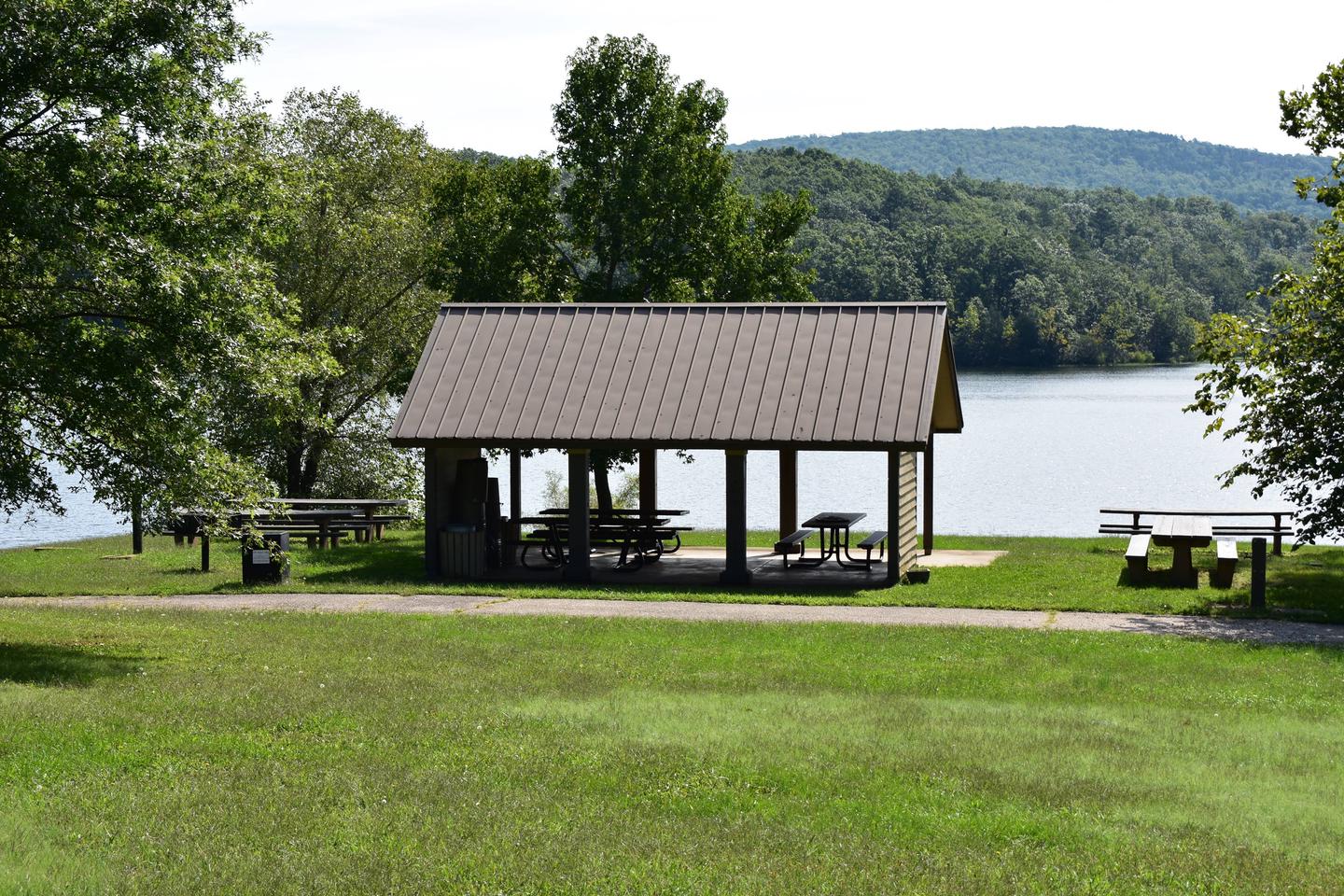
The large group sites can accommodate up to 50 people and a nearby picnic pavilion can hold up to 75. The pavilion is paved, with a roof overhead and is equipped with multiple tables and grills.
Accessible vault toilets and drinking water are provided. Electricity is not available, but some sites will accommodate RVs up to 40 feet in length. Some sites are available on a first-come, first-served basis.
The beach provides accessible flush toilets, drinking water and coin-operated showers. A small play area with a slide and climbing structure is adjacent to the beach.
Natural Features
Located in southern Missouri, the Council Bluff Lake was created by a dam across Big River. It is 440 acres in size and 87 feet deep in some places.
The Chapel Hill Beach is at the eastern end of the campground and provides 54,000 square-feet of sandy beach. Visitors can either walk or drive to the lake.
Nearby Attractions
The Trace Creek section of the Ozark Trail is located just west of the recreation area.