
Directions
Take I-70 west of Denver to exit 116 (Highway 82 East Glenwood Springs/Aspen). Follow 82 E for about 12 miles, then turn right onto Highway 133 south. Drive about 15 miles, then turn left at north entrance to the town of Redstone, CO. Campground is on left.
Phone
970-927-0107
Activities
BIKING, HISTORIC & CULTURAL SITE, CAMPING, FISHING, HIKING, WILDLIFE VIEWING
Keywords
REDS,WHITE RIVER NF -FS
Related Link(s)
Colorado State Road Conditions
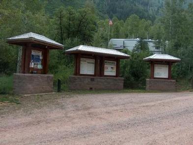
Overview
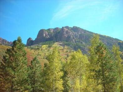
Redstone Campground is set amidst a scattering of aspen groves on a ridge above the Crystal River at 7,800 feet, creating an ideal setting for guests seeking recreation and relaxation in White River National Forest.
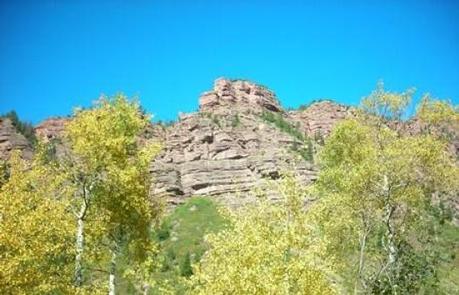
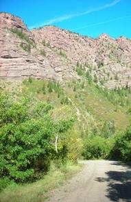
Sites in the campground are widely spaced and offer wonderful views of red rock outcroppings and cliffs, though an understory of tall grass and a scattered forest provides plenty of privacy.
Recreation
Crystal River, a tributary of Roaring Fork River, is renowned for its fly fishing. Rainbow, brown, cutthroat and brook trout are plentiful in this waterway.
A hike up Mt. Sopris offers spectacular panoramic views. This 12,953-foot mountain dominates the surrounding landscape. The hike is 14.8 miles with a 4,600-foot. elevation gain. In summer, wildflowers carpet the trail through aspen groves and mixed conifer forest, climbing up to talus slopes.
Facilities
Redstone Campground has 37 standard sites, able to accommodate tents, trailers and RVs.
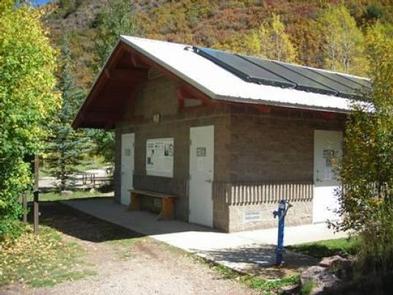
The campground is equipped with picnic tables, a picnic shelter, campfire rings, showers, flush toilets, and drinking water. Electrical hook-ups are available at 17 of the sites for an additional fee. Firewood is available on-site.
Playground facilities and horseshoe pits are great for family and group gatherings.
Natural Features
In the heart of the Rocky Mountains, the 2.3 million acre White River National Forest is a place of serenity and adventure, boasting 8 wilderness areas, 4 defined seasons, and 10 peaks surpassing 14,000 feet in elevation.
The Crystal River flows near the campground and drains the Valley of the Coal Miners, a glacial valley that was once a center of coal mining in southwestern Colorado.
Wildlife in the area abounds. Bighorn sheep navigate rocky ridges and bull elk bugle at dusk. Scenic rivers sustain populations of cutthroat, rainbow, and brown trout. Alpine regions provide habitat for pika and ptarmigan. These species, along with many others, depend on surrounding undeveloped wilderness, clean streams, and diverse forests to live.
Nearby Attractions
The quaint mountain town of Redstone is a hidden gem located south of Carbondale. In addition to shops, galleries, and restaurants, the town boasts a castle that was built by industrialist John Osgood at the turn of the century.