SWINGING BRIDGE, ID Campground Reservation, Info, Images, Map, Directions

SWINGING BRIDGE, Idaho Campground Images, Info & Reservations

Listen

Directions

From Horseshoe Bend, ID, take State Rt. 55 north for 21.5 miles to the campground sign. Turn left after the sign into the campground(on west side of highway).

Phone

541-351-1182

Activities

BOATING, CAMPING, FISHING

Keywords

SWIN,PAYETTE RIVER HIGHWAY 55,BOISE NF – FS

Related Link(s)

Rec Area Info & Images

Forest Service Concessionaire

Idaho State Road Conditions

Forest Service Concessionaire

Idaho State Tourism

Overview

Swinging Bridge Campground is located 10 miles north of Banks, Idaho just off Highway 55 at an elevation of 4,000 feet.

The North Fork Payette River flows next to the highway, where extreme kayaking is a popular activity.

Recreation

The North Fork of the Payette River is a very popular location for expert kayaking. Whitewater rafting is nearby on the Main and South Fork sections of the Payette River.

Anglers will find good to excellent fishing for whitefish and rainbow trout.

Facilities

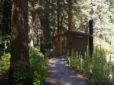
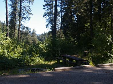
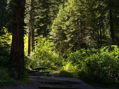
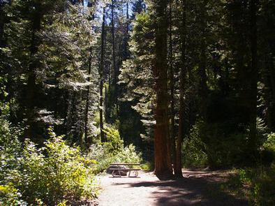
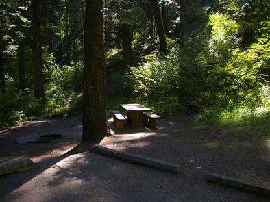
The campground contains single-family sites, each with a picnic table and campfire ring. Vault toilets are provided. Roads and parking spurs are paved. Because of its proximity to the highway, some noise from passing traffic is to be expected.

Natural Features

The campground is situated is a scenic canyon just above Highway 55. The mountains are forested with a mix of Ponderosa and lodgepole pines and shade is plentiful within most of the campground. Summer days are warm, reaching 80-90 degrees; nights are cooler.

Reservation

More from CampingHiking.net:

TOKETEE LAKE CAMPGROUND, Oregon Campground Images, Info & Reservations

Listen Directions From Roseburg, OR, travel east on OR-138 East /NE Diamond Lake Boulevard for 59 miles, turn left onto Forest Road 34. Keep left at the bottom of the hill and cross the bridge. Proceed 1.5 miles to the campground entrance on the right. Phone 541-498-2531 Activities BOATING, FISHING,

RUJADA CAMPGROUND, Oregon Campground Images, Info & Reservations

Listen Directions From Cottage Grove, take exit 174 on Interstate 5, then take Row River Road #2400 east 19 miles to Layng Creek Road #17. Turn left (northeast) on Road #17 and continue for 2 miles until you reach Rujada Campground, located on the right, across Layng Creek. Phone 541-767-5000

WILLOW GROVE CAMPGROUND, Tennessee Campground Images, Info & Reservations

Listen Directions From Byrdstown, Tennessee, take Highway 111 south for about 13 miles. Turn north on 294/Willow Grove Road (at Big Springs Market) and continue for about 16 miles, then turn right into the camp entrance, just before Willow Grove Marina. It is recommended that visitors do not rely soley

PLOTNIKOF LAKE CABIN, Alaska Campground Images, Info & Reservations

Listen Directions Accessible early June through October. This cabin is located 45 miles southeast of Sitka, 4 miles east of Whale Bay, on the south-central part of Baranof Island. Access by floatplane is 40 minutes from Sitka. For geographic features surrounding the cabin, refer to USGS topographic map Port Alexander