
Directions
Located 26 miles southwest of Dayton, Wyoming along U.S. Highway 14.
Phone
406-587-9054
Activities
BIKING, BOATING, FISHING, HIKING, VISITOR CENTER, WILDLIFE VIEWING, HOTEL/LODGE/RESORT PRIVATELY OWNED, OFF ROAD VEHICLE TRAILS
Keywords
PRUN,BIGHORN NF – FS
Related Link(s)
Overview
Prune Creek Campground is located along the Bighorn Scenic Byway (U.S. Highway 14) near the Burgess Junction at an elevation of 7,700 feet. The Bighorn National Forest offers a wide variety of activities, including hiking, fishing, scenic driving and a number of historic sites. The administering organization is Gallatin Canyon Campgrounds; e-mail: gccampgrounds13@gmail.com
Recreation
Off-road vehicle trails, scenic jeep roads, hiking, fishing and canoeing are available in the surrounding area. Diverse hikes vary from loop trails to treks along creeks and over mountain peaks; many trails access the Cloud Peak Wilderness.
Nearby Sibley Lake is open to non-motorized craft and offers an accessible fishing dock on the shoreline. Anglers fish for rainbow, brown and brook trout.
Facilities
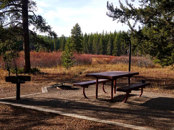
The campground offers several single-family sites each equipped with a picnic table and campfire ring with grill. Accessible vault toilets, drinking water and trash collection are provided.
Natural Features
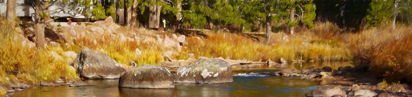
The campground is situated on the banks of the South Fork Tongue River in the Bighorn Mountains, where craggy granite peaks rise over 13,000 feet above sea level. A forest of lodgepole pines covers the area, creating excellent wildlife habitat.
Nearby Attractions
Shell Falls Visitor Center, at the overlook of Shell Falls, is about 23 miles southwest. This center offers interpretive trails, scenic views, and educational displays about natural features such as flora and fauna and area history.
The Medicine Wheel National Historic Landmark is about 28 miles from the campground. This unique geoglyph signifies all creation, all races of people, birds, fish, animals, trees and stones. According to tribal beliefs, the circular shape of the wheel represents the earth, sun, moon, the cycles of life, seasons and day to night.
Arrowhead Lodge, Bear Lodge and Elk View Inn are nearby, offering off-road vehicle rentals and fishing supplies, as well as dining options and general stores.
Charges & Cancellations
Refunds: Refund requests made through www.recreation.gov will be charged a $10 processing fee. This cancellation processing fee is retained by the reservation service contractor along with the non-refundable reservation fee. All requests for the return of the non-refundable reservation fee and the cancellation processing fee will be declined by the campground concessionaire as they did not receive these fees (these are the fees retained by the reservation contractor, a different entity).