
Directions
From Lovell, Wyoming, take U.S. Highway 14A (not U.S. Highway 14) 33 miles east. The highway has a 10% grade; not recomended for RVs and motorhomes. From Dayton, Wyoming, take U.S. Highway 14/14A west 73 miles via Burgess Junction. This is the recommended route for RVs and motorhomes.
Phone
406-587-9054
Activities
BIKING, HISTORIC & CULTURAL SITE, CAMPING, FISHING, HIKING, HORSEBACK RIDING
Keywords
BALD,BIGHORN NF – FS
Related Link(s)
Overview
Bald Mountain Campground is located along the Medicine Wheel Passage Scenic Byway (U.S. Highway 14A), 33 miles east of Lovell, Wyoming. The Medicine Wheel National Historic Landmark is nearby. Visitors enjoy the area for its scenic natural beauty and recreational opportunities. The administering organization is Gallatin Canyon Campgrounds; e-mail: gccampgrounds13@gmail.com
Recreation
From the area’s historic mining sites to the ancient Native American Medicine Wheel, to hiking through open meadows and along the cliffs on the west rim of the mountains, the Bighorn National Forest offers many recreational opportunities.
Jaws Trailhead is near the campground, offering access to Bucking Mule Falls Trail and Porcupine Creek. Scenic off-road driving is available on Hunt Mountain Road or Burgess Overlook jeep trail.
Facilities
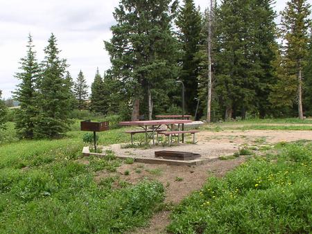
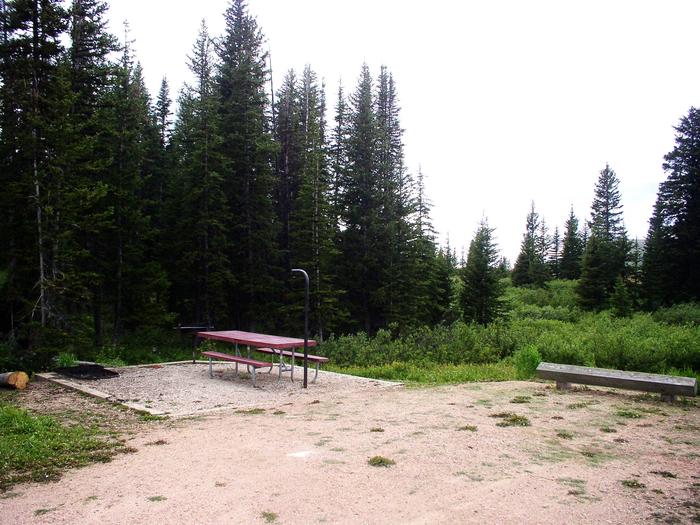
The campground offers single-family sites, each with a picnic table and campfire ring with grill. Accessible vault toilets, drinking water and trash collection are provided.
The nearest dump station is 25 miles east at Burgess Junction
Natural Features
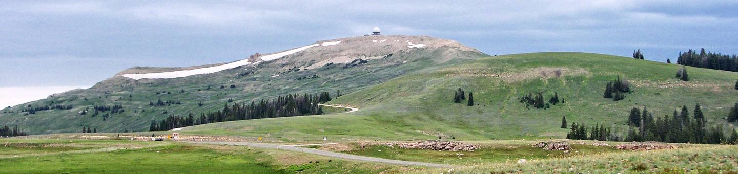
Bald Mountain is part of the Bighorn Range in northern Wyoming. A forest of pine and aspen covers the campground, which sits near top of the mountain at an elevation of 9,200 feet. Small creeks wind through the campground and temperatures can drop significantly once the sun goes down.
Nearby Attractions
The Medicine Wheel National Historic Landmark is 4 miles from the campground. This unique geoglyph signifies all creation, all races of people, birds, fish, animals, trees and stones. According to tribal beliefs, the circular shape of the wheel represents the earth, sun, moon, cycles of life, seasons and day to night.
High Country Lodge is nearby, offering guided horseback riding and backcountry pack trips, off-road vehicle rentals and guided fishing trips.
Charges & Cancellations
Refunds: Refund requests made through www.recreation.gov will be charged a $10 processing fee. This cancellation processing fee is retained by the reservation service contractor along with the non-refundable reservation fee. All requests for the return of the non-refundable reservation fee and the cancellation processing fee will be declined by the campground concessionaire as they did not receive these fees (these are the fees retained by the reservation contractor, a different entity).