STONEY GROUP SHASTA-TRINITY, CA Campground Reservation, Info, Images, Map, Directions

STONEY GROUP SHASTA-TRINITY, California Campground Images, Info & Reservations

Listen

Directions

From I-5 in Redding, California, take 299 west to Weaverville. Go north on State Highway 3 for 14 miles. The campground is on the left.

Phone

530-275-8113

Activities

BOATING, CAMPING, FISHING, WATER SPORTS, SWIMMING SITE

Keywords

STON,STONEY GROUP SHASTA TRINITY,SHASTA-TRINITY -FS

Related Link(s)

Rec Area Info & Images

California State Road Conditions

Forest Service Concessionaire

California State Tourism

Overview

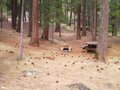
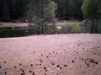
Stoney Group Campground is nestled on the banks of Stoney Creek on the Stuart Fork Arm of Trinity Lake. This group camp can accommodate up to 60 people with tents. The sites are given some shade from tall trees, and two popular recreation areas on Trinity Lake are located nearby.

Recreation

The campground is adjacent to the popular Stoney Creek Swim Area, which offers a beach and picnic tables. A boat ramp and marina are located less than a mile away.

Popular activities in the area include power and non-motorized boating, fishing and water skiing. Anglers can cast for catfish, as well as a variety of bass, trout and salmon.
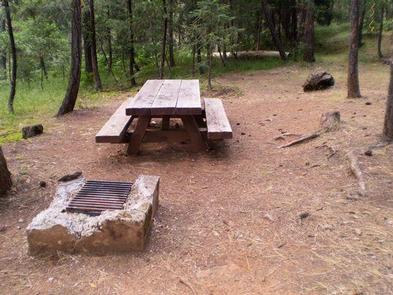
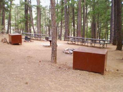
Facilities

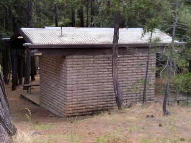
There are flush toilets, drinking water, group pedestal grill, fire ring, several tables and bear-proof food lockers.

Natural Features

Trinity Lake sits at an elevation of 2,370 feet and is surrounded by the Trinity Alps. Black bears are frequently spotted in the area, as well as bobcats, mountain lions and a variety of bird species.

Shasta-Trinity is the largest national forest in California with a diverse landscape encompassing five wilderness areas, hundreds of mountain lakes and 6,278 miles of streams and rivers.

Nearby Attractions

The nearby town of Weaverville is listed on the National Register of Historic Places. The former mining town offers restaurants, shopping and self-guided walking tours.

Reservation

More from CampingHiking.net:

SKULL CREEK, Utah Campground Images, Info & Reservations

Listen Directions Located off Highway 44, just west of the junction of Highways 44 and 191 in the Flaming Gorge area, about 35 miles north of Vernal, Utah. Phone 435-784-3445 Activities BIKING, BOATING, CAMPING, FISHING, HIKING, WILDLIFE VIEWING Keywords SKUL,SKULL CREEK,FLAMING GORGE,ASHLEY NF – FS,Flaming Gorge National Recreation Area Related

SPRINGHILL, Arkansas Campground Images, Info & Reservations

Listen Directions From Barling, Arkansas, take SR-59 north for 1.5 miles and follow signs into campground. Phone 479-452-4598 Activities BIKING, BOATING, CAMPING, FISHING, HIKING, BIRDING Keywords SPRH,JOHN PAUL HAMMERSCHMIDT LAKE,JOHN PAUL HAMMERSC Related Link(s) Rec Area Info & Images Arkansas State Road Conditions Arkansas State Tourism Overview Springhill Park sits

HEART BAR CAMPGROUND, California Campground Images, Info & Reservations

Listen Directions From I-10 in San Bernardino, take the Alabama exit in the city of Redlands to Lugonia Avenue (State Highway 38). Travel northeast on Highway 38 for approximately 30 mile,s to Forest Route IN02. Continue less than a mile to the campground. Phone 909-866-8550 Activities BIKING, CAMPING, FISHING, HIKING

DEER CREEK CABIN (MT), Montana Campground Images, Info & Reservations

Listen Directions Deer Creek Cabin is located approximately 30 miles south of Big Timber, Montana. It can be accessed by 3 different routes. It is recommended that renters carry topographic maps, GPS and compasses for navigation since the route may be difficult to find. One route to follow is the

LAKELAND PAVILION, Texas Campground Images, Info & Reservations

Listen Directions While traveling East on US Highway 380, turn right (South) on State Highway 78 at Farmersville. Go South about 4 miles to CR 550. Turn right on CR 550 and continue about 2 miles to the entrance of the park. The pavilion is inside Lakeland Park. Phone 972-442-3141