PEACEFUL VALLEY, CO Campground Reservation, Info, Images, Map, Directions

PEACEFUL VALLEY, Colorado Campground Images, Info & Reservations

Listen

Directions

From Denver, go north on Interstate 25 to U.S. Highway 36 west. Continue on U.S. 36 through Boulder to Lyons. Take Colorado Highway 7 and go approximately 12 miles, then Colorado Highway 72 for approximately 4 miles.

Phone

303-541-2500

Activities

BIKING, CAMPING, FISHING, HIKING, HORSEBACK RIDING

Keywords

PEAC,ARAPAHO AND ROOSEVELT NF – FS

Related Link(s)

Rec Area Info & Images

Colorado State Tourism

Forest Service Concessionaire

Colorado State Road Conditions

Overview

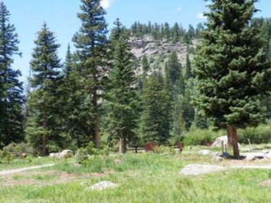
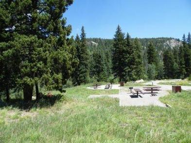
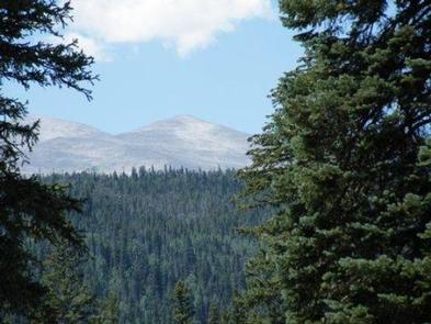
Peaceful Valley Campground is situated in a glacial valley, on the banks of the Middle Saint Vrain Creek at an elevation of 8,500 feet in northern Colorado. The campground has some conifer trees with open grassy areas.

Recreation

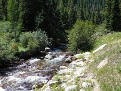
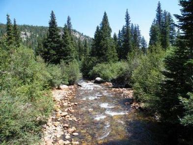
The Middle Saint Vrain Creek is a good fly-fishing stream where anglers cast for rainbow, brown and cutthroat trout.

Many trails in the vicinity are open to hiking and biking, including Sourdough and Buchanan Pass Trails. Mountain biking is allowed on the first five miles of Buchanan Pass Trail.

The Bunce School Roads are popular among off-road enthusiasts.

Facilities

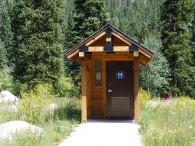
There are 17 sites in the campground. Nine are suitable for RV camping and eight are more suitable for tents. Each site has a picnic table, fire ring and grill. The maximum vehicle length that can be accommodated is 45 feet, although no utility hookups are available. There is a maximum of eight people per site; site #17 is oversized and will accommodate ten people. The roads in the campground are paved. There is one hand pump with potable water, trash dumpsters, vault toilets and firewood is for sale.

Natural Features

The campground is situated on the banks of the Middle Saint Vrain Creek in the mostly flat, glacial Peaceful Valley. A mixed conifer and aspen forest covers the area.

Nearby Attractions

Rocky Mountain National Parkâ??s main entrance is 24 miles north in Estes Park. Estes Park is a full-service community.

Reservation

More from CampingHiking.net:

Miller River Group Camp, Washington Campground Images, Info & Reservations

Listen Directions From I-5 north, take exit 194 to Highway 2. Continue for about 48 miles, then turn south at the Money Creek Campground sign. Continue about 3 miles to the campground. Phone 360-804-1103 Activities BIKING, CAMPING, FISHING, HIKING, WILDLIFE VIEWING Keywords MILR,MT. BAKER-SNOQU NF – FS Related Link(s) Rec

LITTLE COTTONWOOD CAMPGROUND, Utah Campground Images, Info & Reservations

Listen Directions Travel east of Beaver approximately 6 miles on SR 153. Phone 435-438-2436 Activities CAMPING, FISHING, HIKING, VISITOR CENTER, WILDLIFE VIEWING Keywords LITTLE COTTONWOOD CAMPGROUND,LITTLE COTTONWOOD,COTTONWOOD,FISHLAKE NATIONAL FOREST Related Link(s) Rec Area Info & Images Utah State Road Conditions Utah State Tourism Overview The Little Cottonwood Campground is conveniently

DEWAYNE HAYES, Mississippi Campground Images, Info & Reservations

Listen Directions From Columbus, Mississippi, take U.S. Highway 45 north to the junction with U.S. Highway 373/50 west. Turn left and continue for 1.5 miles to the junction with Stinson Creek Road. Travel 2 miles to Barton’s Ferry Road and turn left. Proceed a half mile to the park entrance.

CALF CREEK CABIN, Montana Campground Images, Info & Reservations

Listen Directions From White Sulphur Springs, head east on Highway 12 for 3 miles and turn left (north) on Highway 89. Continue about 15 miles, then head west (left) on Road 119 for 9 miles to the cabin. From Great Falls, head east on Highway 87/89 about 23 miles to

NEMO LANDING, Missouri Campground Images, Info & Reservations

Listen Directions From Springfield, MO, take US 65 north past Louisburg, MO, to NN Highway. Follow NN Highway south to Nemo, MO. Turn south at the 4-way stop and find the entrance to Nemo Landing on the left side of the highway. Phone 417-993-5529 Activities CAMPING, SWIMMING SITE Keywords NEMO,POMME

WHITE LEDGE CAMPGROUND, New Hampshire Campground Images, Info & Reservations

Listen Directions From Conway, New Hampshire, follow State Route 16 south for 5 miles. The campground is on the right. Phone 603-447-5448 Activities BIKING, CAMPING, FISHING, HIKING, PICNICKING Keywords WHIL,WHITE MOUNTAIN NF -FS Related Link(s) Rec Area Info & Images New Hampshire State Tourism Forest Service Concessionaire New Hampshire State