


Directions
From Leadville, Colorado, head west on County Road 4. Continue on the paved road about 9 miles to May Queen Campground on the right.
Phone
719-486-0749 (FOR INFORMATION ONLY, NO RESERVATIONS
Activities
BOATING, HISTORIC & CULTURAL SITE, CAMPING, FISHING, HIKING, SWIMMING SITE
Keywords
MAYQ,TURQUISE LAKE,TURQUOISE LAKE,PIKE AND SAN ISABEL NF- FS
Related Link(s)
Colorado State Road Conditions
Overview
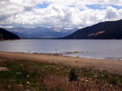
May Queen Campground is located at the far western end of Turquoise Lake in a shaded lodgepole pine forest. Conveniently perched near the Charles Boustead Memorial Tunnel, May Queen offers easy access to boating, fishing and hiking.
Incredible views of the Holy Cross and Mount Massive Wildernesses can be seen from the area, and visitors are likely to see native wildlife like chipmunks, beavers and porcupines.
The Charles Boustead Memorial Tunnel is a 5.5-mile tunnel that transports water from the Fryingpan and Roaring Fork River Basins through the Continental Divide to the Arkansas River Basin by emptying water into Turquoise Lake.
Recreation
Explore the 6.4-mile Turquoise Lake Trail, which parallels the shoreline of Turquoise Lake from May Queen Campground to the dam. The trail offers moderate hiking with spectacular views and a variety of flora and fauna, as well as remnants of old mines. The Timberline Lake trailhead is 1/2 mile up the road. A 2-mile hike to this lake is rewarded with stunning views and high alpine lake fishing. The Colorado Trail can also be accessed from this trailhead. On Turquoise Lake, sailing, boating and canoeing are enjoyed. Anglers seek out mostly mackinaw and rainbow trout.
Facilities
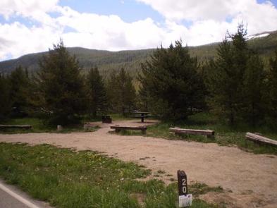
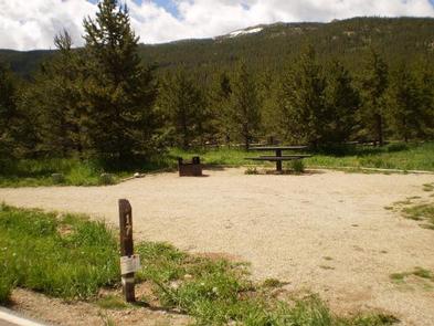
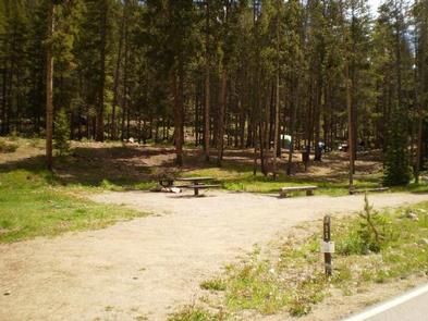
Drinking water is available and vault toilets are onsite. Each site comes with a campfire ring and picnic table. No electric hookups are available. Easy access to the lake is provided for canoes and other hand-carried boats. Trailered boats can use Matchless Boat Ramp located on the east side of Turquoise Lake.
Natural Features
The campground sits at an elevation of 9,900 ft. on Turquoise Lake. Most campsites are situated on a level, open field along a creek, feeding into the lake. Six first come-first, serve-sites are perched on the wooded hillside above the creek.
Nearby is the Mount Massive Wilderness area, a 30,540 acre expanse encompassing Mount Massive, Colorado’s second highest peak at 14,421 feet. Much of the wilderness is above timberline with many alpine plant communities and permanent snowfields.
Nearby Attractions
Nearby is the abandoned bed of the Colorado Midland Railroad, built in the 1890s. The trail is hard to trace, but visitors may find artifacts in the gulch it once crossed.
The town of Leadville, a historic gold and silver mining town, is a fun place to explore with the family.
Drive on the Top of the Rockies Scenic Byway to Independence Pass, one of the highest paved passes in Colorado. Continue over the pass to the town of Aspen, a well-known ski resort town.