LAKE HILL, UT Campground Reservation, Info, Images, Map, Directions

LAKE HILL, Utah Campground Images, Info & Reservations

Listen

Directions

Located approximately 5 miles east of Ephraim, Utah on Forest Highway 8 in Ephraim Canyon.

Phone

435-283-4151

Activities

BOATING, CAMPING, FISHING, HIKING

Keywords

LAKH,MANTI-LASAL NF -FS

Related Link(s)

Rec Area Info & Images

Utah State Tourism

Utah State Road Conditions

Overview

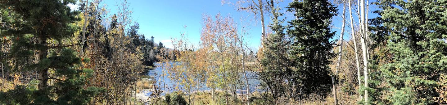
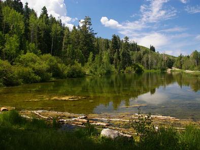
Lake Hill Campground is situated next to pretty Lake Hill Reservoir just five miles from Ephraim, Utah at an elevation of 8,400 feet. Visitors enjoy fishing, canoeing and exploring local trails.

Recreation

Canoeing and rainbow trout fishing are popular activities on the small but scenic man-made reservoir.
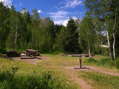
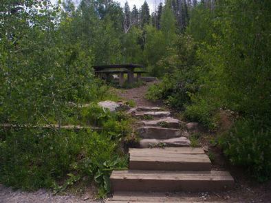
Facilities

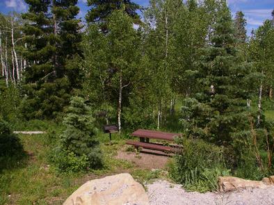
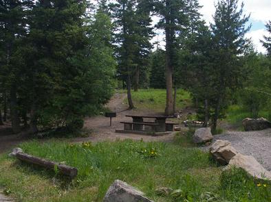
The campground contains two groups sites: GP1 is located on a hillside above the lake, but the lake is not visible; GP3 is next to the lake and offers scenic views. However, expect high volumes of traffic near GP3 Additional single-family sites are available as well, most of which are below the lake. Vault toilets and drinking water are provided. Roads and parking spurs are dirt.

Natural Features

A mixed forest of spruce, fir and aspen covers the area, offering partial shade in most sites, with some more exposed than others. Summer wildflowers and wildlife are abundant.

Nearby Attractions

Ephraim Canyon is a haven for ATV enthusiasts. Several trails crisscross the region, making up part of the 350 plus miles of the exciting Arapeen OHV Trail System. Jimmies Fork Trail and the Great Basin Experimental Trail begin nearby, offering hiking, mountain biking and horseback riding opportunities.

The self-guided Great Basin Experimental Range Auto Tour runs along Ephraim Canyon, offering a glimpse into the history and workings of one of North America’s oldest range research sites.

Reservation

More from CampingHiking.net:

LOCKABY, Oregon Campground Images, Info & Reservations

Listen Directions From Estacada, take Highway 224 east for 15 miles to the campground. Phone 503-630-5721 Activities BOATING, CAMPING, FISHING, HIKING, WATER SPORTS, WILDLIFE VIEWING Keywords LOCK,MT. HOOD NF – FS Related Link(s) Rec Area Info & Images Oregon State Road Conditions Oregon State Tourism Forest Service Concessionaire Overview Lockaby

CASS LAKE LOOP, Minnesota Campground Images, Info & Reservations

Listen Directions Follow U.S. Highway 2 east of the city of Cass Lake for 4 miles to the entrance of Norway Beach Recreation Area. Phone 218-835-4291 Activities BIKING, BOATING, CAMPING, FISHING, HIKING, WATER SPORTS, WILDLIFE VIEWING, SWIMMING SITE Keywords Cass Lake Campground,Annex Campground Related Link(s) Rec Area Info & Images

TILLICUM, Oregon Campground Images, Info & Reservations

Listen Directions The campground is on Highway 101, 3 miles north of Yachats and 4 miles south of Waldport, Oregon. Look for campground and beach signs on 101. Physical Address: 8199 Hwy 101 N Yachats, OR 97498 Phone 541-547-3679 Activities CAMPING, FISHING, HIKING, SWIMMING Keywords TILI,SIUSLAW NF – FS Related

WINDY GROUP CAMP, Oregon Campground Images, Info & Reservations

Listen Directions Take Highway 58 approximately 8 miles east of Willamette Pass to the Crescent Lake Junction. Turn west on Forest Road 60 and continue approximately 7 miles to the campground. Phone 541-323-1746 Activities BOATING, CAMPING, FISHING, HIKING, SWIMMING SITE Keywords WING,DESCHUTES NF – FS Related Link(s) Rec Area Info

SAN GORGONIO, California Campground Images, Info & Reservations

Listen Directions Take I-10 East to Redlands. Take the University Street exit, EXIT 80. Turn left (northbound) on University Street. Turn right onto E. Lugonia Avenue/SR-38. Continue on State Highway 38 for approximately 20 miles to the campground entrance. Phone 909-866-8550 Activities BIKING, CAMPING, INTERPRETIVE PROGRAMS, FISHING, HIKING, WILDLIFE VIEWING,