INDIAN CREEK (UT), UT Campground Reservation, Info, Images, Map, Directions

INDIAN CREEK (UT), Utah Campground Images, Info & Reservations

Listen

Directions

From Orangeville, Utah, travel northwest on State Route 29 for approximately seven miles. Turn onto Cottonwood Creek Road 040 and travel north for 12 miles, to Upper Joe’s Valley. Continue to the campground.

Phone

435-384-2372

Activities

BIKING, CAMPING, FISHING, HIKING

Keywords

IND1,MANTI-LASAL NF -FS

Related Link(s)

Rec Area Info & Images

Utah State Road Conditions

Utah State Tourism

Overview

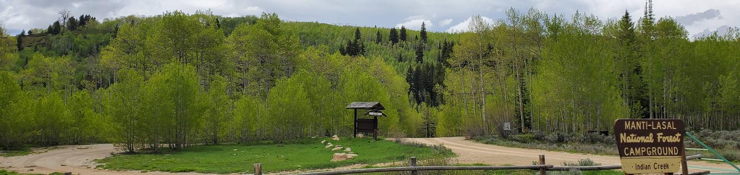
Indian Creek Campground is located in a high mountain valley surrounded by beautiful peaks, at an elevation of 8,000 feet. Visitors enjoy exploring the area trails on foot, and by horse and on off-road vehicles.

Recreation

Horseback riding, hiking and mountain biking are popular activities in the Indian Creek area. Many trails crisscross the surrounding valley and mountainsides.

Facilities

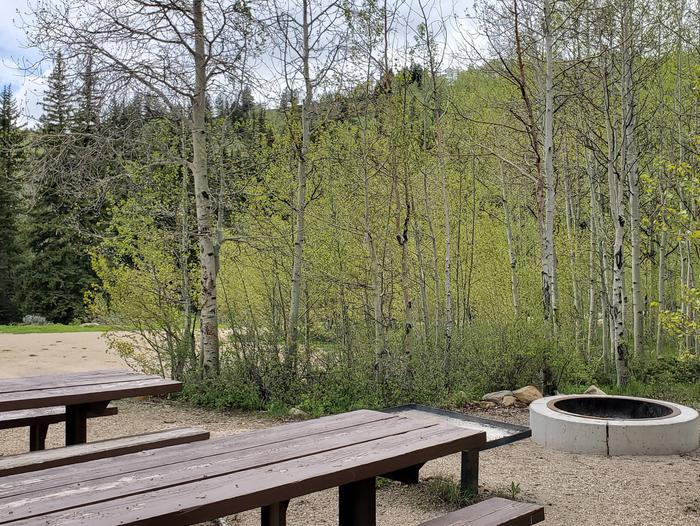
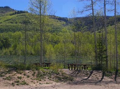
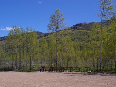
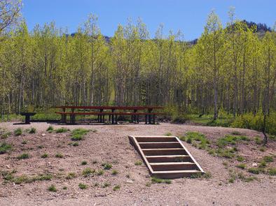
The campground contains seven large, group-sized campsites that can accommodate from 30 to 70 people. Vault toilets and drinking water are provided, but no electricity or garbage service are available within the campground.

Roads and spurs within the campground are dirt. It can be reached via the well-maintained dirt and gravel Cottonwood Creek Road, which providing relatively easy access for cars and RVs.

Natural Features

Indian Creek is situated in Upper Joe’s Valley, on the Wasatch Plateau in Central Utah. A grove of aspens forests the site, offering only limited shade, but bright autumn color. Sagebrush and pines dot the landscape.

Nearby Attractions

Potters Pond is nearby, offering great canoeing and rainbow trout fishing.

The expansive Arapeen OHV Trail System can be accessed close by and has more than 350 miles of designated, well-maintained trails for off-road vehicles. Trails there are suitable for all riding levels.

Reservation

More from CampingHiking.net:

RICHARDSON LAKE CAMPGROUND, Wisconsin Campground Images, Info & Reservations

Listen Directions From Wabeno, drive north 0.8 miles on Highway 32 to Highway 52. Turn left (west) on Highway 52 and drive 2.4 miles to Richardson Lake Road (FR2880). Turn right (north) on Richardson Lake Road and continue 0.4 miles to the campground. Phone 715-674-4481 Activities CAMPING Keywords Related Link(s)

MOGOTE, Colorado Campground Images, Info & Reservations

Listen Directions From Antonito, Colorado, go west on Highway 17 about 15 miles to the campground access road. Turn right and travel 1/4 mile to the Upper Loop Road. Phone 719-376-2535 Activities CAMPING Keywords MOGO,CONEJOS PEAK RD,15571 COUNTY RD T-5,LA JARA,COLORADO 81140,magotie,magoaty,mogoaty,RIO GRANDE NF- FS Related Link(s) Rec Area Info

TULE, California Campground Images, Info & Reservations

Listen Directions Take state highway 99, to east on Hwy 190 for 25 miles until you arrive to campground enterance. Please follow the signs. Phone 559-784-0215 Activities BIKING, BOATING, CAMPING, INTERPRETIVE PROGRAMS, FISHING, HIKING, HORSEBACK RIDING, HUNTING, PICNICKING, DAY USE AREA, OBSERVATION SITE, INFORMATION SITE, SWIMMING, MOTOR BOAT, RANGER STATION,

ASPEN CABIN, Oregon Campground Images, Info & Reservations

Listen Directions From Lakeview, drive 6 miles north on Highway 395 and turn right (east) on Highway 140. Drive for 8 miles on Highway 140 and turn left on Forest Road 3615. Drive 7.5 miles on Forest Road 3615 to arrive at the cabin. The entire route to the cabin

BIG GAME CAMPGROUND, Wyoming Campground Images, Info & Reservations

Listen Directions From Cody, Wyo., follow Sheridan Avenue west through Cody until the road leaves town, and becomes Buffalo Bill Scenic Byway (U.S. Highway 14/16/20). The campground is 29 miles west of Cody, on the north side of the highway and next to the river. It is between Wapiti Campground

AUX ARC, Arkansas Campground Images, Info & Reservations

Listen Directions From Ozark, Arkansas, take SR-23 south for 1.5 miles to SR-309. Turn left and follow signs to the park. Phone 479-667-1100 Activities BOATING, CAMPING, FISHING, HUNTING Keywords AUXA,OZARK LAKE – ARK.RIV.NAV.SYS,SOUTH PARK,OZARK LAKE – ARK R Related Link(s) Rec Area Info & Images Arkansas State Road Conditions Arkansas